


What you need to know
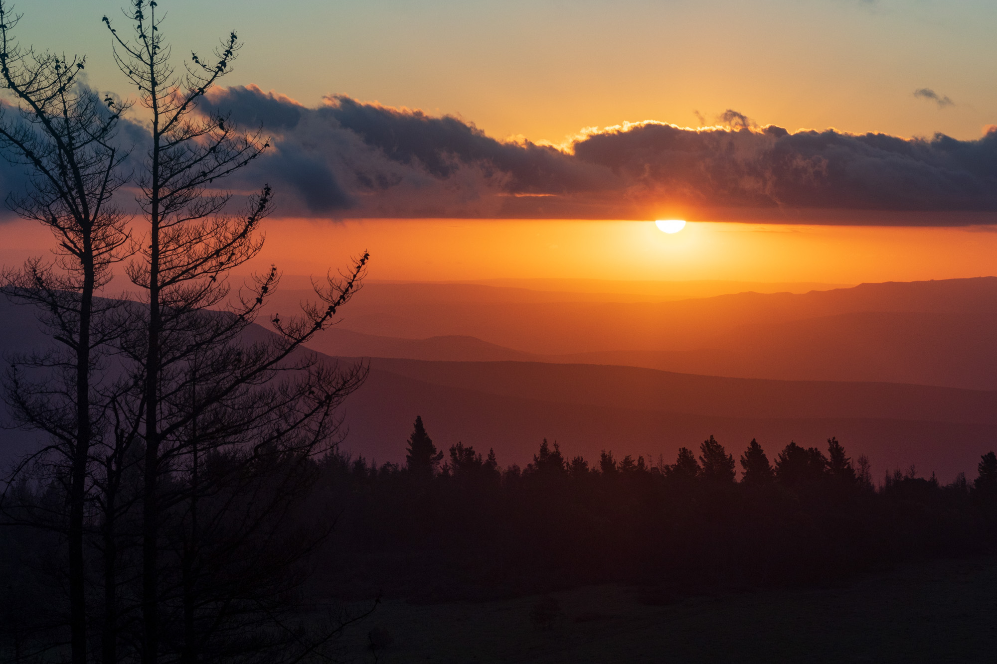
The Amathole Mountain range stretches over some 280 kilometres in several directions. To fully explore their wonders would be impossible to do in a day, nor would one want to. This area is best explored in bite sizes, one day trip, one getaway at a time.
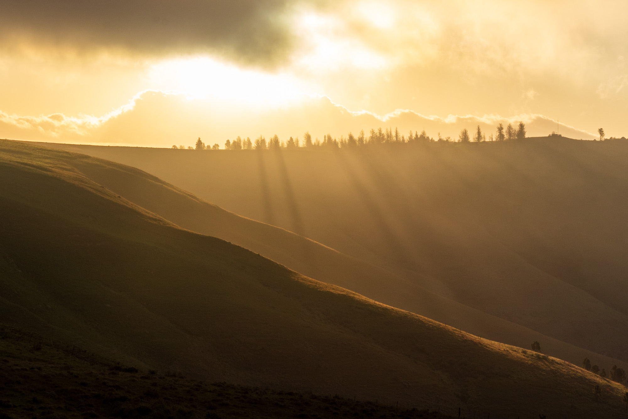
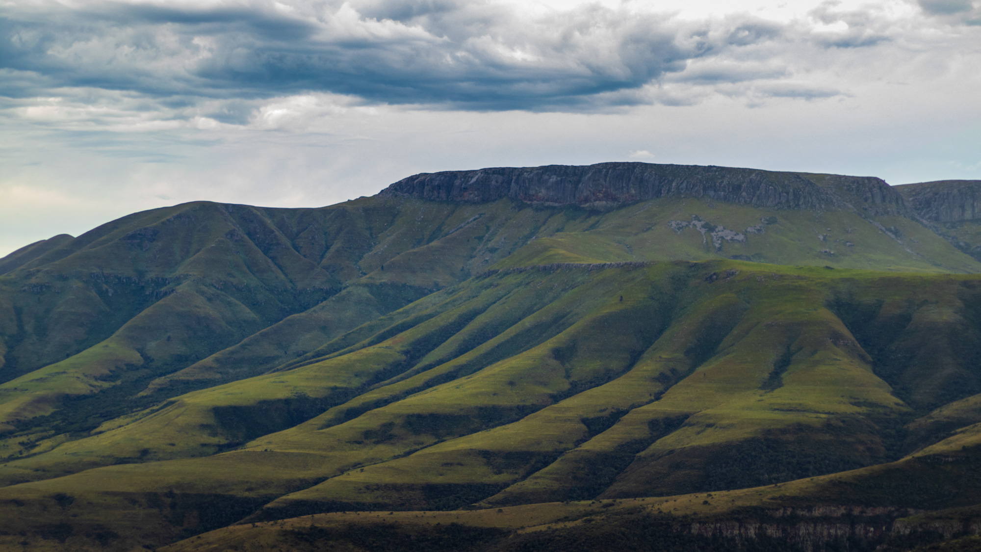 Photo by Malibongwe Tyilo
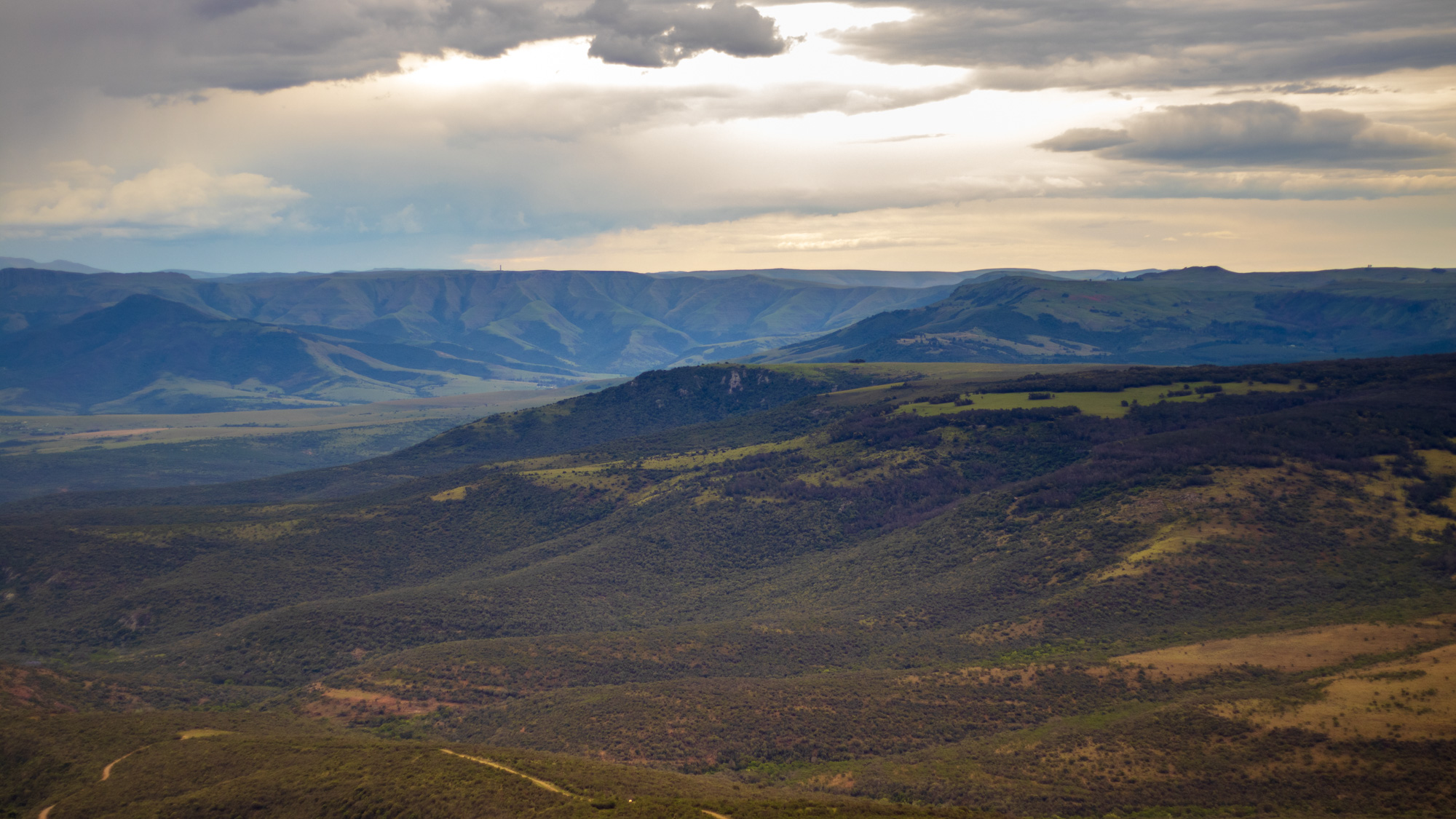 Photo by Malibongwe Tyilo
Beyond the natural beauty of the wind-carved rock formations that make up the mountains, this is also a very significant area when it comes to heritage. It is after all in these mountains that 19th-century Xhosa Chief Jongumsobomvu Maqoma, the oldest son of King Ngqika, fought in three of the Frontier Wars. His half-brother King Sandile also fought the colonial British in the War of the Axe during the 1840s, in these very same mountains.
Towns and villages along some of the routes, such as Alice and Healdtown, are home to educational institutions that produced some of the country’s most prominent voices, such as John Tengo Jabavu, a leading intellectual who became editor of the Xhosa newspaper, Imvo Zabantsundu in 1884; Nelson Mandela, the country’s first democratically elected President; Robert Sobukwe, the founder of the Pan-Africanist Congress; the Rivonia trialists Govan Mbeki and Raymond Mhlaba, among others. Alice was also home to the historic Lovedale press, where the first Xhosa authors were published.
Pick a route
 Hogsback. Photo by Malibongwe Tyilo
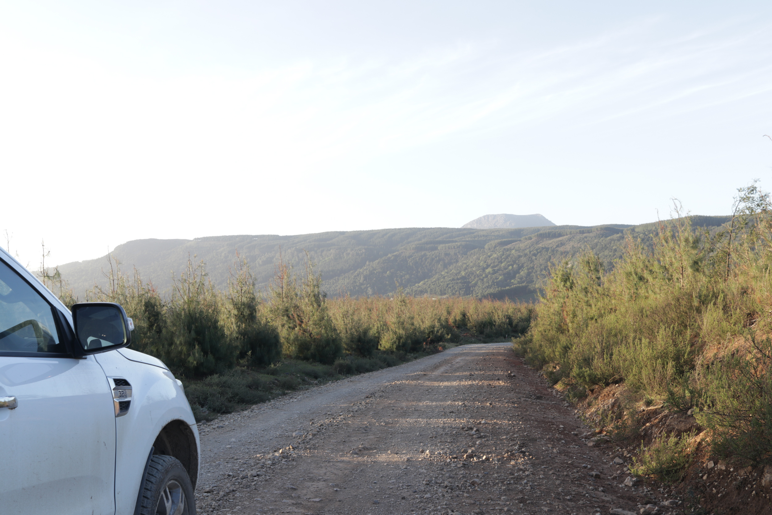
There is no one town from which to start your journey, as routes branch out in several directions. However, if a scenic drive with a couple of stops to eat and view, and possibly go on a short hike is what you’re looking for, catch the R67 from the small town of Fort Beaufort and take the mountain route all the way to the mountaintop village of Hogsback. Depending on what detours you take along the way, the trip can take anything from an hour and twenty minutes, to two hours and twenty minutes.
First stop on the R67
Just 7.5 kilometers from Fort Beaufort, a mere seven minutes into the trip, make sure to stop at the Baddaford farm stall to stock up on snacks for the road, and perhaps a few preserves, jams and chutneys for home. The farm, set among the cliffs, is largely a citrus and avocado farm. The stall has a great selection of homemade pies, and carnivores must make sure to try the venison pie. The cheesecake is also a must. And if stocking up for home, try their tomato chilli jam and their pears in red wine.
Keep calm and carry on
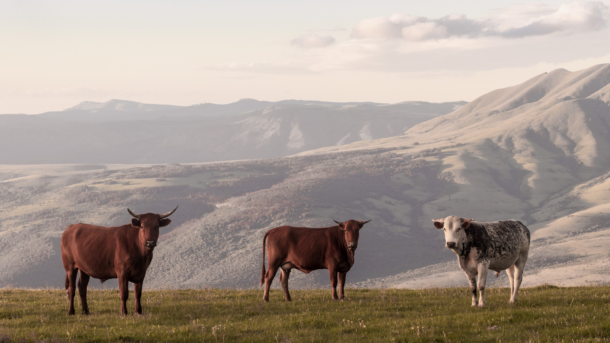 Photo by Malibongwe Tyilo
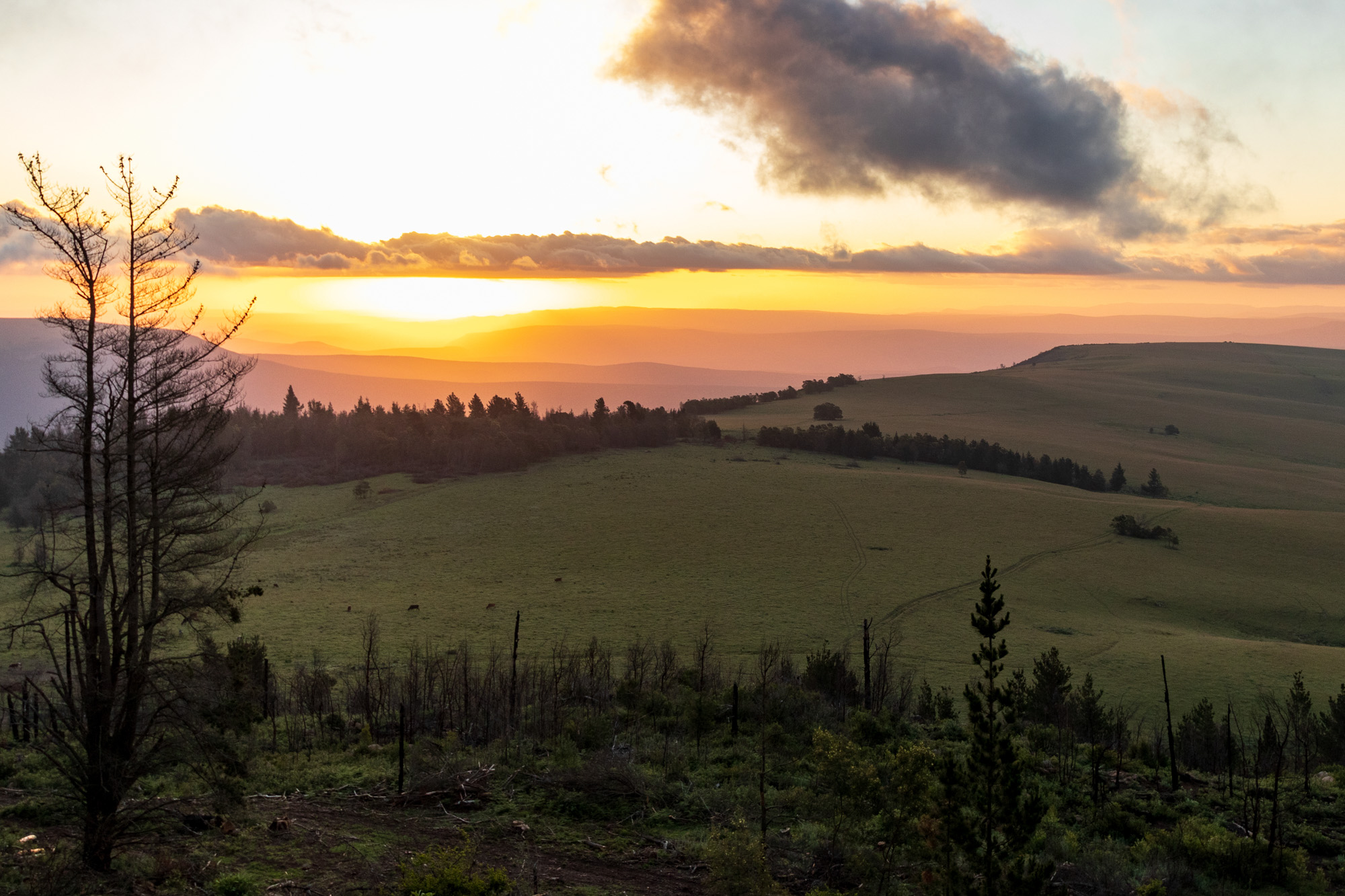 Photo by Malibongwe Tyilo
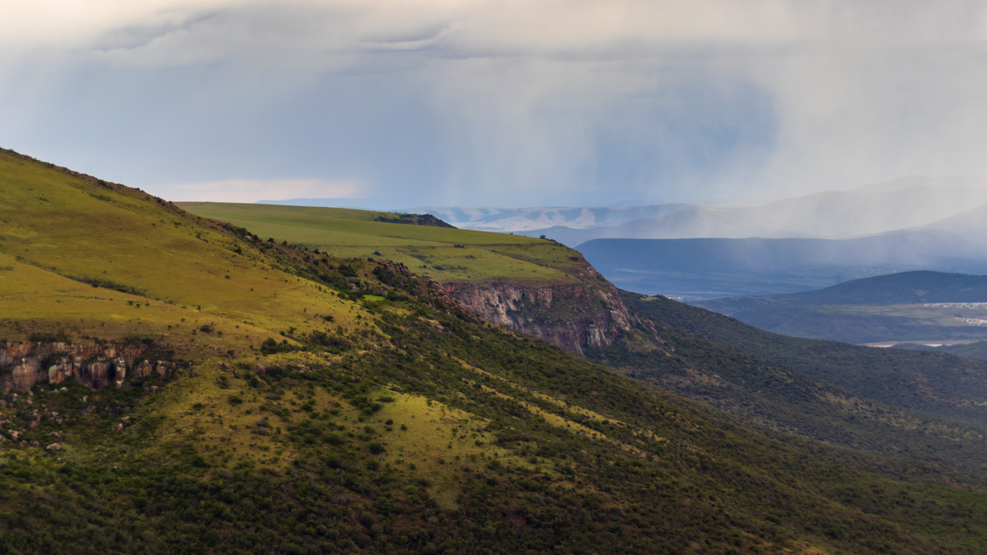 Photo by Malibongwe Tyilo
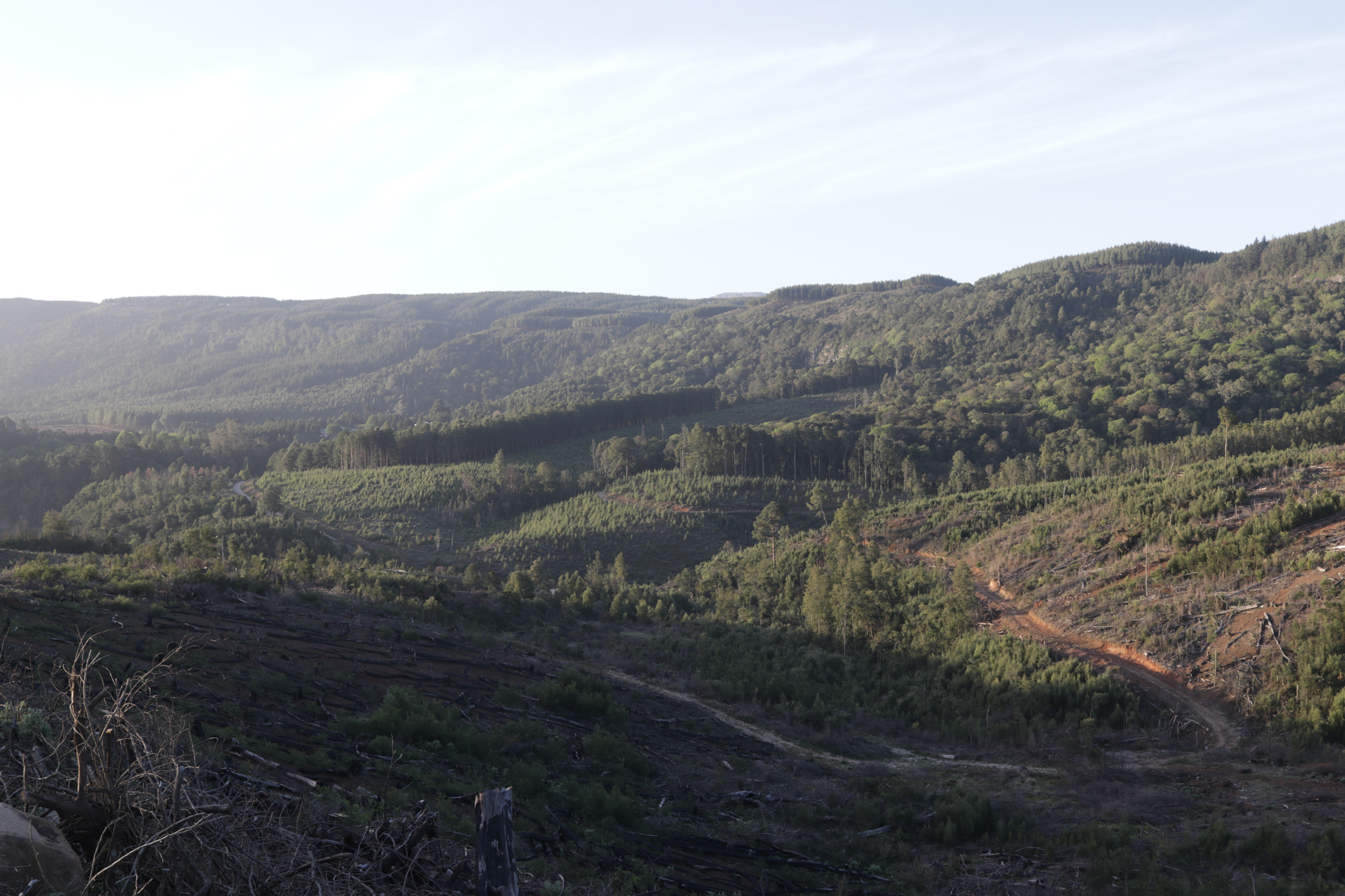 Photo by Malibongwe Tyilo
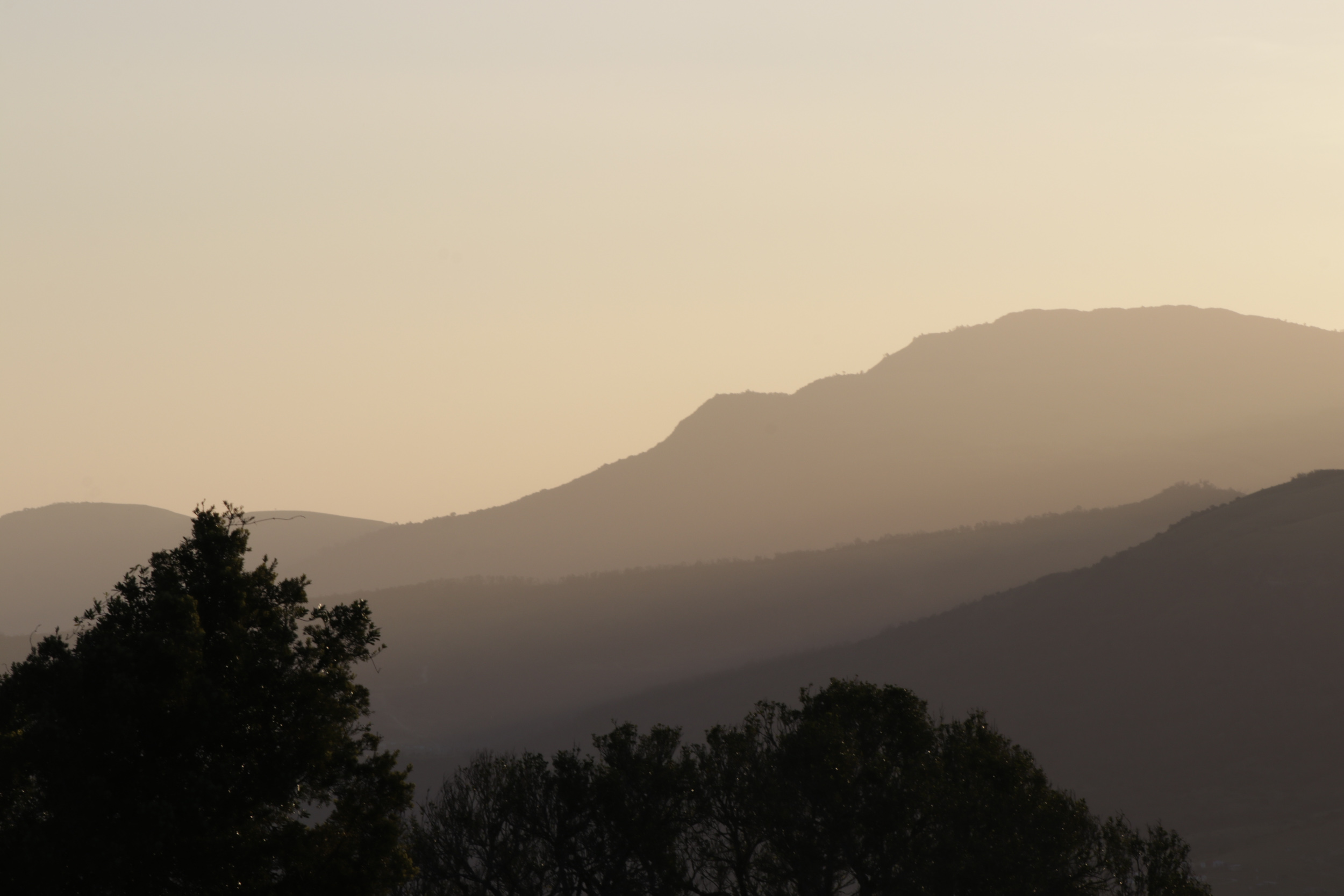 Photo by Malibongwe Tyilo
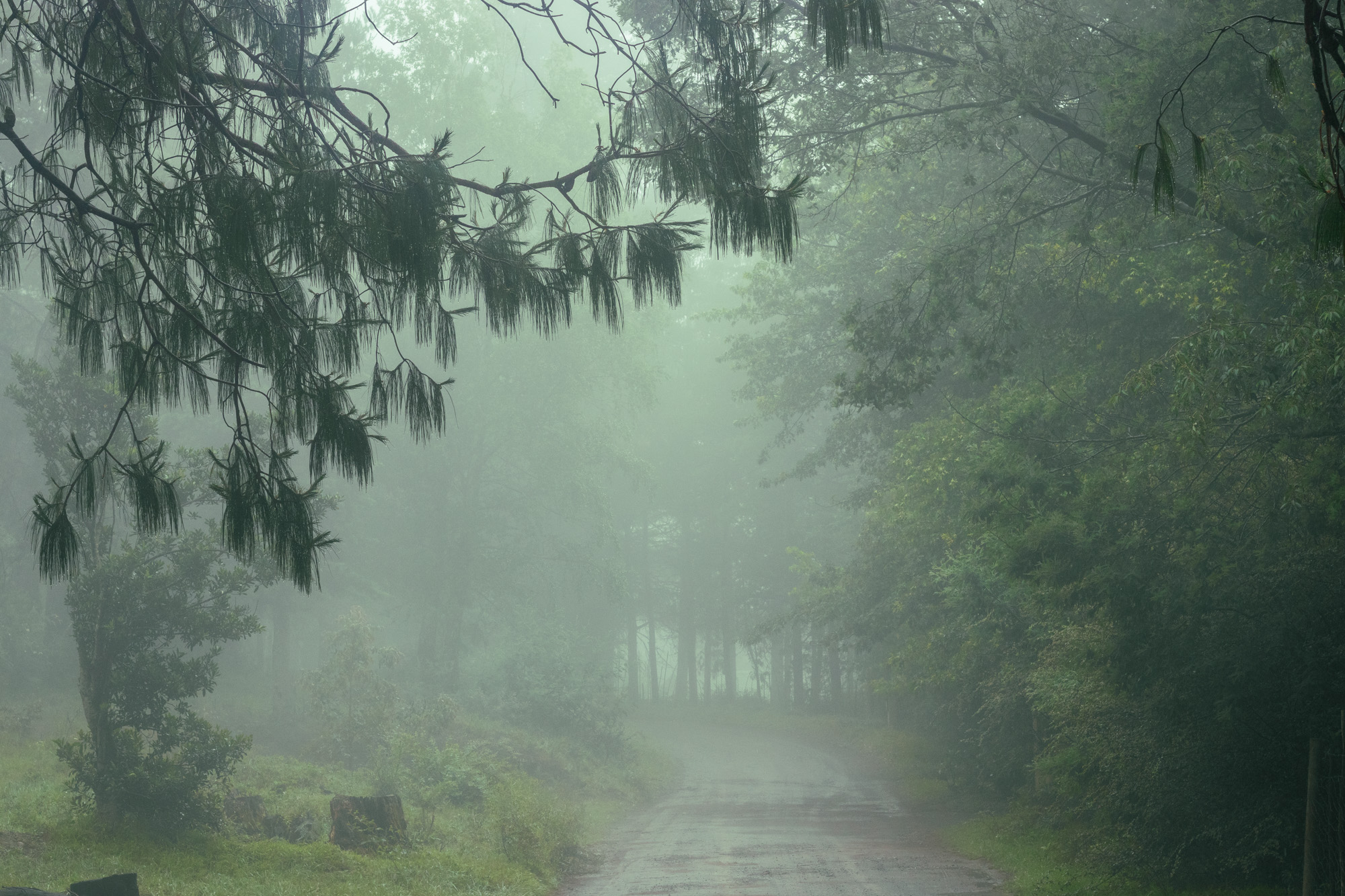
Once you’ve stocked up, carry on along the R67, and enjoy the view. Take in the mountains and rock formations, the grass-covered hills and villages along the route for the next hour and some, then turn right into the R351, and drive for about 12 km. Then before you reach the small town of Cathcart, take a right into the R345 and follow the gravel road to Hogsback. It’ll take you about 30 minutes, and thankfully, you won’t need a 4x4 or SUV.
This road is best taken slowly, with numerous stops to enjoy the seemingly endless rolling hills, the occasional stream, and neat arrangements of cypress trees that pop up along the way. Perhaps open that jar of pears in red wine as you look around and wonder what you did right in this or some other life to be enjoying a moment of such rural perfection.
Middle earth
 St Patrick's Chapel garden, Hogsback. Photo by Malibongwe Tyilo
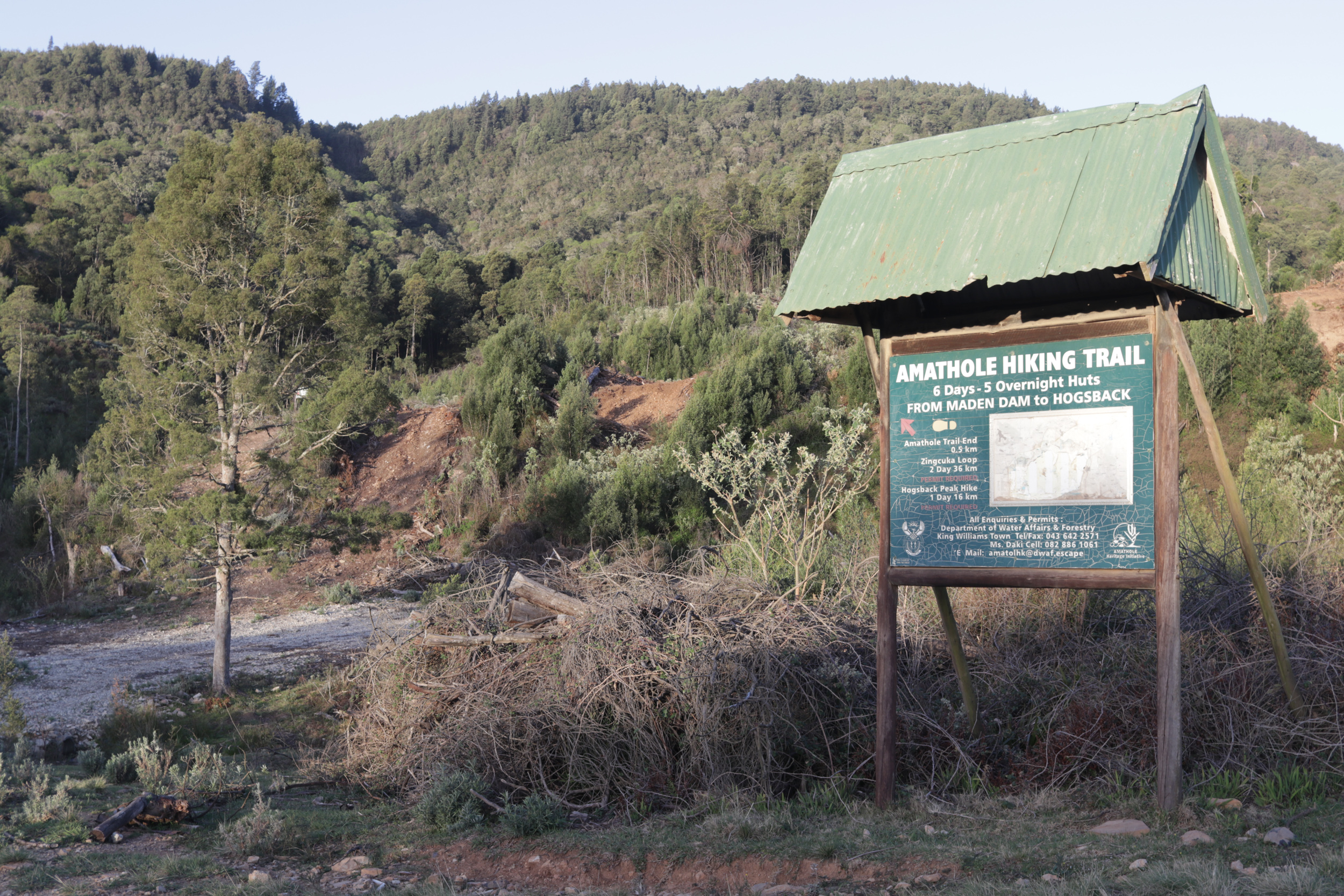 The beginning/end of the Amathole hiking trail, Hogsback. Photo by Malibongwe Tyilo
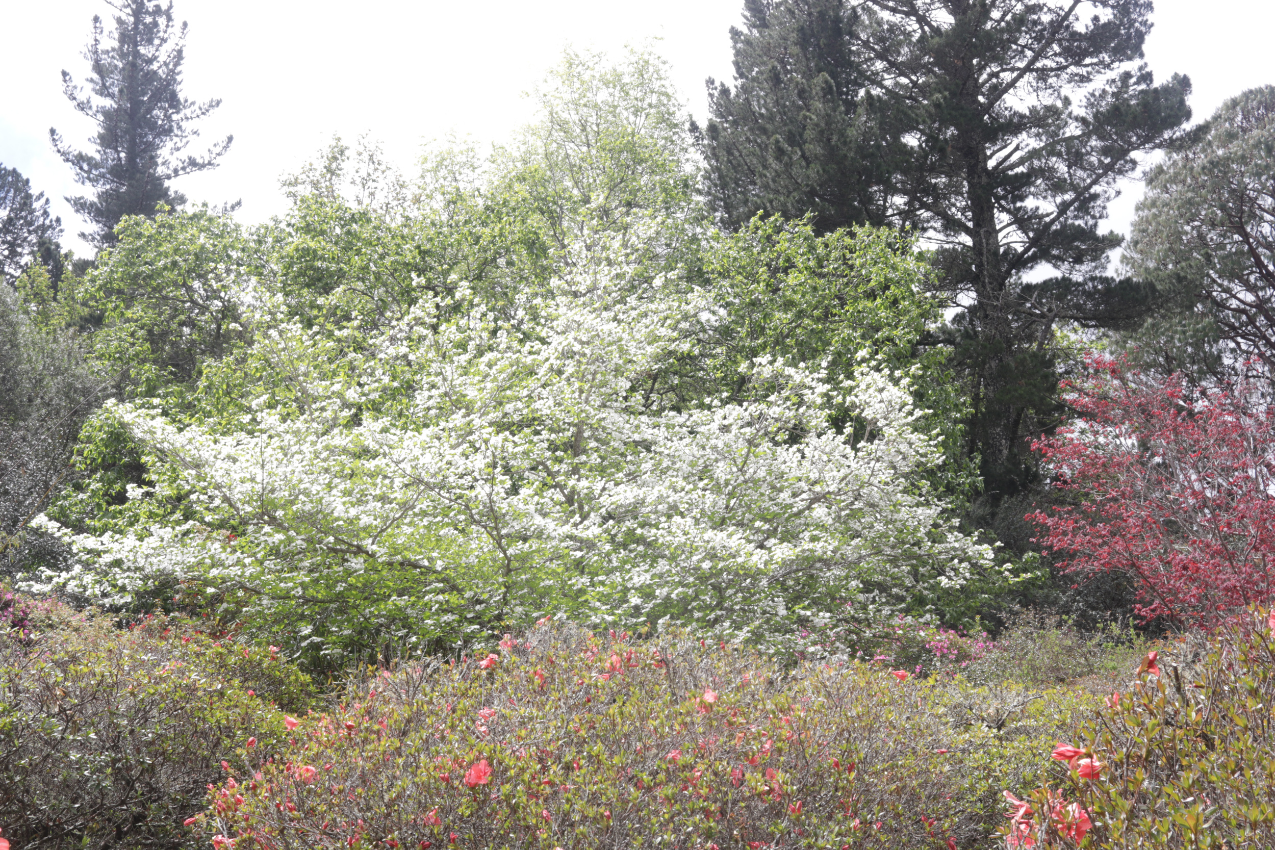
Eventually, your trip will take you to the small hamlet of Hogsback. Situated at 1300 metres above sea level, high up on the Amathole mountains and surrounded by centuries-old Afromontane forests, the lush village is home to a few hundred residents, a wide variety of bird life, samango monkeys, baboons and hares, as well as waterfalls and some of the most incredible English-style private gardens, often open to the public for viewing.
 Summerton Drive, a residential street in Hogsback. Photo by Malibongwe Tyilo
Although highly unlikely, the story goes that JRR Tolkein’s middle earth in The Lord of the Rings series was inspired by Hogsback. Indeed, Tolkein was born in Bloemfontein, and left for England at three years old. Although some claim his family visited Hogsback in those early years, it would be a stretch of the imagination to think that the town made such an impression on a visiting infant Tolkein, that he would later recreate it for his fictional universe.
However, this has not stopped the residents of the magical little village from running with it and taking inspiration from Lord of the Rings lore and giving some of the bed and breakfast accommodation names like The Shire, Hobbiton, Rivendell, Lothlorien and on and on. Go with it – don’t challenge them, or it’s Mordor for you…
Must visit
 The labyrinth at The Edge. Photo by The Edge
 The labyrinth at The Edge. Photo by The Edge
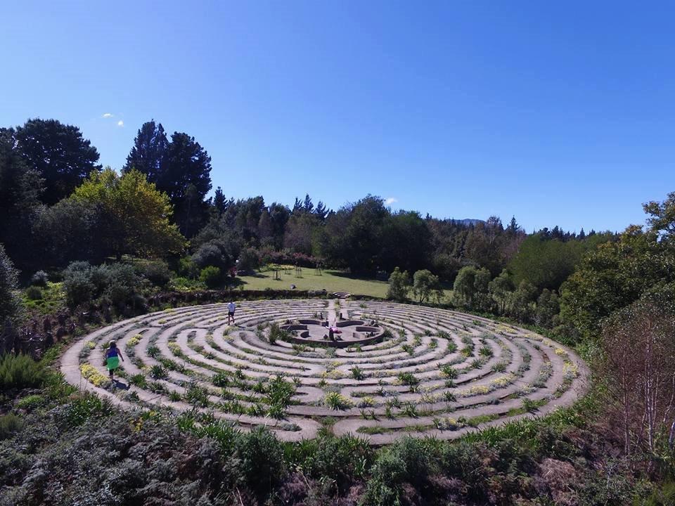
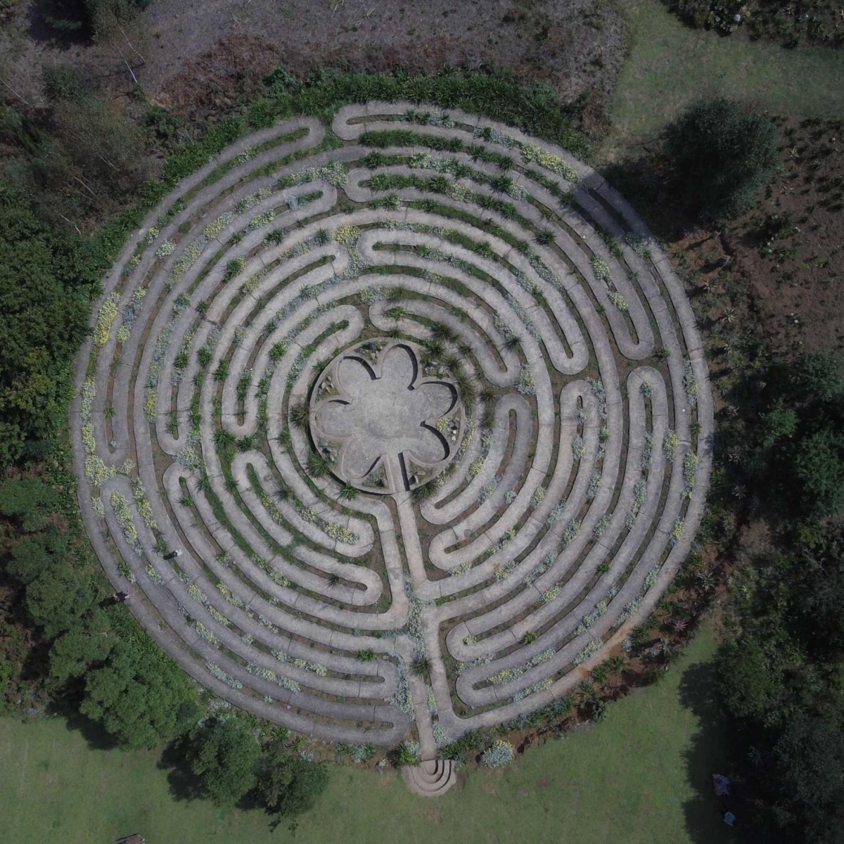
No visit to Hogsback would be complete without visiting The Edge, a restaurant and accommodation venue quite literally on the edge of a cliff. This is meat-eating country, and while you’ll find a couple of okay vegetarian options on the menu, they are somewhat underwhelming. But for the meat-eater the impala shank, or the ribs, are a must.
Ask your waiter to point you towards the labyrinth at the back of the restaurant. It has a diameter of 29 metres and a circumference of 91 metres. The length of the pathway is 700 metres, and the total distance of the walk to the centre and out is 1.4 kilometres. Whether you want to walk it for a meditative moment, or to be mesmerised by the surrounding mountains, glass of wine in hand, don’t leave without a visit
A heritage detour
 Ntaba KaNdoda monument. Photo by Malibongwe Tyilo
 Ntaba KaNdoda monument. Photo by Malibongwe Tyilo
 Ntaba KaNdoda monument. Photo by Malibongwe Tyilo
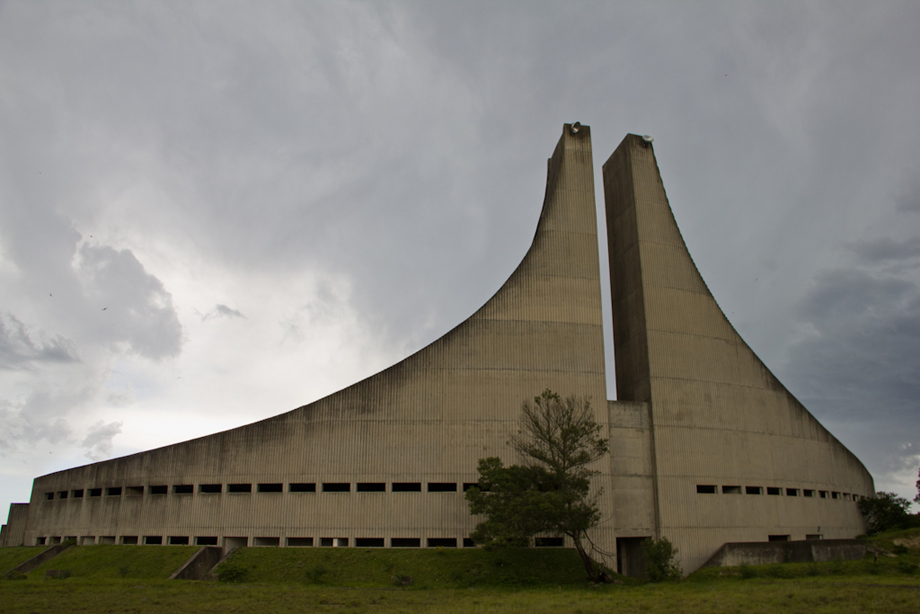
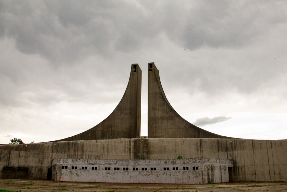
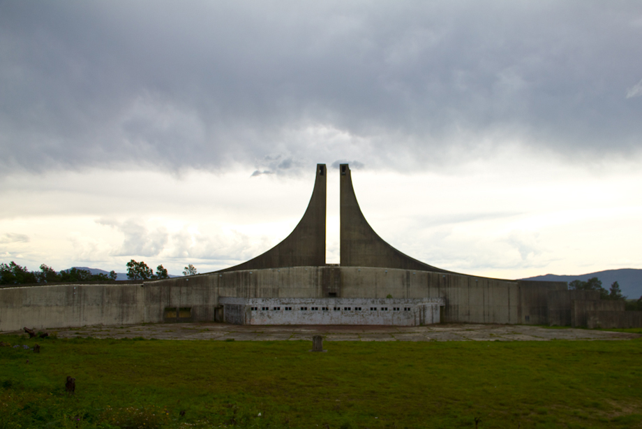
Your day could easily end here; you could calmly drive back home, sleep over in the village, or take one of the many hikes through the village’s forests, or perhaps visit one of numerous waterfalls to immerse yourself in would-be middle earth. If you do, make sure to hike to the Madonna and Child waterfalls. However, if you have an hour or two to spare and want to go off the beaten track for a taste of the heritage this region has to offer, carry on along the R345 and down the mountain pass through the surrounding pastoral villages for half an hour before taking a left on the R63 and heading towards the mountain named Ntaba KaNdoda.
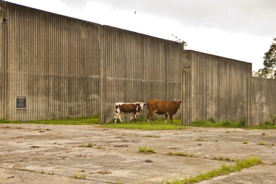
In this case, Google maps will not be the most reliable, as it typically takes drivers on a route that will require them to walk a part of the way. The best route is to drive along the R63 for about half an hour until you reach the R352 towards Keiskammahoek, just before Dimbaza township. Turn left into the road and about 3 to 5 minutes later, look out for a sign that reads: “Ntaba KaNdoda Chief Maqoma’s grave”. Once you see it, turn left into the gravel road and follow it for about 10 minutes until you reach the abandoned Ciskei-era monument atop the mountain, to your left. In its current state, the structure still stands tall and imposing, yet neglected and derelict, its grounds now turned into grazing land for cows from the surrounding villages.
 Ntaba KaNdoda monument. Photo by Malibongwe Tyilo
 Ntaba KaNdoda monument. Photo by Malibongwe Tyilo
 Ntaba KaNdoda monument. Photo by Malibongwe Tyilo
 Ntaba KaNdoda monument. Photo by Malibongwe Tyilo
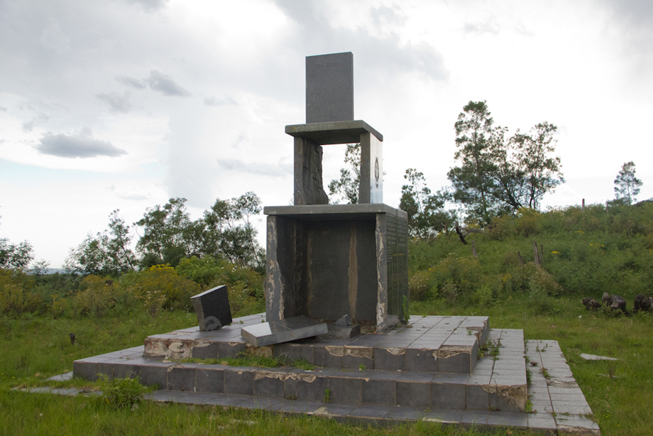
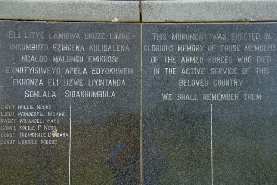
As per Buffalo City Tourism’s records, “It was here that Chief Maqoma camped overnight before marching into battle with Ndlambe’s people. It was also Ntaba KaNdoda that provided protection and cover for retreating Maqoma following his defeat at the Battle of Amalinde. It subsequently became the scene of much fighting between the Xhosa and the British during the War of the Axe (1846-1847), the War of Mlanjeni (1850-1853) and the War of Nchayechibi (1877-1878).” Chief Maqoma’s remains also lie buried here.
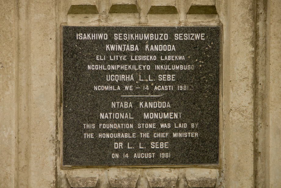
Later, in apartheid South Africa, then Ciskei homeland president Lennox Sebe commissioned the monument and opened it in 1981, to further entrench Ciskean identity. Its 18,000-seat arena hosted annual Ciskean celebrations, during which Sebe would enforce attendance by public servants. As reported by the Eastern Cape Herald in 1985, “When the people of [Ciskean township] Zwelitsha threatened to boycott the Independence Celebrations in 1985, Sebe personally threatened to cut off the town’s electricity and water”.
Sadly, the monument’s ruins stand as not only a reminder of apartheid cruelty and madness, but also a reminder of the criminally poor effort at preserving historically significant heritage sites across the province that hold many a lesson, and cautionary tales, for present-day South Africa.
Nonetheless, while buildings may come and go, and many an institution along the Amathole may lie in ruins, these mountains stand tall and unshakeable, as they have through centuries of battle after battle; home to heroes, villains, intellectuals, colonists, and generations of perfectly ordinary South Africans whose life stories might never make the history books. DM/ML