


 The last corroding remnants of the Aristea. Photo: Frank Boshoff
 I was headed towards Hondeklipbaai to indulge in a five-day walk in the Namaqua National Park and its environs. And this was not your standard “walk from A to B” – this camino consisted partly of individual walks showing off a number of aspects of the larger environment.
Driving up towards the Northern Cape, the dull, dreary, much-needed rain slowly gave way to clearer skies and sunshine.
The final left turn off an artery en route to Klipfontein took me towards the coast through a verdant valley, eventually to enter the park through its gate a few kilometres east of Hondeklipbaai.
Day 1
We slept in tents at Boulder Bay, a desolate spot with windshields to guard against the ever-gusting southwesterly. The temperatures dropped significantly during our meet and greet with the crew and fellow walkers, accompanied by hot food, warm company and a beckoning tent in the naughty corner for snorers.
Getting up the next morning was, initially, a chore, but considering the beauty of the day and the scenery, it was quite exciting.
In addition, the sound of gentle laughter generated by a compatriot, which would be a feature of this walk, rang out as a quiet clarion call – and would for future late risers.
 Flowers begin to peep out after a wet winter. (Photo: Frank Boshoff)
My bergvoete (ugly feet, according to someone close to me) were about to graduate to strandlopers (sand walkers). They would be equated to, and be in the company of part of my history, Autshumao, who was also known as Harry (soon to become Larry) the Strandloper.
Every morning a breakfast of coffee, rusks and cereals set the scene for a joust with the ever-present gentle yet cold breeze, with feet ensconced in trusty hiking sandals. Yet, on this day, there was some uncertainty regarding my “fitness”. Would my winter lethargy hold me back?
We were driven to our starting point, Skuinsbaainoord, south of where we had slept. Our walk started northwards up the coast. The rugged magnificence of the coastline, including the pure white sand of Langstrand, was an indicator of the nature of our future path.
We eventually passed our campsite of the previous night and walked further north until we reached the caves at the mouth of the Spoegrivier. How beautiful the north-facing “caves”, large rock caverns and landlocked grottos, which, in a previous time, sheltered the Nama folk who had farmed here with sheep thousands of years ago.
The high, arching caves reminded me of the Ereboog (a sandstone wonder) outside Eselbank in the Cederberg, another area close to my heart.
This cold coastal region is a special place with special people able to survive here. I am humbled in acknowledging that I doubt I am one such. As with many other parts of this expansive coast, there are old, rusting shipwrecks that abound, the most prominent of which is the Aristea.
The walking day ended with a drive into Hondeklipbaai, where we would spend two nights in homely comfort while continuing the walking programme.
 Entrance to the caves at Spoegrivier. (Photo: Frank Boshoff)
Day 2
Another cold breeze accompanied us as we started the walk after a comfortable sleep. We were to walk a large circle passing the working lighthouse, starting with a short route in a northerly direction on the promontory of the bay. The bay reminded me so much of a smaller version of Paternoster.
Skirting the lighthouse, there is an area of the beach named Koperstrand, or Copper Beach, because its dark-coloured sand is seemingly indicative of this element, among other minerals, in its makeup.
However, beyond the idyllic nature of the setting, some stark reminders of where we were geographically as well as socially were painfully evident.
A significant percentage of the population is without prospects in terms of employment, it seems, and this shows in the condition of the houses and the state of the meagre infrastructure.
The old fish processing factory has long been stripped bare of what little value it contained. Gone are the days of crayfish and fish processing as well as accepting copper, by rail, for transfer elsewhere. It carried a visual look of decay, hidden despair and apathy. According to our hosts, drugs and alcohol further wreak havoc.
Turning inland, the scenery included many mine dumps showing signs of some natural rehabilitation in the sporadic growth of plants.
A specific sign mentioned rehabilitation in progress, yet I wondered what percentage of the total cost of any mining activity is being spent on it.
 The view of Hondeklipbaai is reminiscent of Paternoster. (Photo: Frank Boshoff)
The scarred landscape, before we arrived back at the coast, this time south of the bay, was forever testimony to the greed of the boomtown days.
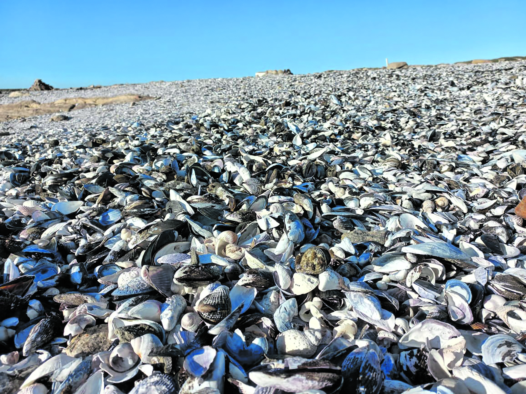
All this did not stop the delayed sign of flowers starting to blossom. Back on the coastline, nature took to showing off again. The butterfly of the beach, and bilobate shells of mussels, adorned the shore, soon to be a component of the coarse white sand by virtue of natural scouring processes.
Storm-generated, kelp was strewn across the landscape, drying in the weak winter sun. This is potentially good money for the entrepreneur and sorely needed employment for the locals.
Eventually, back at our starting point, a tourist spot, Spitfire Rock showed its prowess. Thundering Atlantic swells battered the gneissic rock, rocketing into the sky like a massive explosion, testing the theorem of an irresistible force meeting an immovable object. The rocks have held sway for thousands of years. But, what majesty as the spray rocketed skywards, giving life to the spitfire name.
Day 3
After an exquisite meal and a comfortable bed, a 6am wake-up call beckoned. It started with an hour-long ride in temperatures dipping as low as 2°C. We started the perambulation for the day, this to be a “short” 17.2km towards a fishing village called Brazil.
Again, desolate fields of nothing but vegetation, punctuated with abandoned homesteads with attendant windpumps, all not functioning.
How many lives were lived in these houses? How many residents revisited there, if any? It adds to the melancholy of life… Possessions, money, and worldly things of a past generation mean very little to future generations and zero to the departed.
A note must be made here of the horizon, which included the periodic appearance of a portable, sheltered toilet every 5km. In light of scant and very low vegetation, it was a boon for those wishing to take a dehydration break in private.
Finally, our route ran down towards the coast, and Brazil. As always, the welcome site of our home for the evening provided appropriate mental and physical shelter and culinary delights.
Dinner was enjoyed at a sports bar, close to our finish point for the next day (Kleinzee), to which we were conveyed by car. How pleasant to dine in the lap of luxury every evening after a hard day’s slog.
 Destroyed signs. (Photo: Frank Boshoff)
 An abandoned homestead. (Photo: Frank Boshoff)
Day 4
Another 20km walk, this time to said Kleinzee, mostly on, or adjacent to, the coastline. The sand tracks were again lined by various coastal succulents, many of which seemed bursting with life-giving juices because of the wet winter.
In turn, my life-giving juices were starting to run dry as we did a bit of bundu-bashing towards our destination. Maybe I should upgrade my sandals with updated 4x4 software, much like I had done with my dance shoes?
Oddly, the distant skyline of the small Kleinzee looked like that of a large city. Maybe this was because of not seeing “large” skylines for so long.
Our destination was a campsite in the town. Obviously, this dorp was a relative metropolis in the mining boom era. The remnants of this are starkly apparent based on the investment made by De Beers at the time. It is punctuated by disused, abandoned and now derelict infrastructure of all sorts. I assumed that the now much smaller population is similarly neglected or struggling to survive.
The lovely bathrooms at the campsite and the catering at the restaurant for that evening again made us forget tired muscles and blisters. This was our last formal evening together, since walking the following day would end at Hout Hoop, where our vehicles were waiting to be saddled up. A tantalising yet bittersweet thought.
On the morrow, a relatively short walk of about 17km inland.
 The corroding remnants of the Aristea. (Photo: Frank Boshoff)
Day 5
This was to be a quick walk (yeah, right). Well, suffice it to say that an early start was followed by a slow (for me) final slog to our cars. I started losing my energy stores towards the end, and I was very happy to finish the walk with a little help. Sad farewells were made with a promise to meet again under similar circumstances.
What stood out for me during the experience was the beauty of nature and the coastline, the ugliness of the detritus of greedy mining, the sadness of the decline of once booming villages and the resilience of the residents remaining there. DM
You can visit too by clicking here or here.
This story first appeared in our weekly Daily Maverick 168 newspaper, which is available countrywide for R35.
