


 The Prieska NG Church. (Photo: Chris Marais)
 In the 1980s, the little coastal village of McDougalls Bay was a kind of salty sea dog hangout. The only guys living there permanently were, well, salty sea dogs. And then you had the seasonal holidaymakers who owned shacks of many shapes, hues and tones.
Somebody even hauled an old expired double-decker bus over to McDougalls Bay, plonked it on the sand, hooked it up to power and lived in it.
That’s mostly all changed nowadays. There’s been some significant investment in the area and the general mien of most of the village homes has risen dramatically.
It’s still a holiday haven for Namaqualanders and the odd long-distance Gautenger, and there are still a few colourful mariners lurking about, but one look at the rise in local property prices will tell you McDougalls Bay has become very popular.
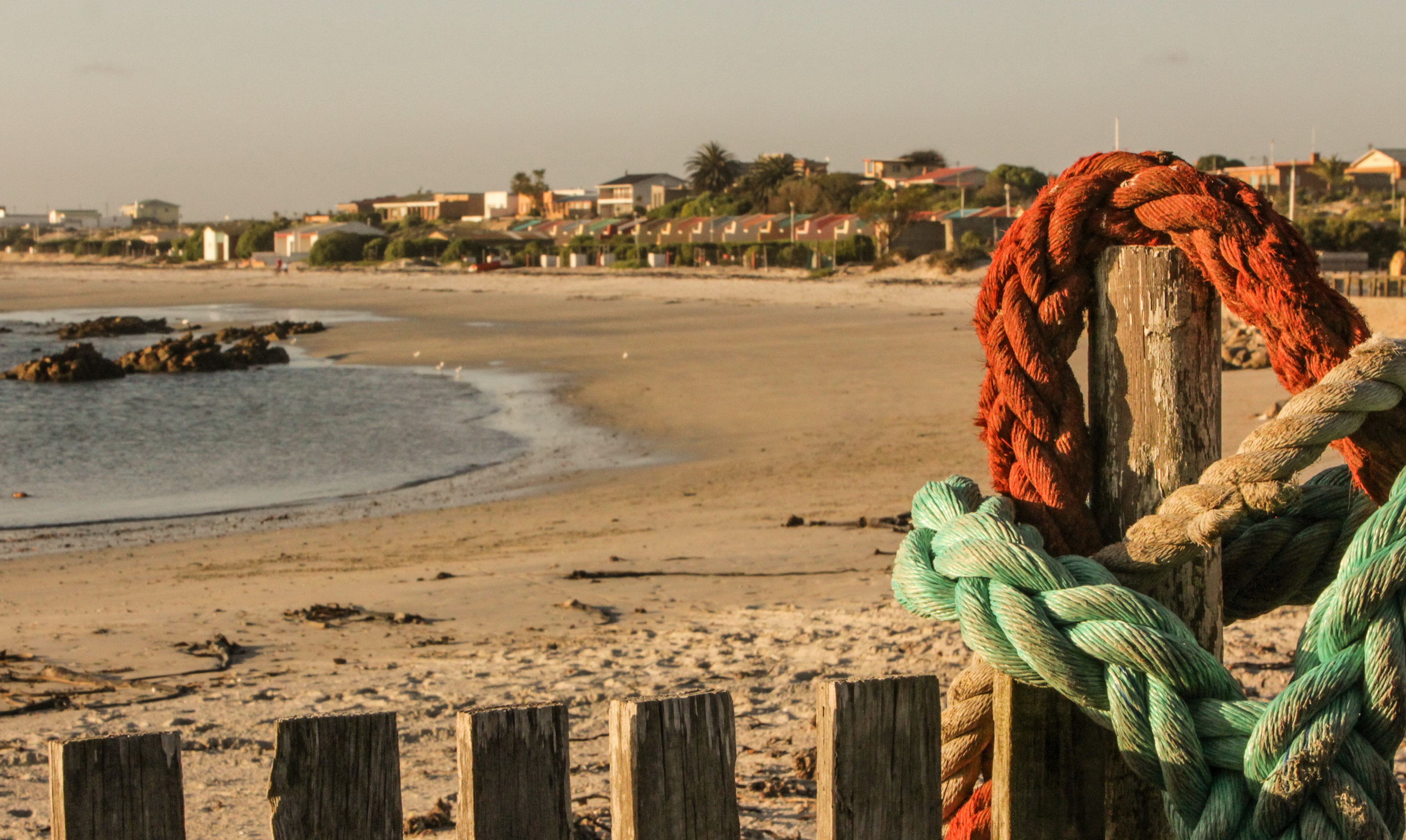
During the lazy summer months at year’s end, the village is awash with jet skis, kayaks and surfboards. Crayfish braais are the order of the day. McDougalls Bay lies a spit away from the legendary Port Nolloth, where it’s all about the diamonds that are dredged from the ocean banks along the coast.
Port Nolloth AKA Port Jolly
“There are more diamonds than raindrops in Namaqualand” is the old saying in the region.
Port Nolloth, near the mouth of the Gariep River, built its fame on the once-fabulous store of diamonds that came out of the Gariep and settled in the offshore shelf formation. Nearly everyone who lives in Port Nolloth is involved in diamonds or tourism.
You feel it as you drive in on the R382 road: it’s a frontier village, stuck at the end of a scrub desert, often shrouded in mist and full of legend.
Read more: The sea cowboys and diamond divers of Port Nolloth
The diamond divers who take on the sea have diminished in numbers over the years, but they still go out on calm days and work the alluvial undersea beds along the coast of Namaqualand.
Some toil away all their lives for a pittance, while others strike it rich and disappear for brighter lights – but only for a while. The charm of living in Port Nolloth always brings one back.
 The Blues Breaker, one of the legendary diamond diving boats out of Port Nolloth. (Image: Chris Marais)
There is also something strangely magical about this little port, which was once famous for shipping out the copper of Namaqualand. As you go to sleep in your rented cottage near the seafront, you will hear the regular muted clanging of the bell buoys in the channel.
For overlanders, Port Nolloth is a good launchpad for trips into the Richtersveld to view nature or visit local communities. Some even begin their odysseys into Namibia from this area, crossing into that country from the Noordoewer side.
Okiep Coppertown
As you drive north from Springbok towards the Namibian border on the N1, look out for the tall smokestack on your right.
That’s the historic icon of a tiny place called Okiep, which was once the centre of the South African copper mining industry. In fact, just before the dawn of the 20th century, Okiep boasted the richest copper mine in the world.
 The old chimney of a copper smelter in Okiep. (Image: Chris Marais)
Also called O’okiep, the village was once linked to Port Nolloth by a rather quaint railway line which crossed the Anenous Pass on its route to the coast. New arrivals from Port Nolloth would spend two days on hard benches as the little train chugged towards Okiep.
During the South African War, Okiep was besieged by General Jan Smuts and his Flying Commando. The legend goes that during the sieges of Springbok and Okiep, Boer snipers would be on the lookout for any British soldiers daring to walk the streets of these settlements. The rule was that they would not shoot at women or children.
The problem for the Brit soldiers was how to get to the saloon without being picked off by enemy snipers. So they hit on the obvious solution: borrow a dress and a sun-bonnet and mince across to the bar like a woman on a mission.
Today, Okiep is a tiny place most famous for its seasonal flowers. In fact, if you want to experience northern Namaqualand at its most colourful, then the Springbok-Okiep area is where you’ll want to be based.
Carnarvon Space
Carnarvon was, until recently, the almost-exclusive preserve of sheep farmers and aviation nuts.
This is the land of the corbelled house, the open horizon, the black-faced Dorper sheep, the wind pump and the aeroplane – just about any kind of aeroplane.
The Dorpers with their high-quality lamb’s meat have taken over from the Merino wool sheep in these parts.
Read more: Carnarvon: A Karoo town with ears on the universe
The wind pumps – most of them much-beloved Climaxes – are essential to get at the underwater aquifers that deliver a particularly sweet brand of Karoo water.
 Downtown Carnarvon on a quiet afternoon. (Image: Chris Marais)
The aeroplanes come here because of all the wondrous dry pans to the north, from which private pilots like to land and take off. And now there is SKA – the Square Kilometre Array. The scientists chose this area because it’s one of the quietest places on the planet. Which is just where one needs to be when listening closely to outer space.
This silence is why SKA, a huge, multibillion-dollar international science project even surpassing the CERN Large Hadron Collider, is to be centred in the Upper Karoo.
The Carnarvon area is the most significant part of a one million-metre complex radio telescope, with its dishes and antenna stretching through Africa and across to Australia, picking up ancient and very significant signals from “out there”.
So, watch the space around Carnarvon. It’s about to get very exciting…
Prieska Lost Goats
If you’ve ever wondered how Prieska got its name, it’s a Koranna word pronounced “Prieskab” and it means “The Place of the Lost Goat”. Whose goat? Was it ever found? Did they eat it? No one knows.
 The Prieska NG Church. (Photo: Chris Marais)
This little town near the Orange River has another oddity: on Prieska Koppie there’s a rather handsome British fort made entirely of unprocessed tiger’s eye. It must be the only fort in the world constructed from semi-precious stones.
To love Prieska, you need to have eyes for the dry country. The town is part of the “Rock Garden Route” which stretches all along the N10, west to the N7 and up to the Namibian border. But once you have an appreciation for Pachypodia (called the “half-mens” – half-human in Afrikaans) and quiver trees and Lithops succulents, you’ll never fancy an English garden again.
During flood season the normally khaki-toned Prieska presents the delightful sight of the Orange River in full spate, rushing through the endless brown landscape of the Northern Cape on its way to the Atlantic Ocean. DM

For more stories on the Karoo from Julienne du Toit and Chris Marais, try their Karoo Roads series of books, priced at R350 (landed) each.
The Karoo Quartet Special (Karoo Roads 1 – 4) consists of more than 60 Karoo stories and hundreds of black and white photographs. Priced at R960 (including taxes and courier in South Africa), this Heritage Collection can be ordered from julie@karoospace.co.za