


 Kamieskroon DRC Mother Church in the spring rains. (Photo: Chris Marais)
 You wouldn’t think that a Northern Cape place such as Britstown once used to breed those clompy Clydesdale horses you normally associate with damp British weather and English country markets. But back in 1885 a group calling themselves the Smartt Syndicate set up shop in these parts, constructed a couple of dams and planted lucerne, which they fed to their herds of karakul sheep and Clydesdales.
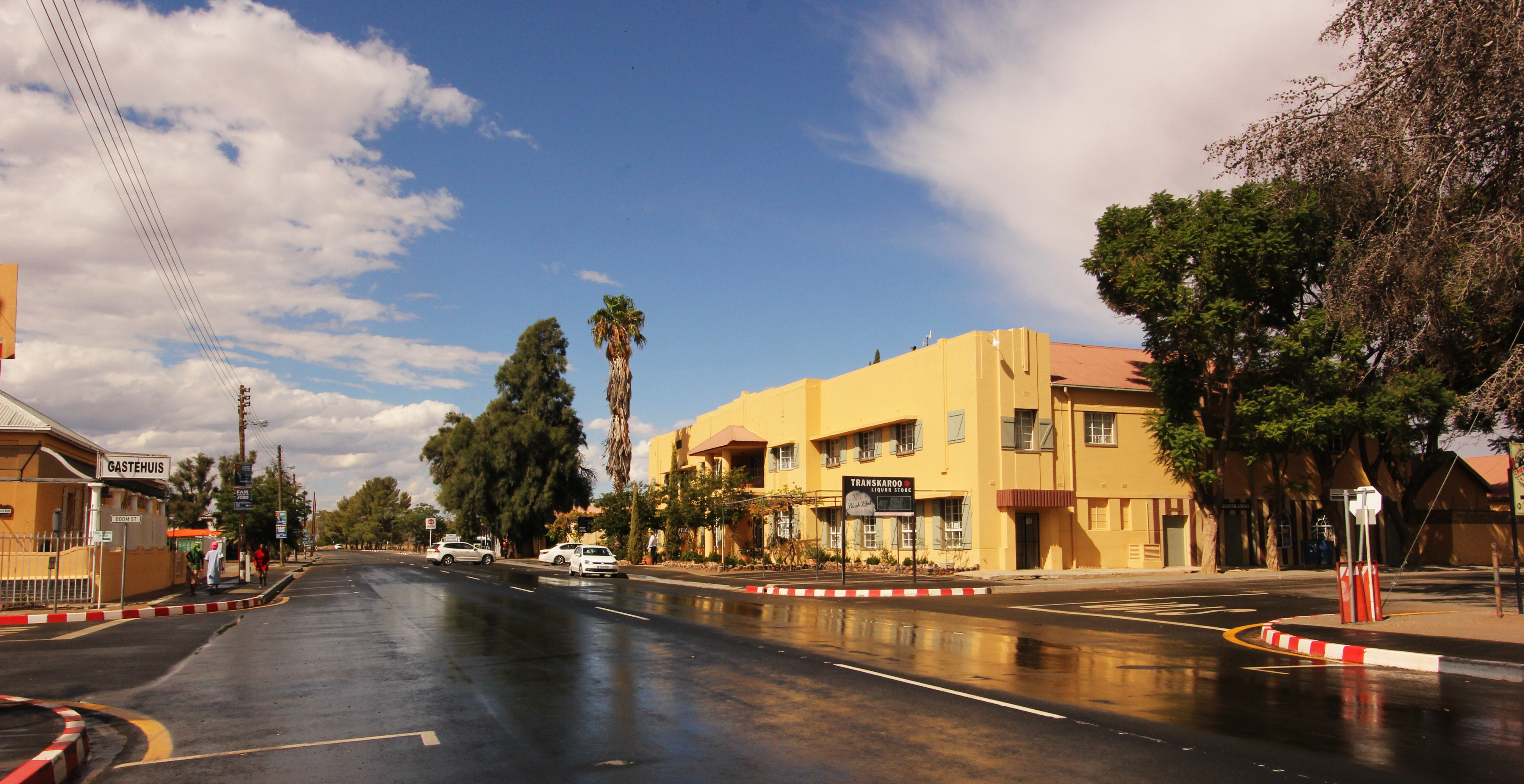
These days, much of the action happens around the Transkaroo Country Lodge in the middle of town. From here, you can organise some of the finest natural experiences in the Karoo: hiking trails on local farms, which expose you to stunning views and landscapes.
Britstown is named after one Hans Brits, a local resident who used to travel with explorer David Livingstone. Brits realised that the recent diamond boom in the Kimberley area would bring thousands of fortune-hunters streaming into the Northern Cape. So he set up a town on his farm, which lay smack dab in the middle of the Diamond Way (the route between Cape Town and Kimberley), and it became a way station providing fodder, food, drink and occasional musical merriment for trans-Karoo travellers with dollar signs in their eyes.
And when gold was discovered up in the Witwatersrand where Johannesburg now stands, Britstown became an even more sought-after stopping point. A lot of beers were served in Britstown during the boom years before the South African War. But the Great Trans-Karoo Railway Line was built, and the diggers took their travelling ease on this famous train instead.
And Britstown became what it is today: a quiet little settlement in the Karoo.
Colesberg Walking Tour
 On a walking tour of Colesberg’s architectural heritage sites. (Photo: Chris Marais)
The rocky hills around Colesberg have seen a lot of action in millennia gone by.
The Stone Agers were the first humans to wander through these koppies. The trekboer and his herds followed in colonial times, and then came the missionaries from all over Europe.
The South African War at the turn of the 20th Century saw to it that Colesberg was, for a few years, a very dangerous place to be. Nervous townsfolk used to watch the koppies for signs of a sniper or a large gun emplacement.
It also became the home town of international golf ace Gary Player, the local seat of the sheep industry and a major racehorse-breeding district.
There’s a fantastic rural school on an outlying farm, a tourism school in town and a massive accommodation network to welcome the Johannesburg–Cape Town traffic.
For those travellers who have time to look around for a day or so, Colesberg offers a great walking tour. Just ask your overnight host for a pamphlet and follow the signs.
You will see all the classic Karoo and Cape Dutch architecture here, mostly from Victorian days. The local museum offers an insight into early colonial days in Colesberg; there’s an old horse mill (currently a popular bar), the old courthouse, the Mother Church and a visit to the local township.
Griquatown – missionary settlement
 A museum in memory of a remarkable missionary’s wife in Griquatown. (Photo: Chris Marais)
Mary, the daughter of famous missionaries Robert and Mary Moffat of Kuruman, married that remarkable adventurer-missionary, David Livingstone. She was born in Griquatown, which has one of the most colourful histories of all the settlements of the Northern Cape.
The original settlers of Griquatown were a KhoiKhoi clan which came up from Piketberg, in the Western Cape. Led by Adam Kok, they established the town as the centre of their Griqua Republic. Working with another Griqua leader, Andries Waterboer, Kok set up a state which had its own coinage, flag and gunpowder factory. The British authorities gave them two small cannons, which they called Old Niklaas and Old Grietjie.
Griquatown – the first settlement north of the Orange River – became a centre for adventurers, stock thieves, farmers, lovers of Cape Brandy and outlaws. The Griqua leaders set up a “hanging tree” in the town to discourage bad behaviour.
Adam Kok eventually led his followers off to Philippolis and then subsequently to Kokstad in the Eastern Cape. Griquatown became part of Griqualand West, which was annexed to the Cape Colony.
Tourists passing through Griquatown can visit the Mary Moffat Museum, the two cannons (at the grave of Andries Waterboer) and a local factory which is processing some of the most beautiful semi-precious stones to be found in the district.
Raging cows of Kakamas
 One of the old classical water wheels of Kakamas. (Photo: Chris Marais)
Kakamas is a Khoi term meaning “poor pasture” or “raging cow” or “brown”, depending on your source.
However, the town of Kakamas in the upper Northern Cape snuggles into a fast-flowing Orange River and is today a place of vast table grape vineyards and lucerne fields.
In fact, if you overfly Kakamas, you will see how verdant it is, lying in a riverside strip of Irish green. And then just a few kilometres out either side of the Orange, you see scrub desert lands.
So the real story of Kakamas is all about water and how it feeds the people who live here.
At the turn of the 20th Century, farmers were given riverside plots if they reciprocated by building a system of irrigation canals and tunnels. A locally designed water wheel complex was built to bring the precious fluid to higher ground and pretty soon the breakfast tables of England and Europe were bedecked with grapes and peaches from Kakamas.
Kakamas also falls on the axis of Bushmanland and the Kalahari, and its Khoi founder was a river pirate who later reformed and became a devout Christian. Klaas Lucas, one of the “river people”, also founded neighbouring Keimoes, which means “mouse nest” in Khoi.
One of the major attractions in the area lies northwards, in the form of the Augrabies Falls National Park. This, in Khoi, means “the noisy one” and it’s a very apt name, as the Gariep River narrows at one point and cuts through granite with great force and thunder. Augrabies is full of interesting trails, and the falls themselves must not be missed – just take care in the rainy season.
Wildflowers of Kamieskroon
 Kamieskroon Dutch Reformed Mother Church in the spring rains. (Photo: Chris Marais)
As you approach the Namaqualand village of Kamieskroon on the N7, it presents a picture of rural tranquillity that makes one dream about living here some day in the future.
Kamieskroon nestles snugly into the foothills of the Kamiesberge, and if you come here in the spring months of August through October, there’s mostly always a flower party going on.
The wildflowers run like garlands about the village, but that’s not all. Take a drive 20km to the west and you’ll find the Namaqua National Park, where the daisy fields are so vast the intense colour floods the senses.
The late, great, local photographer Colla Swart once said this about the blooms around Kamieskroon:
“The spring flowers are only the lipstick on the face of Namaqualand. I love it all. It’s like seeing my father’s face. But I didn’t just love his smile. I loved all of him.” DM

For more stories on the Karoo from Julienne du Toit and Chris Marais, try their Karoo Roads series of books, priced at R350 (landed) each.
The Karoo Quartet Special (Karoo Roads 1 – 4) consists of more than 60 Karoo stories and hundreds of black and white photographs. Priced at R960 (including taxes and courier in South Africa), this Heritage Collection can be ordered from julie@karoospace.co.za