


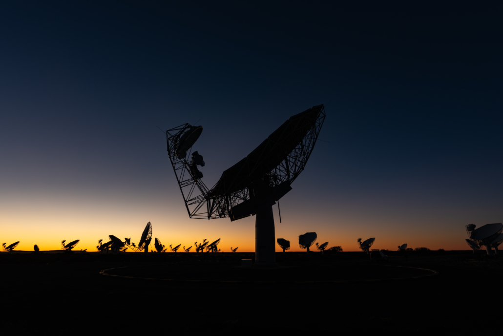
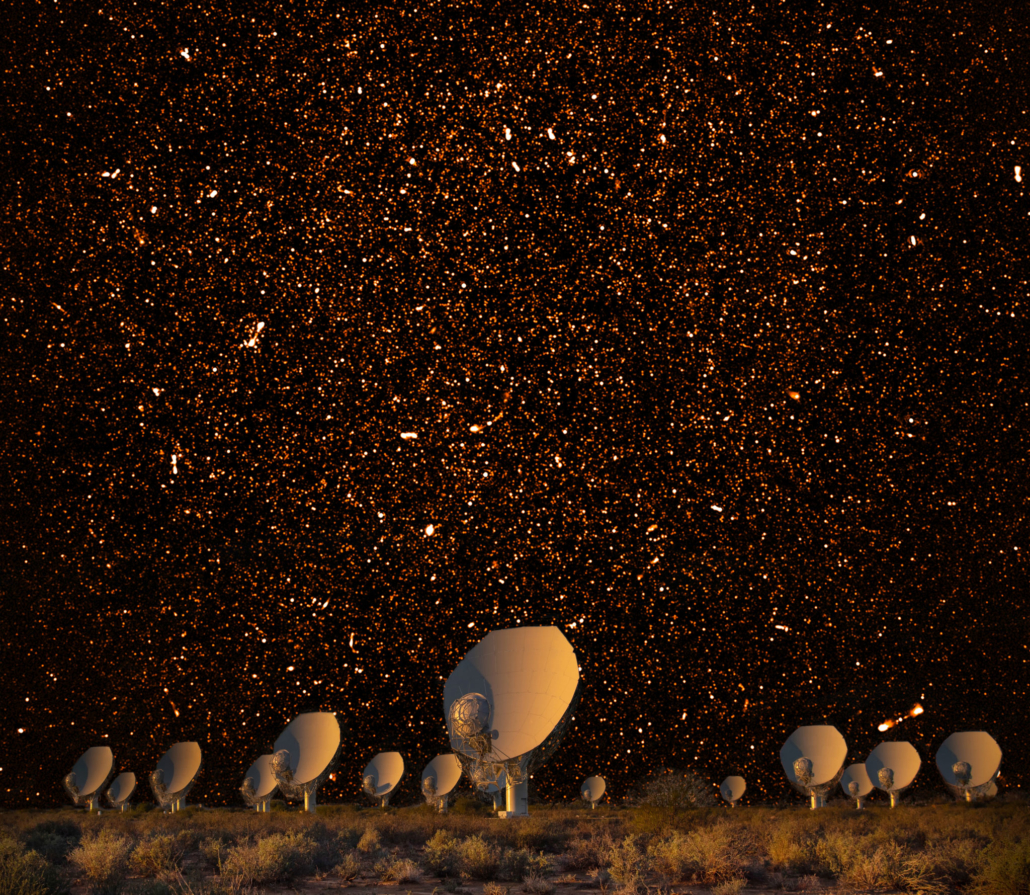
 MeerKAT and bubbles. Image: SARAO
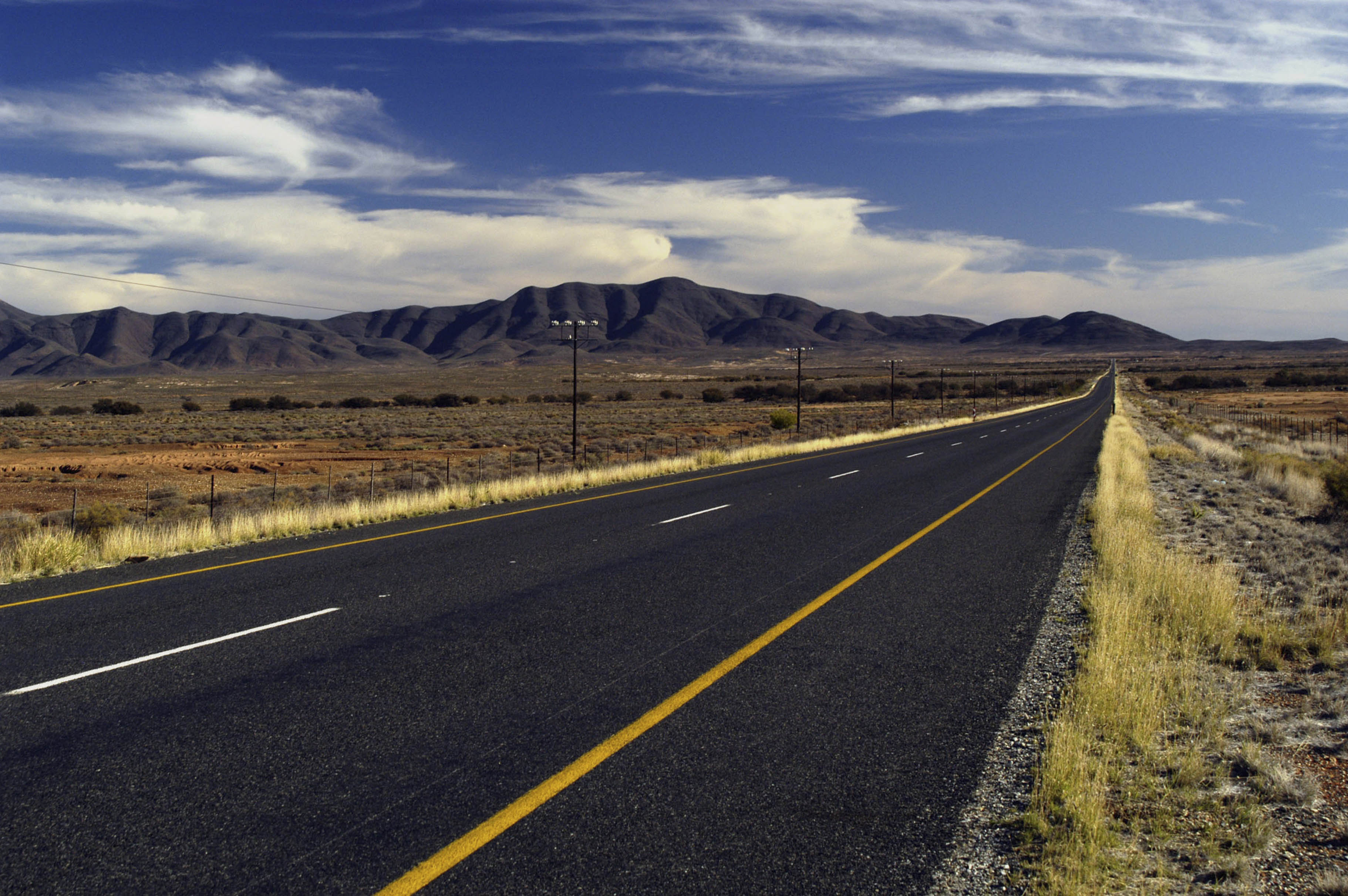
 The route eventually took us south through Kenhardt and Brandvlei in the heart of the Northern Cape, on the R27, a road of pristine simplicity.
The region has the advantage of conditions that favour road longevity (stable geology, low rainfall and low traffic), and this explains the road’s immaculate condition – but it is hard to believe that the planning authorities ever imagined that the route, which effectively connects Upington and Calvinia, would justify the cost of its construction in purely economic terms, no matter how favourable the environment. Thus, its mere existence is harder to explain.
Was there some militarily strategic reasoning behind it?
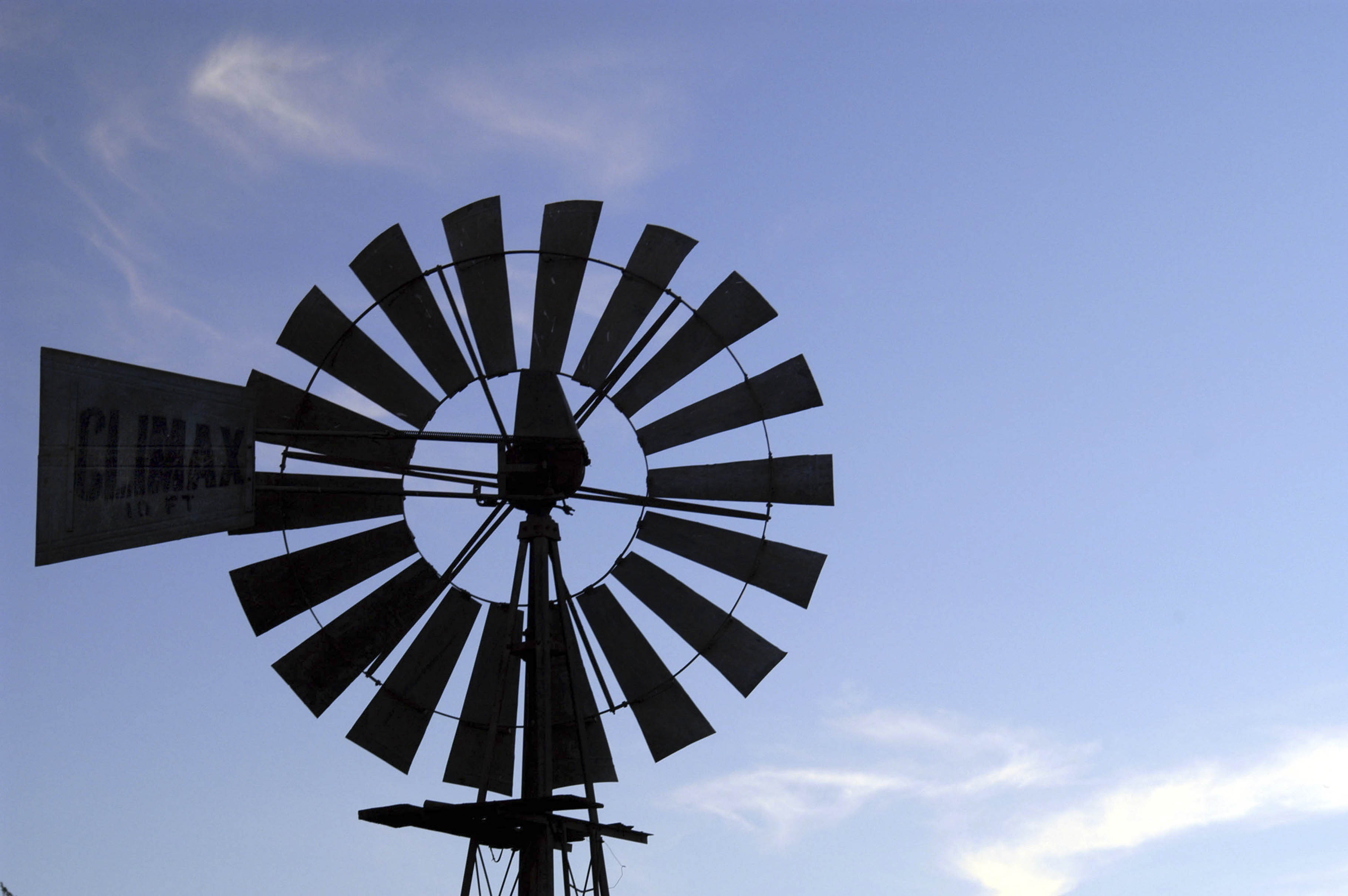 Calvinia, Northern Cape, Karoo, on the R27 road. Close-up of a Climax wind pump silhouetted against blue sky. Image: Supplied
An odd road on the map
According to Wikipedia, an artillery battalion, helicopter squadron and a ground attack jet squadron were located in Brandvlei from 1974 until 2005, but the reference link is broken so this cannot be verified.
Was there perhaps just a particularly well-connected mayor in Kenhardt, population 4,800, at some moment in the 1960s or 1970s?
Political considerations are known to affect road planning decisions: A former Department of Transport engineer told me that PW Botha once poked his finger at Upington and Askham (a village near the Botswana border, population 278 in 2001) on a map, saying “Daar moet a pad hier kom.”)
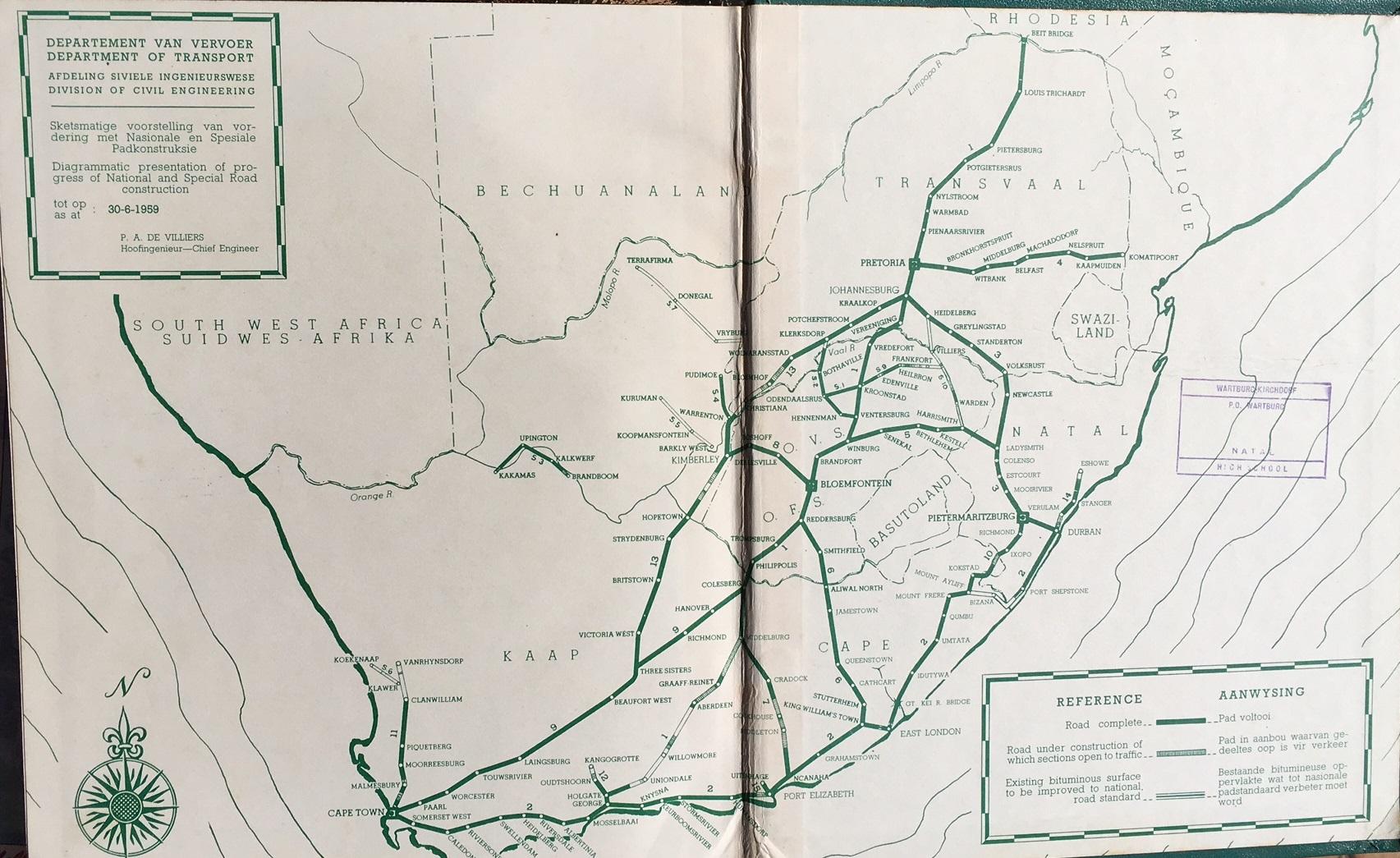 Department of Transport Map of South Africa, 1959. Image: The Heritage Portal
Even major routes are susceptible to political interference: The same engineer told me that the N1 almost terminated in George rather than Cape Town because an influential member of the National Road Board in the 1930s was a lawyer from George.
Perhaps there is a similar story behind the construction of the R27. Or perhaps it was built just because the gaping void in the road network between Calvinia and Upington just looked so odd on a road map.
Whatever the case may be, the R27 is there now, and the place is no longer the Karoo written wistfully of in the 1950s by South African journalist and author, Lawrence Green, traversed at “the pace of the ox,” under “the great hush that reigned before the coming of petrol engines”.
And yet the line of development that went from ox carts to petrol engines and from dirt tracks to tarred roads has not continued, as Green may have feared, toward an ever noisier, more polluted and more frantic Karoo, even if it is now bisected by a beautiful, modern road.
In fact, thanks precisely to the quality of the road and the soundproofing of modern cars, that great hush can perhaps be approached more closely today than when Green was writing.
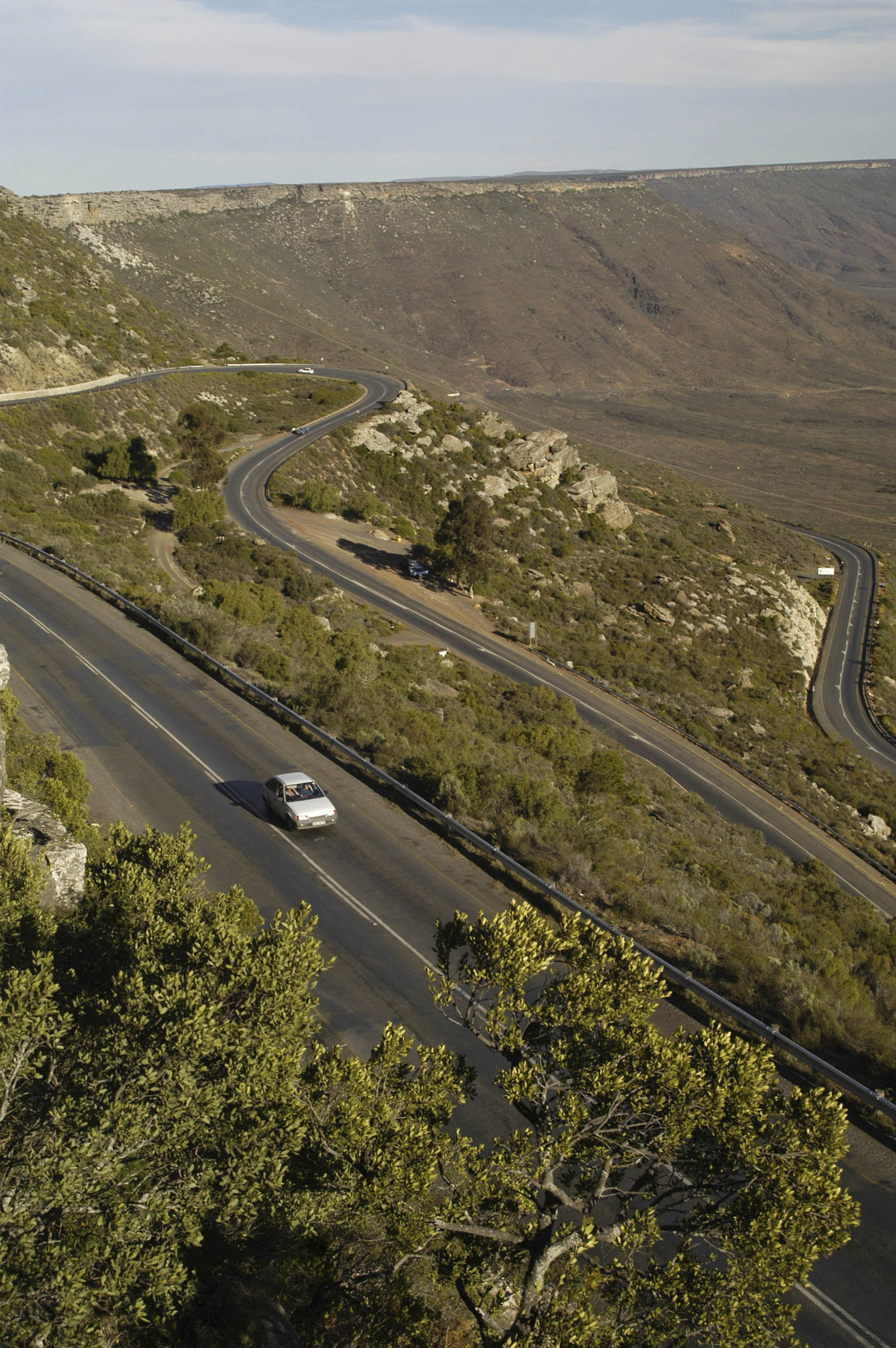
 R27 road heading towards the Vanrhyns pass on the way to Nieuwoudtville, near the Northern Cape border. Looking back down the empty road towards Vanrhynsdorp surrounded by Karoo-like vegetation. Image: Gallo Images/ MARYANN RIVERS-MOORE
 View from the Vanrhyns Pass winding its way to Nieuwoudtville on the R27 road on the border between Northern and Western Cape. Image: Gallo Images/ MARYANN RIVERS-MOORE
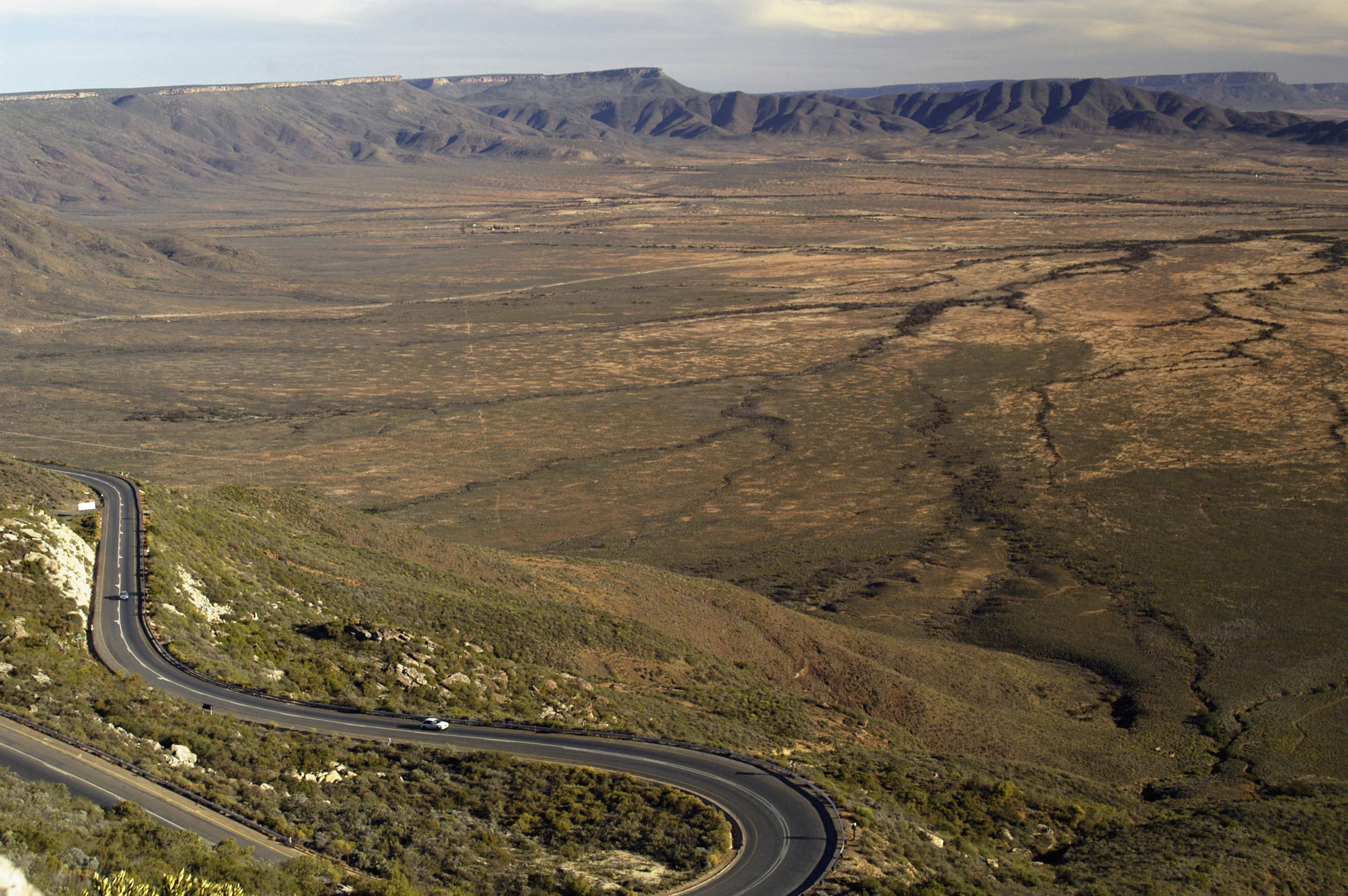
Anything but nothingness
Between Kenhardt and Brandvlei, bends in the road can be counted on the fingers of one hand, the angles of these bends measured in single digits and their fractions.
This minimalism is manifestly borrowed from the landscape itself, an ancient ocean floor punctured only occasionally by great frozen eruptions of dolerite, and covered with sparse, waist-high shrubs, kokerboom and rounded boulders of the same dolerite oxidised to a deep and distinctive rusted aubergine black.
The landscape forms a stage for meteorological dramas on a grand, operatic scale – a thunderstorm, seen first some way off in the distance to the west, a mass of cloud dragging along with it a dense column of rain as it migrates eastward, looking like a herd of giant avian jellyfish.
We intercept the storm about 50km outside Brandvlei, and for about five minutes, the Permian Karoo Sea is restored and the car is a submarine.
The anonymous author of the Wikipedia entry on Kenhardt writes that “if you travel south from Kenhardt towards Brandvlei, you will pass through a huge landscape of nothingness for the next 200km and more”.
 View from the Vanrhyns Pass winding its way to Nieuwoudtville on the R27 road on the border between northern and western Cape. Karoo-like vegetation surrounding the Pass. Image: Gallo Images/ MARYANN RIVERS-MOORE
Redundantly, the entry on Brandvlei, evidently penned by the same scribe, records that if you travel north from Brandvlei towards Kenhardt, too, you will pass through a huge landscape of nothingness for the next 200km and more.
Nothingness is the same no matter which way you go through it, it would seem.
And yet, even after setting aside the great gravel-and-asphalt thing beneath the wheels, and supposing for the sake of argument that the natural landscape can be safely rounded off to zero, the space between Kenhardt and Brandvlei can be described as nothingness only under a parochial and anthropocentric definition of thingness – parochial insofar as the region was, until the 1800s, the heartland of |xam-speaking Bushmen, who have left traces of their lives on the landscape itself (artworks, tools, rock gongs); anthropocentric insofar as what is empty of noise is ipso facto full of information – in this instance, information in the form of radio waves pouring in from the farthest reaches of the galaxy and beyond, which makes the region, in the words of the Astronomy Geographic Advantage Act of 2007, “uniquely suited for optical and radio astronomy”.
Making space for the telescope
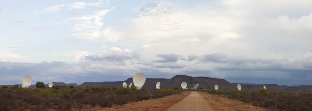
The Act established an astronomy reserve inside which the South African portion of the Square Kilometre Array telescope is being constructed.
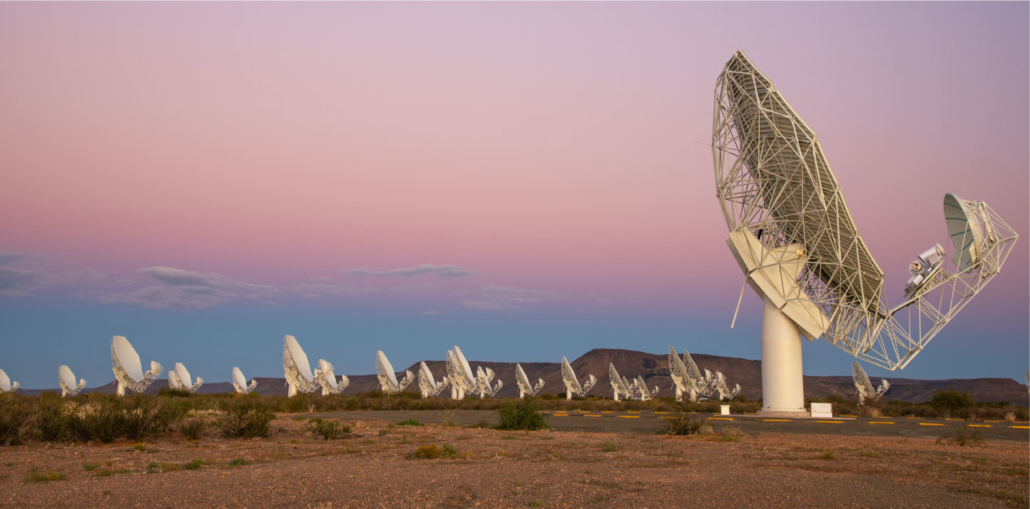
The Square Kilometre Array (SKA) is so named because, when complete, the collecting area of its 197 base stations will add up to one square kilometre. The project is an international collaboration between 14 countries, with about 100 different organisations contributing to its design and development.
Already, a torrent of astronomical data from the 64 base stations of the MeerKAT precursor project is being sent to scientists around the world, the dividend of the international co-operation on which an instrument of such scale depends.
 MeerKAT, 2016. Image: SARAO
The data from the SKA will be used to test the theory of relativity, refine our understanding of the formation of stars and galaxies, and even investigate the possibility of extraterrestrial life.
To do this, it will plumb a cosmic quiet, a hush that reigned for millions of years, not just before the coming of petrol engines, but before even the creatures that lived in the ancient Karoo sea had died and become the fossils that would be transformed, over still more millions of years, into fuel.
The R27 passes right through the astronomy reserve and just to the west of the 50km radius “buffer zone” of the Core Astronomy Advantage Area, where most of the base stations will be located and where the regulation of human electromagnetic activity will be most severe.
Even a barbed-wire fence vibrating in the wind might interfere with the telescope’s sensitive antennae.
 MeerKAT, 2018. Image: SARAO
The base stations will radiate out from the core in three great curves, not unlike the arms of a spiral galaxy. The base station at the tip of the westernmost arm will come within just five kilometres of the R27, and thanks to the flatness of the land, it is likely that many more of them will be visible from the road when the Array is complete.
With luck, in the decades to come, travellers on the R27 may see not only the base stations of the SKA, but also the descendants of Khi Solar One, the 50MW concentrated solar power plant outside Upington, which appeared to us as a glow, hovering near the horizon like a setting sun as we followed the Orange River between Upington and Keimoes, where the N14 becomes the R27 and begins its traversal of the |xam heartland.
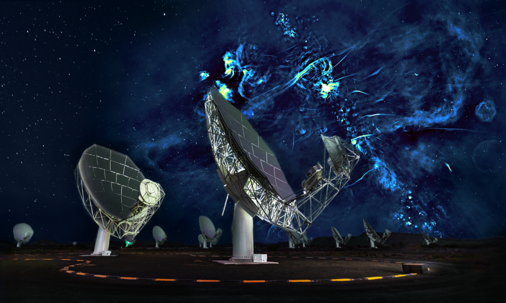
 Night sky. MeerKAT, 2019. Image: SARAO
 MeerKAT and bubbles. Image: SARAO
Responsible for the glow but not visible from the road is a heart-shaped, 2.3km-diameter field of heliostats – articulated mirrors, themselves each 10m across, that track the arc of the sun and reflect its light back to the top of a 200m tower to create the tiny new sun that we saw from the road.
Tony Jackman wrote earlier this year about a trip through the Karoo on the N1. Decrying the recklessness of drivers willing to risk their own lives and those of other road users for the most marginal of gains, he resolved never again to drive to Cape Town during the Christmas holidays.
His dissatisfaction with the journey went beyond the danger, though: “The true depths and nuances of the Karoo are rendered meaningless in the sweltering chariot race,” he observed, “its arid beauty devolved into a giant obstacle to get through and survive.”
The Karoo has changed and it will go on changing.
For some, perhaps all of us at certain times, it will always be an obstacle to get through – whether it is a huge landscape of anonymous nothingness or is scattered across with the ancient and modern outputs of human creativity will not make much difference.
For others, meanwhile, every new trace of a human hand will be just one more step in the direction of ruin, almost a desecration, and the eventual disappearance of these traces a moment to be hungrily anticipated.
But we are not condemned to a choice between indifference and eager fatalism, because it is possible to imagine a near science-future of the Karoo in which it plays host to technologies that observe its depths and nuances by design, and are to that extent in harmony with it.
In this future, even amid the serene and respectful presence of our best science, the R27 will remain the preferred route for the type of journey that is not constrained completely by a narrow calculation of only its most obvious costs and benefits. DM/ML
In case you missed it, also read 'Eavesdropping on the sky: The backstory of MeerKAT and SKA'
https://www.dailymaverick.co.za/article/2021-08-17-eavesdropping-on-the-sky-the-backstory-of-meerkat-and-ska/
[hearken id="daily-maverick/9591"]