


 A wave platform on a modern shore at De Hoop Vlei, Western Cape. This feature was studied by the team’s geologists to better grasp the characteristics of ancient platforms. (Photo: Paul Hearty)
Welcome to the Pliocene – an ancient proxy for a future world in which big carbon can rewrite global temperatures and expanding oceans can swallow liveable land.
To catch a glimpse of how such a hostile planet could become a reality for modern humans, a major new analysis published by the American Geophysical Union urges us to travel several million years into the deep past. Back then, the atmosphere’s carbon dioxide needle hovered around 400 parts per million, roughly the same as today – and what’s more, these very conditions churned up sea levels many metres higher than modern oceans, the paper suggests.
As a natural pressure cooker, this epoch has intrigued climate modellers for years, but they lacked data for how the Pliocene’s motherload of CO2 fed into other big-picture drivers of potentially catastrophic change, such as melting ice caps and rising sea levels.
Supported by a $4.25-million grant from the US National Science Foundation to cover a research period of five years, an expert group of geologists, glaciologists, climatologists and crust modellers set out to help solve this puzzle. They dubbed their grant “Pliomax”, short for “Pliocene maximum sea level”.
Team Pliomax’s mission? Using the Republic of South Africa as a prime natural laboratory to see just how high sea levels can soar in a 400ppm world like ours.
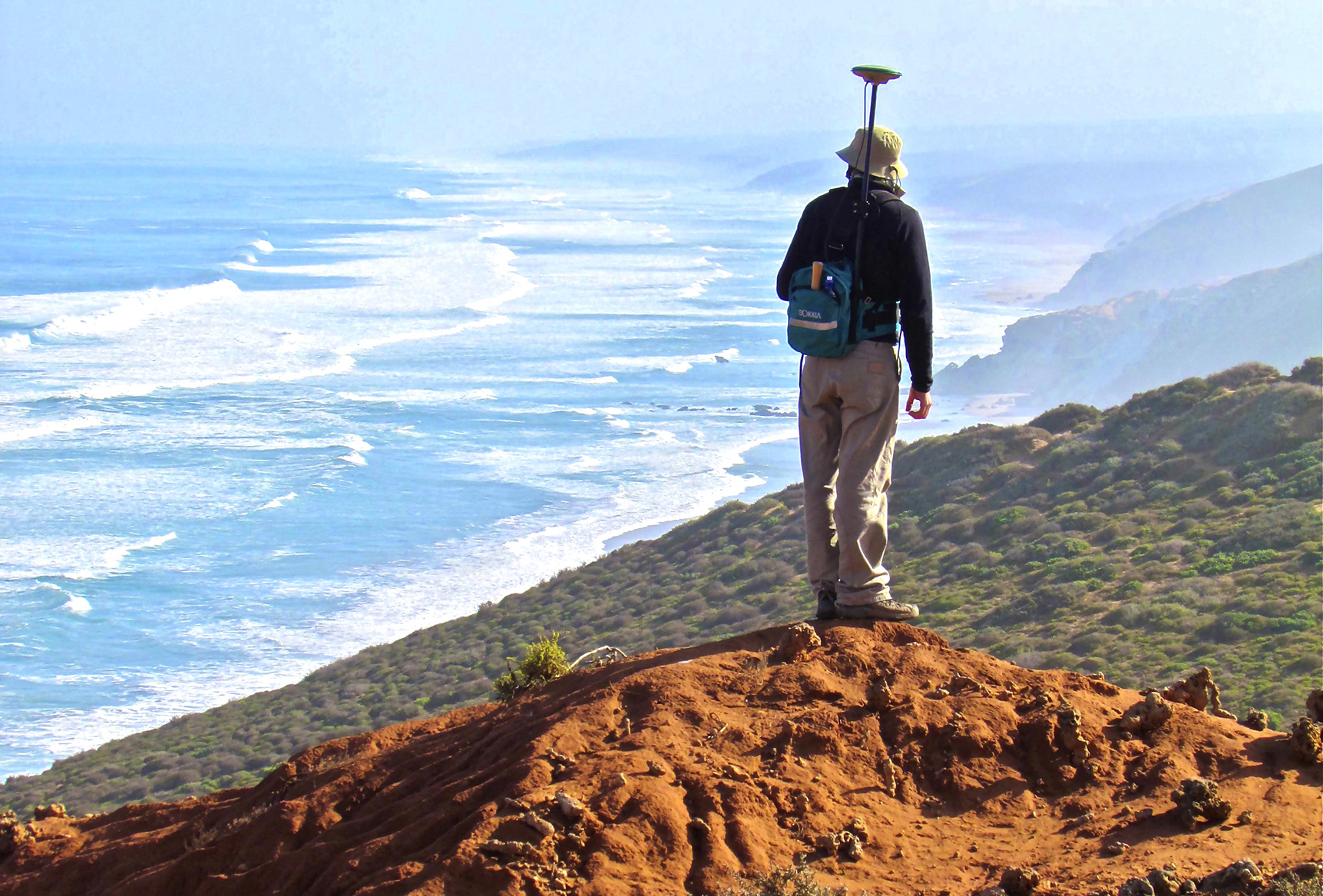
 David Lester Roberts surveys the upper part of the Cliffs Point sea-level deposits at Papendorp, Western Cape. Fossils from these deposits date to the early Pliocene at 4.6-million years. (Photo: Paul Hearty)
Reshaping the field of marine geology
Where movement in the Earth’s crust, and forces such as ice, wind and water have not disturbed bedrock and soil too much, we have in these layers of sediment a time machine – reliable and sure. That is why South Africa lured the Pliomax team: its coastline is known to be relatively stable and accessible. Among geologists it is also prized for its beautifully preserved deep-time sediments showing how far primal oceans may have thundered inland, not only during the Pliocene, but also the subsequent epoch, the Pleistocene.
“It’s not always exactly what you see – sea levels are moving… but the land is also moving,” says lead author Professor Paul Hearty, a marine-geology and sea-level specialist with the Jackson School of Geosciences at the University of Texas at Austin.
For instance, the southeast US is a powerful example of such a moving land, shaped by more than mere plate tectonics. “Ice sheets once stretched all the way down to present-day New York City,” muses Hearty. “The weight of the ice actually deformed the Earth’s crust.”
As that ice melted over tens of thousands of years, the crust rebounded and deformed, complicating measurements for geologists. It was Hearty’s colleague and co-author, the leading paleoclimate authority Professor Maureen Raymo, who first came to the insight that crust deformation caused wildly varying estimates of Pliocene shorelines.
Mapping with Hearty and co not only the tectonically stable coasts of South Africa, but also those of the southeast US, Argentina and western Australia for additional papers, Raymo realised something other than tectonics – ice sheets – must have caused conflicting measurements.
“We provided the first model the scientific community could use to correct for shorelines in the deep past,” Raymo told Daily Maverick.
The scientist is the first woman to win the Wollaston Medal in the geological award’s 190-year history, joining the ranks of Charles Darwin and James Lovelock as one of the most influential scientists of her time. She is the recently appointed interim head of Columbia University’s Lamont-Doherty Earth Observatory, which popularised the term “global warming”.
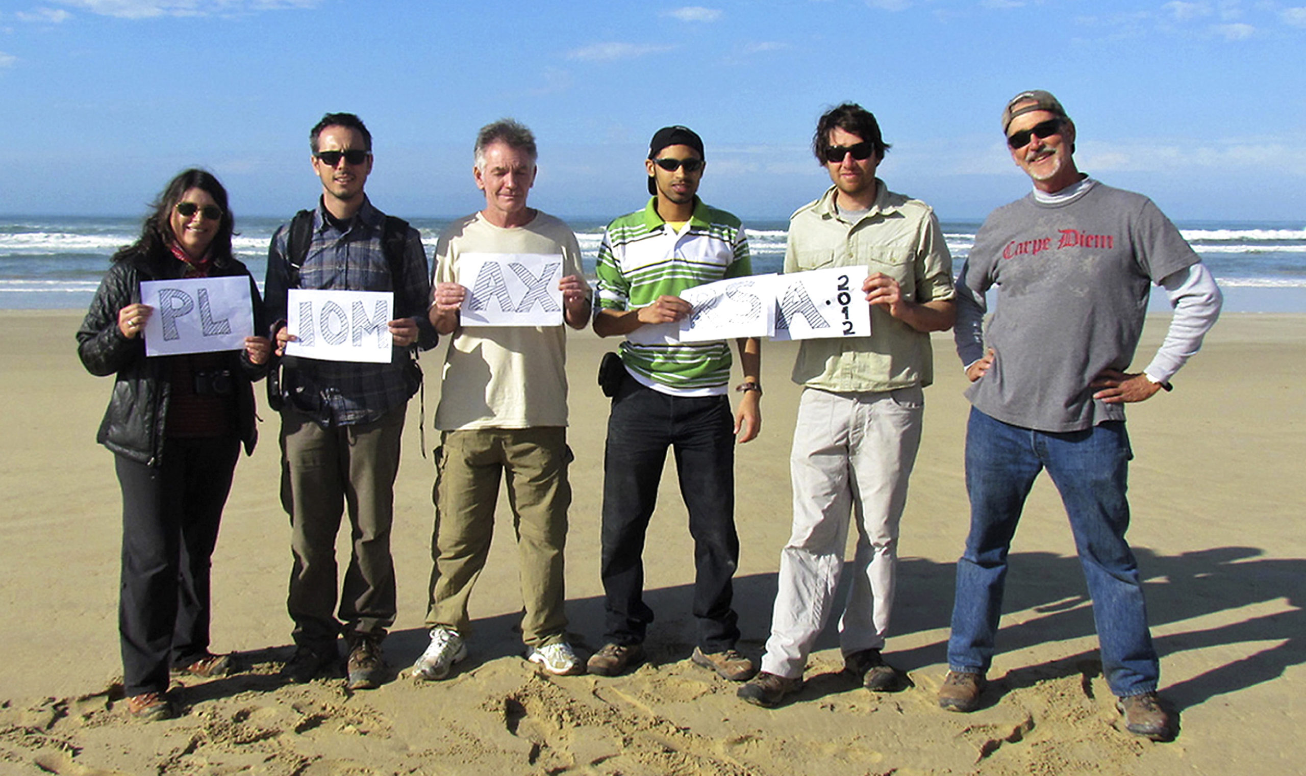 Dubbed ‘Pliomax’, the scientists gather at Still Bay on the Cape coast. They hail from US, German, Australian and South African institutions. Left to right: Co-authors Maureen Raymo, Alessio Rovere, David Lester Roberts, Eugene Bergh, Mick O’Leary and lead author Paul Hearty. (Photo: Paul Hearty)
The rock whisperer’s mines
To trace the ghostly edges of South Africa’s Pliocene oceans, Hearty and Raymo – together with their co-authors Professor Alessio Rovere, Dr Mike Sandstrom and Dr Mick O’Leary – selected 17 sites along the country’s western and southern coasts. (An additional co-author, the South African field geologist Dr David Lester Roberts, died in September 2015. Dr Roberts discovered the oldest fossilised Homo sapiens footprints – Eve’s Footprints – on the country’s Atlantic coast in 1995.)
Hunting down portals that would hopefully betray clues of past sea levels was a matter of scouring 700km of coast between Hondeklip Bay in the northwest to Mossel Bay in the southeast; as well as relying on some previous literature, trained eyes, instinct and patience.
As a good starting point, the researchers knew they were not interested in the kind of rocks that make up Cape Town’s Table Mountain, forged in a different, much older geological uplift: “If you have a bunch of craggy, spiky rock, like you do there, it’s not going to give you anything,” explains Hearty. “You can’t really preserve marine deposits – like shells and things – among that hard, metamorphic rock.”
Instead, their targets were exposed tide-sculpted outcrops, cliffs, terraces and platforms holding fossil shells and marine invertebrates, such as oysters and barnacles. Even whale bones were fair game.
“Where you should go, you know, is flying by the seat of your pants,” says the affable Hearty. “You just basically say, ‘Well… this dirt track looks good. Let’s try it.’ ”
A long-time collaborator of the climatologist James Hansen – the scientist to put climate change on the map by testifying before US Congress in 1988 – Hearty first became interested in rocks as a young pottery master’s student in the early ’80s. A search for clay sent him over to the geology department at the University of Nebraska in the Midwest US. Before he could say “rock hammer”, he was a geology professor’s field assistant, taking his PhD at the University of Colorado Boulder.
“I learnt to read rocks – it’s just so gratifying,” he says. “And the rocks don’t lie. They don’t care if it’s the Pliocene or 5,000 years ago. What the rock says is where the sea-levels are at.”
Among the crew, Hearty became known as the “rock whisperer” for his ability to decipher the language of rocks. He was driver “most of the time, because I knew where I wanted to go”.
“So we’re screaming down the road at 100km/h – and all of a sudden I’m lying on the brakes,” he says of the moment they hit paydirt near Bredasdorp on the southern coast. Stressing his point, he imitates screeching brakes.
“And about 15m off the road, there’s this shell bed,” he smiles, “and the shells are still in their living position in what we presumed to be Pliocene marine beds.”
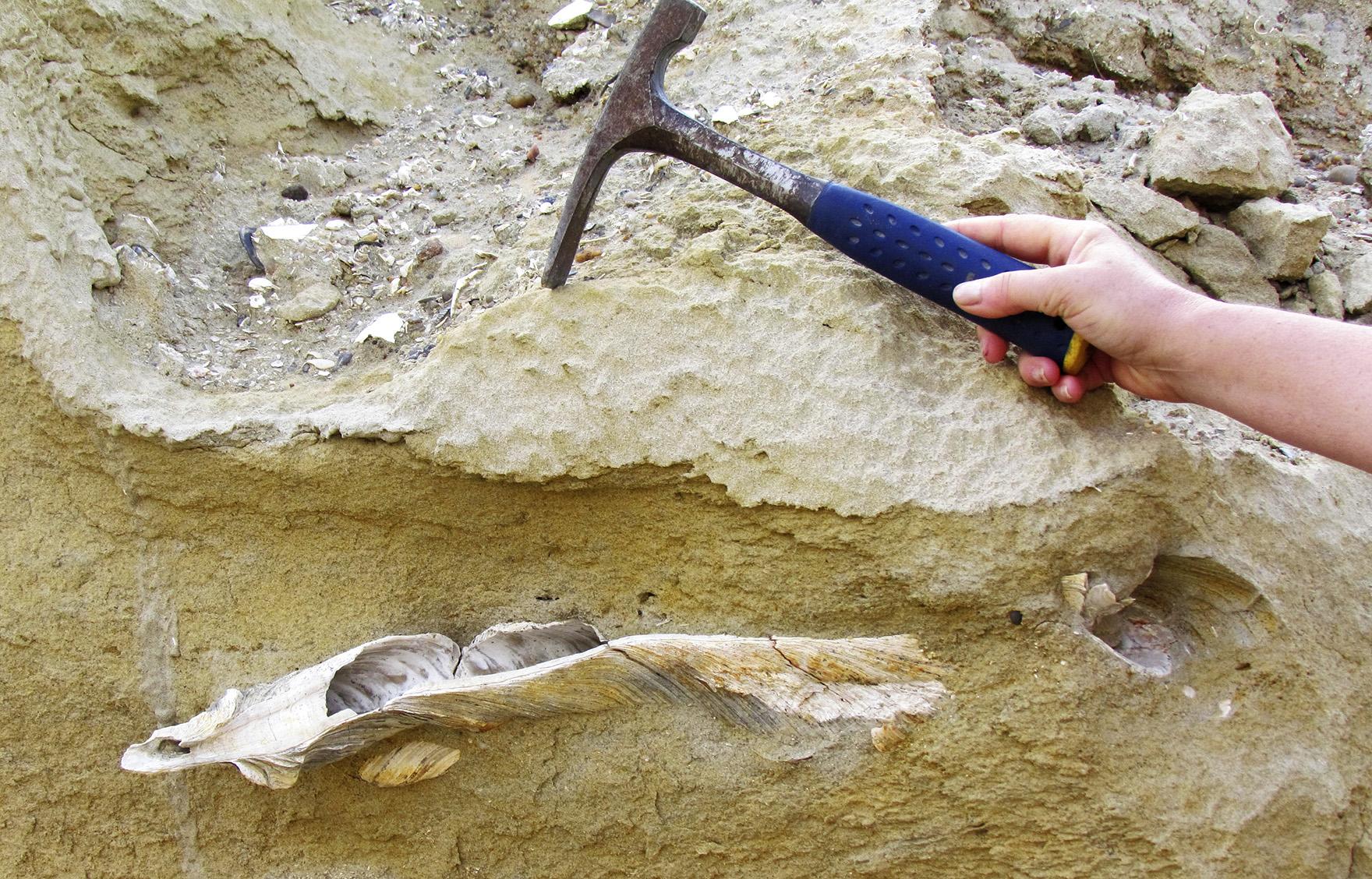 A giant fossil oyster about 45cm long found on a Pleistocene shoreline in a quarry pit near Hondeklip Bay, Northern Cape. Fossil whale bones were discovered in the same deposit. (Photo: Paul Hearty)
The authors, the paper says, often followed outcrops on foot for hundreds of metres, “or more in some cases” by road, until these features revealed vast marine terraces in all their dimensions – such as an impressive coastal plain in the De Hoop/Bredasdorp region.
Stretching inland for some “10 or 15km”, says Hearty, this broad, sweeping terrace includes three-million-year-old levels towering above today’s shoreline. Near the windswept town of Hondeklip Bay in the Northern Cape province, the Pliocene shoreline could also be seen about 10km inland.
Not all site visits were loose re-enactments of King Solomon’s Mines, the H Rider Haggard novel in which a group of Victorian adventurers luck upon treasure in an African rock chamber.
Roberts had arranged for the researchers to work in coastal quarries and test pits belonging to De Beers Consolidated Mines in Namaqualand. Hearty says these proved “remarkably productive” in terms of unearthing sea-level evidence and fossils.
“The miners excavate right through the sediments of these marine deposits all the way down to bedrock. They basically clear out all of what they would call ‘overburden’. We call it a career,” he chuckles.
At the Western Cape’s half-donkey town of Papendorp, the Olifants River mouth arises from the Cederberg wilderness and empties into the bracing Atlantic. Here, on a sea cliff called Cliffs Point, the scientists stumbled into some steep territory.
“Cliffs Point wasn’t really stable rock so you can’t pick your way down the side. You basically have to slide down and try to slide back up,” says Hearty. “So, when you go scaling down those cliffs, you’re going to have a lot of debris moving underneath you.”
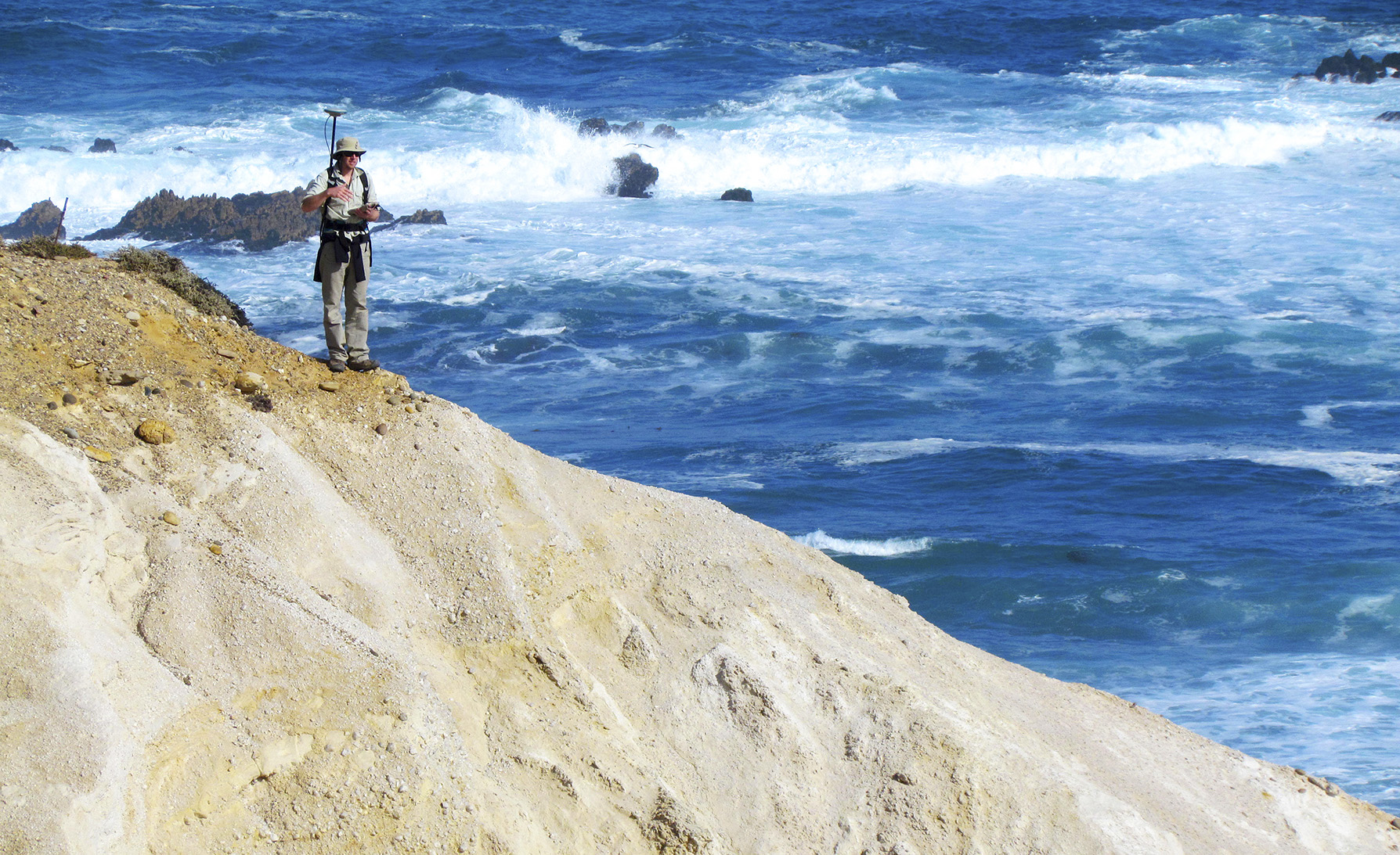
 Researcher Mick O’Leary employs a differential GPS to measure precise elevations of fossil sea-level deposits at Cliffs Point, Western Cape. (Photo: Paul Hearty)
For Hearty, Papendorp’s river mouth was the real rock star. This proved among the highest of sites that yielded firm age estimates.
“Cliffs Point has virtually everything from the bottom up – it shows exactly how the sea level comes up, erodes a platform and deposits boulders on that platform,” Hearty, in his element, enthuses. “And then you have all the subtidal, intertidal and supratidal deposits of dunes, and whatever else. And on top of all that, you see the typical coastline and soils.”
To build a detailed reference of these sites, the research team collected samples of sediment and fossils, securing and labelling them in zip-storage bags for lab analysis. They also matched marine exposures to differential GPS data and Google Earth coordinates – providing quick, centimetre-level accuracy on 3D measurements.
“The differential GPS is our new friend,” says Hearty, “because you can be out anywhere on the planet, and measure your elevation to exactly – and I mean exactly – within 10cm.”
The results – sea levels like high-rise buildings
Back at Columbia and SUNY Stony Brook universities in New York, the samples were dated through isotope analysis to help confirm the epochs.
According to the sea-level sleuths’ calculations, several storeys’ worth of water submerged the South African coastline over that time – that is, shores were 20-30m higher than the modern-day high-water mark.
Three of five sampled sites gave reliable age estimates, each proving exceptionally rich in pickings, especially against the backdrop of a field that has not produced many confident sea-level indicators for the all-important Pliocene and the Pleistocene.
The noteworthy Olifants River site delivered 30m-high paleo-shorelines dating back 4.6-million years. At a slightly younger age of 3-million years, the De Hoop/Bredasdorp discoveries yielded up to 28m heights; while Hondeklip Bay revealed a 33m-high fossil shoreline. Rolling in at the 1-million-year mark, Pleistocene fossil shores at Olifants River, De Hoop/Bredasdorp and Hondeklip Bay ranged from 15-2om. Each figure was corrected downward by a few metres to account for the small vertical uplift South Africa’s coast would have seen over these millions of years.
More than 600-million people at risk
What Hearty and his collaborators’ prodigious body of research into South African and other stable coasts reveals is that CO2, with its multiple ripple effects, is in essence a proxy for temperature – and, ultimately, sea-level rise. For instance, sea levels up to 80m have been pinpointed by additional Pliomax-funded research in central Virginia in the US. To explain primordial oceans pushing into the South African interior, “you have to melt all of Greenland and about 25-30% of Antarctica”, says Hearty.
Ice caps are melted by higher temperatures, a process fuelled by CO2, of which we have plenty in Earth 2020’s atmosphere. In June, for instance, the needle at Hawaii’s Mauna Loa Observatory struck a record 418ppm – a waypoint not seen since the Pliocene. The Pliocene’s hotter mercury, says Raymo, was a result of geological processes such as volcanism, weathered rock and buried organic matter pumping out high amounts of CO2 into the Pliocene atmosphere. Temperatures were about 2 to 3°C hotter.
“That’s a natural process happening on time scales of millions of years,” she says. “Sometimes it can go out of balance a bit and then it returns to an equilibrium.”
Yet humans, she warns, are also “geological agents” … “adding CO2 to the atmosphere 10 times the natural rate”.
An upward-ticking CO2 odometer is a loose but conceivable predictor of what coast-living communities may face in the Anthropocene – 600-million people in coastal areas live less than 10m above sea level”, a fact sheet for the UN’s 2017 Ocean Conference in New York points out.
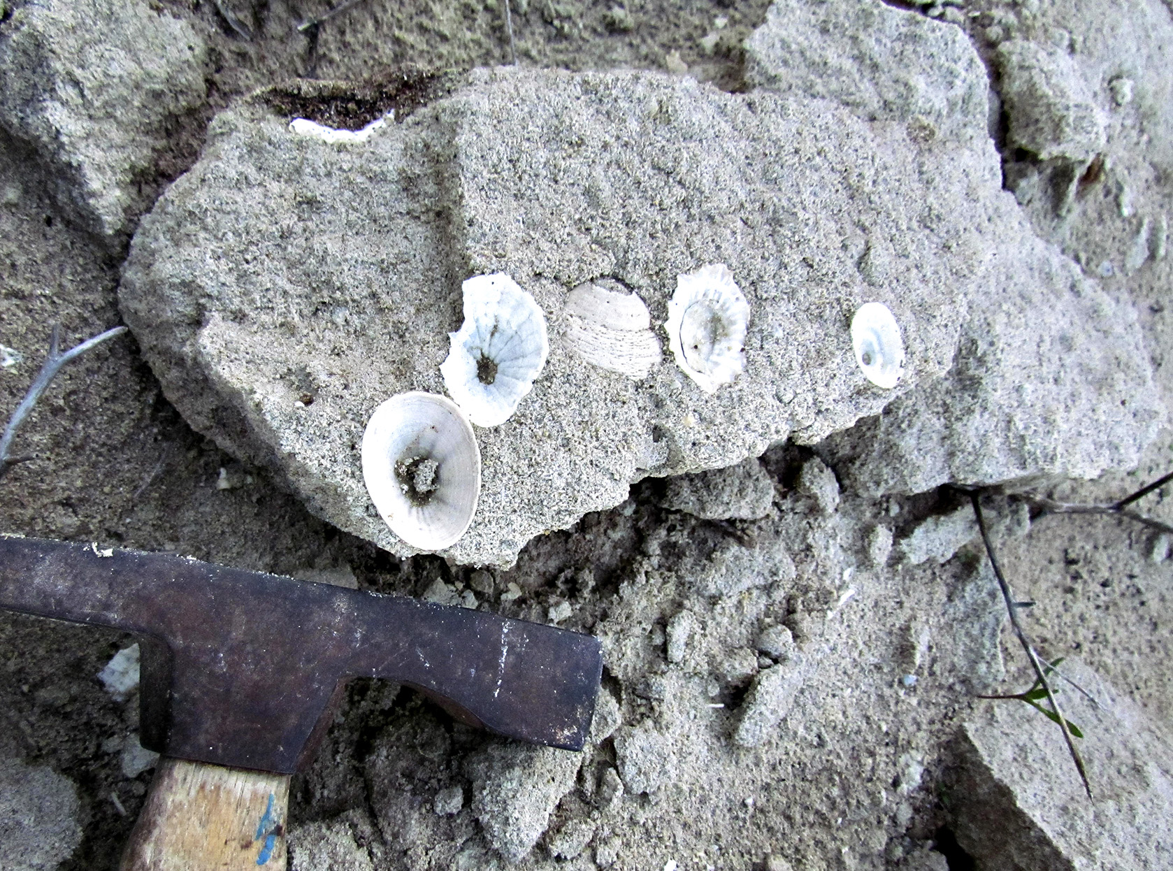 Patella and Fissurella limpet shells attached to a large boulder mark an ancient shoreline near Saldanha, West Coast. (Photo: Paul Hearty)
Sea levels are likely to creep into the coastal neighbourhood with added volumes of at least 30cm by 2100. That’s under a lower-emissions scenario, the UN’s 2019 report on climate and oceans notes – but only if we heed the Paris Agreement’s call to limit global temperatures to “well below” 2°C above preindustrial levels. A higher-emissions scenario exceeds a metre by 2100.
By 2300, business-as-usual commits us to 5.5m. It is not some future Earth we ought to fret about, however – in one of several papers Hearty wrote with Hansen, they warn that the Paris agreement’s target of 2°C warming “above the preindustrial level is highly dangerous”. The world has warmed at least 1°C since 1880, say records by NASA’s Goddard Institute for Space Studies, the organisation that was headed by Hansen for several decades as its longest-serving director. Some hotspots have warmed more than that.
Oceans and their ice – or ice and its oceans, depending on your vantage point – may have contracted and expanded multiple times over millions of years. Take the Miocene and the Paleocene, which predate the Pliocene, as examples of ice-free epochs. Even so, the UN’s oceans and climate report says that, “due to continuing deep ocean heat uptake and mass loss of the Greenland and Antarctic ice sheets”, sea levels in the 22nd century are likely to “remain elevated for thousands of years”.
Them good ol’ Holocene days
Only a century has ticked by since the atmosphere enjoyed the geological equivalent of a mild beach holiday – preindustrial levels of 280ppm.
This would explain why current sea levels have not caught up to Pliocene oceans. But it is also true that, “in 100 years, we’ve gone from being a normal atmosphere to an atmosphere that has not been seen in 3/3.5-million years”, says Raymo.
Humans have altered geological processes so rapidly during our own epoch, the Holocene (which means “wholly recent”), that some argue that the Anthropocene (“human epoch”) is the most appropriate term for this time.
That may be prescient. But what we cannot necessarily say, Hearty hastens to add, is how soon human activities are set to raise the ocean, which covers 70% of the Earth’s surface. Climate predictions can be difficult to make and uncertainties are inherent, not least because sea-level rise is not globally uniform.
Yet, it is the data from the US-led South African study that serves as one of our best examples yet of why a version of the Pliocene could lie in our future and, to a lesser but no-less concerning degree, our present.
“We can watch what’s happening today and see the ice sheets are changing very rapidly,” Hearty reminds us. Many additional global measures – such as extreme temperatures, fires, floods and 2020’s historic Atlantic hurricane season – are also indicating significant climate changes.
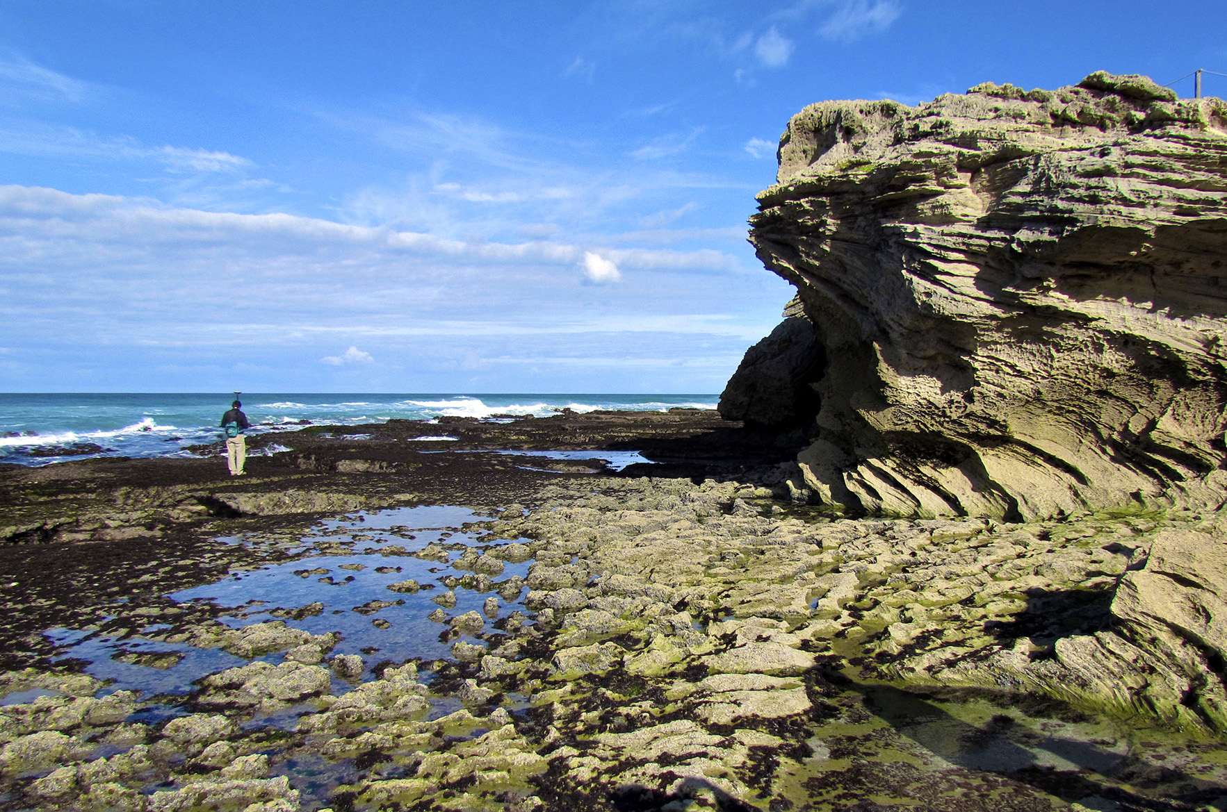 A wave platform on a modern shore at De Hoop Vlei, Western Cape. This feature was studied by the team’s geologists to better grasp the characteristics of ancient platforms. (Photo: Paul Hearty)
Science has another way of phrasing this sort of existential dilemma. In this study’s case, it shows how a country on the southern tip of Africa can get caught up in a story about Greenland and Antarctica thawing in a 400ppm world.
“Our study confirms that ice sheets are highly vulnerable under warming climates and are likely to experience dynamic changes,” Hearty and the rest of the team conclude. Greenhouse-gas savings achieved during this year’s global lockdown may therefore be relatively negligible; still, Raymo calls the Covid-19 pandemic something of a practice run for the climate crisis.
“We see that here in the US” – that is, compared with “countries that looked at the data, understood what it meant for the future and didn’t pretend it wasn’t going to happen,” Raymo says.
“Those are the countries and communities now doing quite well … So, yeah, these are global problems that need global solutions based on the best science.” DM
Read Hearty et al’s full paper, “Pliocene-Pleistocene Stratigraphy and Sea-Level Estimates, Republic of South Africa with Implications for a 400 ppmv CO2 World” in Paleoceanography and Paleoclimatology, a journal by the American Geophysical Union.
Pliomax has several more papers in development or under peer review. Visit the Pliomax website for more.