


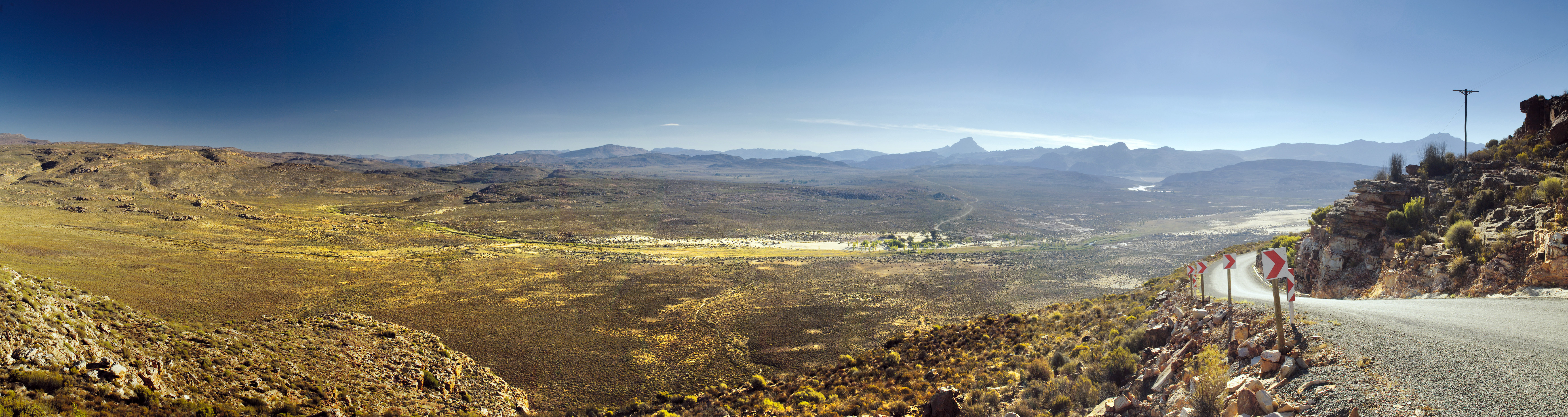
 Clouds streaking over the sandstone rock formations in the Southern Cederberg in South Africa
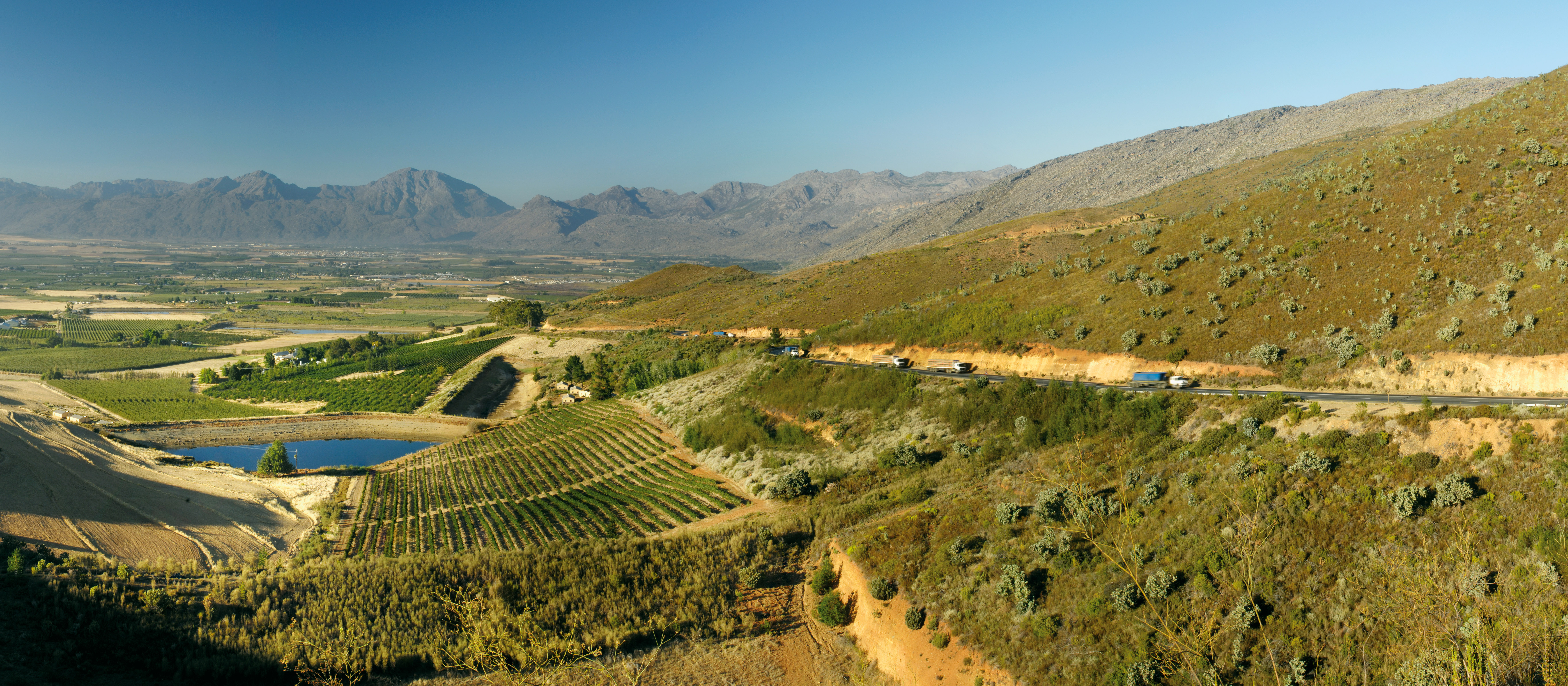
 As the hills rise and fall, cascading through the undulating topography, one is immersed within the presence of the beckoning crimson mountain ranges that fold into one another. Enveloped by emerald-green landscapes that resolutely rise up to meet the road, you’d be forgiven for thinking it is here where the sands of time stood bravely still. Further ahead still, the road passes from one buoyant place to another, and a multitude of magnificent mountain passes that lead to the Koue Bokkeveld and the Cederberg mountains, about 300km north of Cape Town.
The Koue Bokkeveld (Afrikaans for “Cold Buck Shrubland”) is a mountain range in South Africa’s Western Cape province, north of fruit-laden Ceres and south of the Cederberg, and to the east of the Grootwintershoek Wilderness area.
 Artifice site. Image: Carmen Clegg
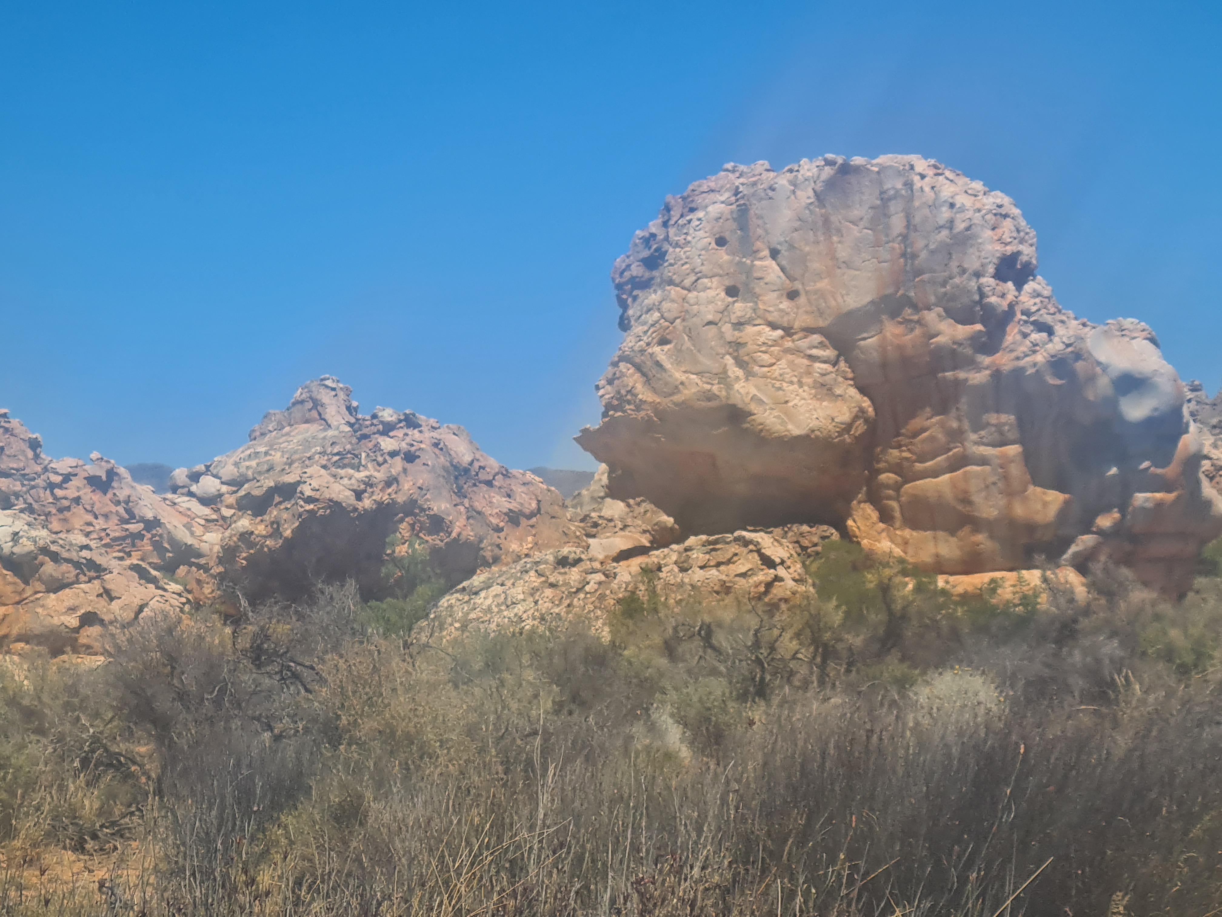 Bulbous holes in porous sandstone rock. Image: Carmen Clegg
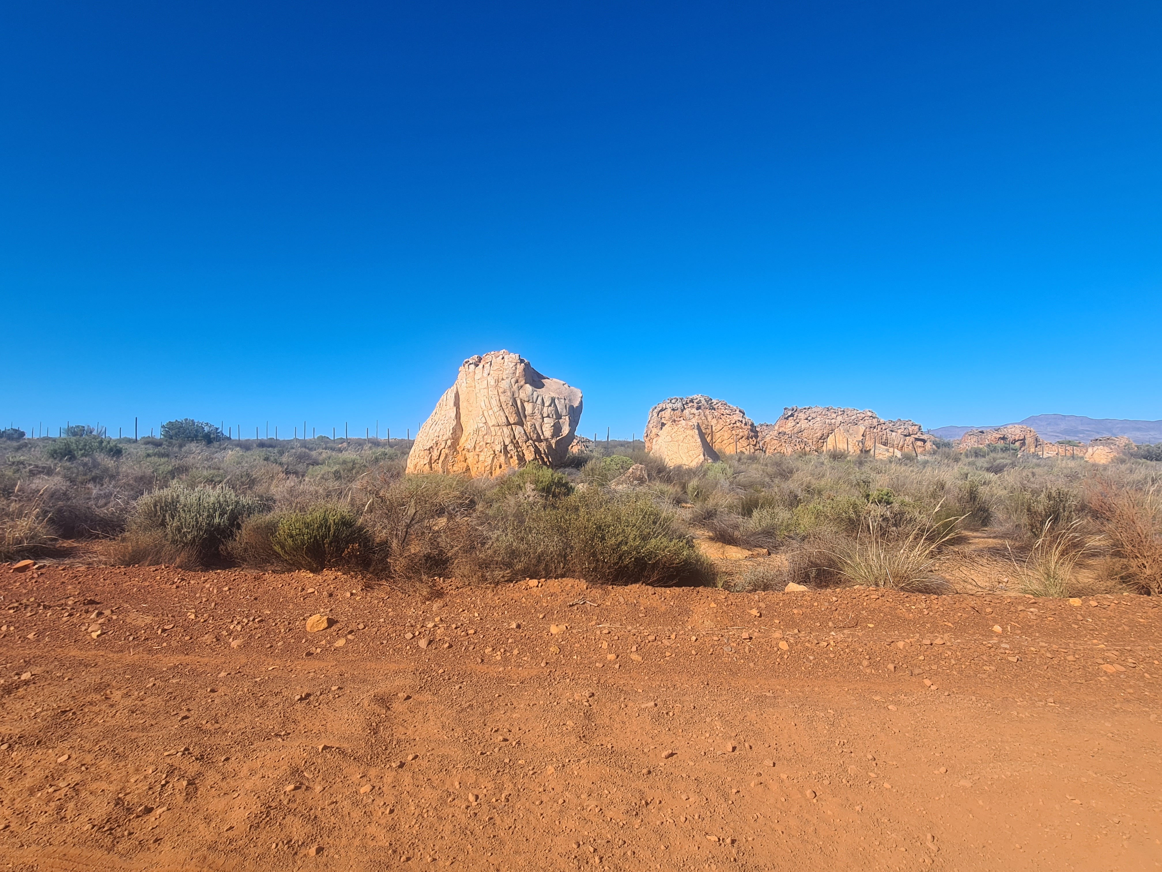
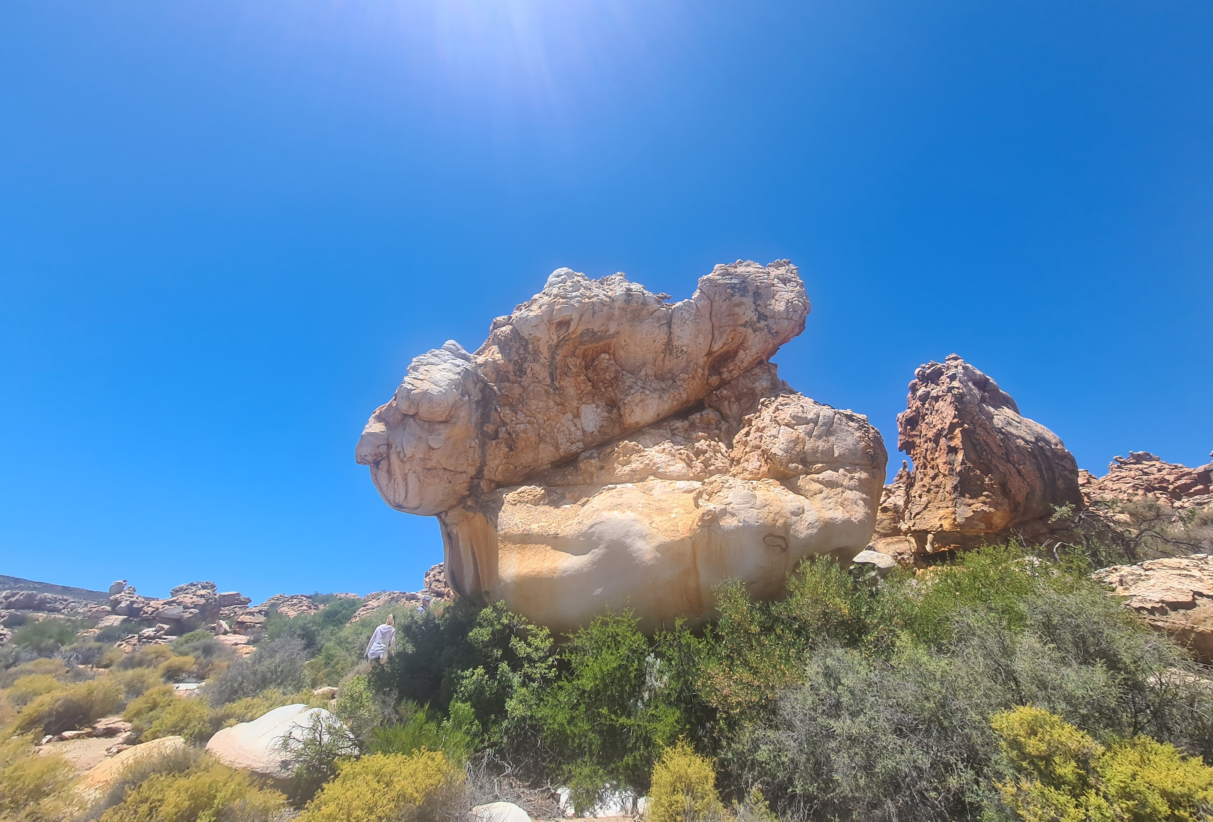
 Suntanned sandstone rock formation in stark contrast to the azure blue sky. Image: Carmen Clegg
Getting there
Driving from the Mother City, you’ll make the most of the picturesque scenery along the way by heading towards the little town of Wellington, preferably at a polite speed. From there, head for the R301 exit, which will take you over the 18km Bainskloof Pass, which was declared a national monument in 1980. A right turn onto the R43 leads onto the Michell’s Pass which snakes around the belly of the surrounding mountains, leading into Ceres, after which, the road will take you through modest Prince Alfred Hamlet and up and over the Gydo Pass. A right turn at the “Ceres Karoo/Cederberg” sign will lead you to the entrance of the Kagga Kamma Nature Reserve which lies in the heart of the Koue Bokkeveld/Cederberg. From here it is a 20km drive on the gravel road towards the reserve entrance, and it comes with the promise of yet another adventure at Katbakkies Pass, where panoramic views await.
 From the Katbakkies Pass, you can see Tafelberg on the left and Sneeukop on the right. Feature text available. Image: Gallo Images/GO!/Denver Hendricks
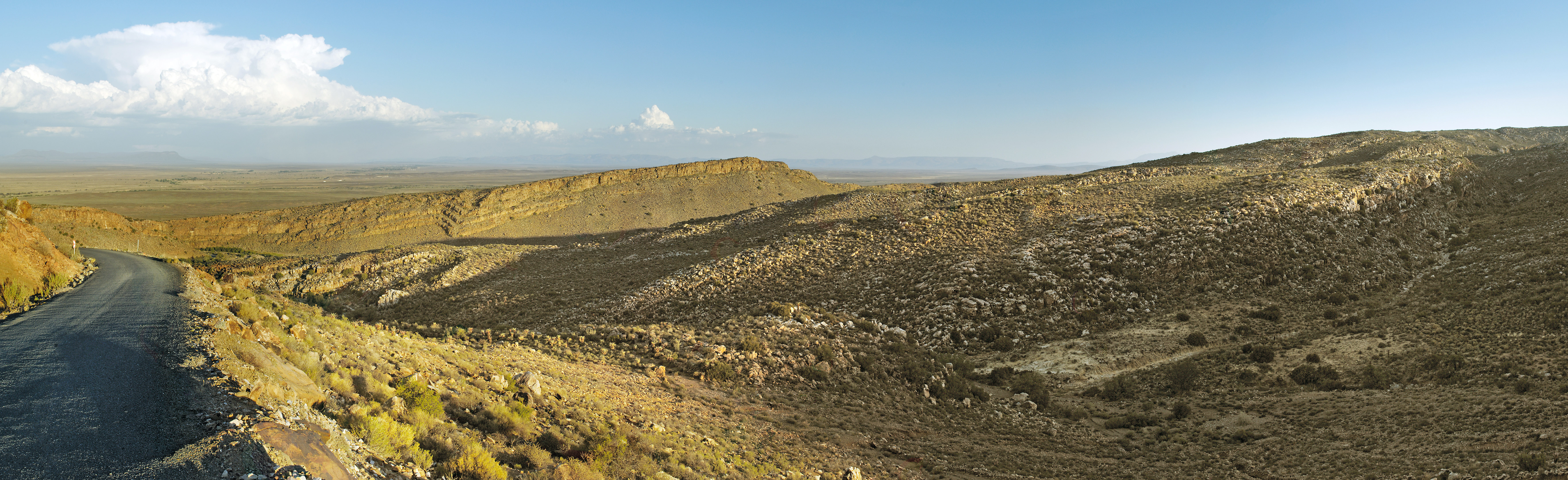 This small pass, followed by Hottentotskloof and the Theronsberg Pass, was part of an old wagon route to the interior, before Du Toitskloof Pass and the N1. Image: Gallo Images/GO!/Denver Hendricks
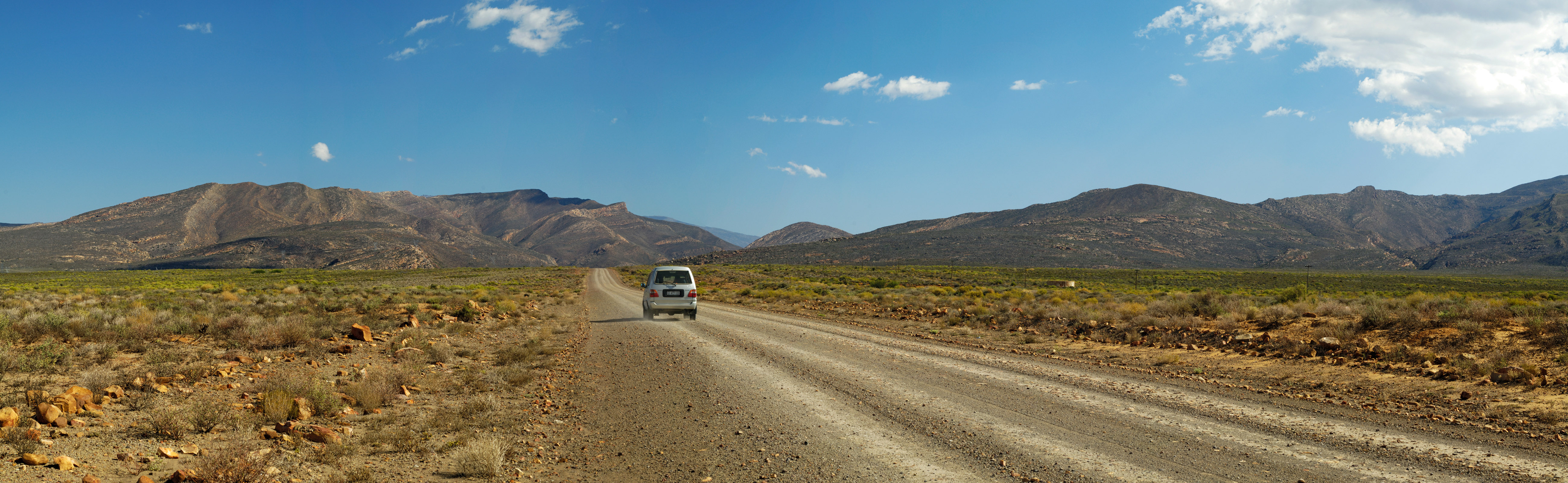 The R355 between Ceres and Calvinia is believed to be the longest gravel road between two towns in South Africa. Image: Gallo Images/GO!/Denver Hendricks
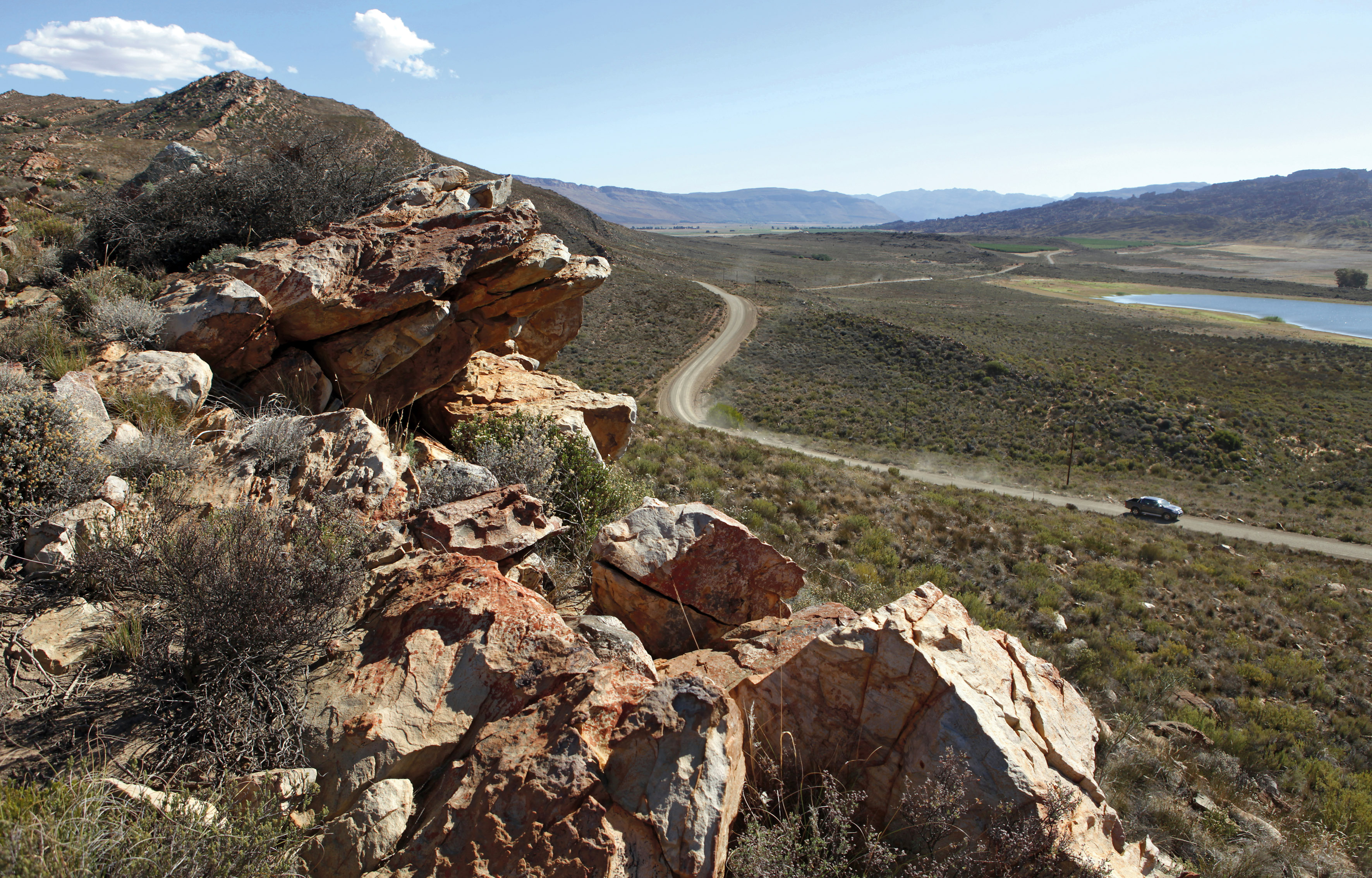 A view from the first lookout point on Katbakkies Pass. Image: Gallo Images/GO!/Ruvan Boshoff
 A scenic view of the Gydo pass. Image: Gallo Images/GO!/Ruvan Boshoff
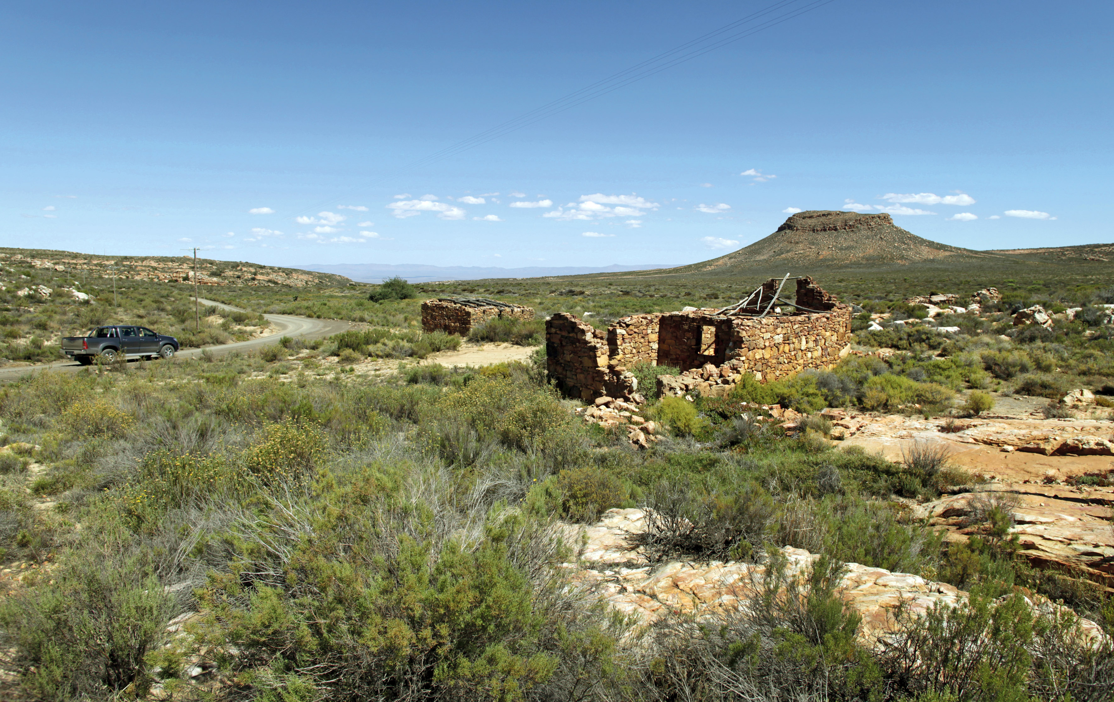 The flat plains next to Pramberg offered good grazing and a convenient overnight stop en route to the Karoo, but those who tried to establish a more permanent settlement were driven off by the lack of a reliable water source. Feature text available. (Photo by Gallo Images/GO!/Ruvan Boshoff)
When you get there
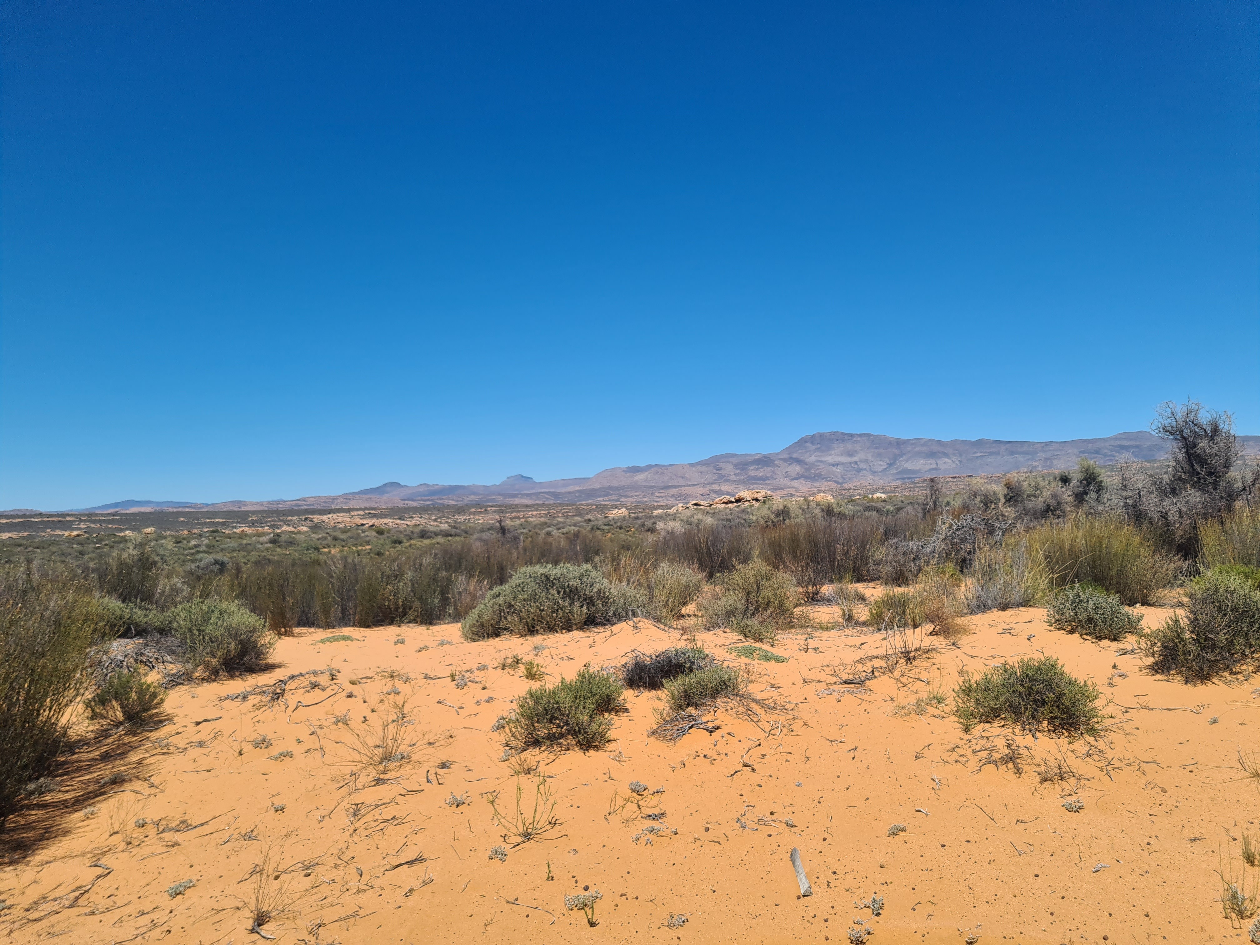
The rocky sandstone outcrops, which are a benevolent presence in these parts, generously emerge from the vast countryside, giving view to this expansive region where intriguing rock formations dominate the prehistoric wilderness.
As its name suggests, the Koue Bokkeveld conjures up images of a barren semi-desert area, with sub-zero temperatures and submerged by vast terrains. At elevations of up to 1,600m, there is often snow in winter. These heights are among the coldest places in the Western Cape in winter. But be warned, this climate is one of extremes, with temperatures ranging from -6°C to a sweltering 46°C on the karroid plains in summer, so be sure to select your seasonal preference well in advance of your trip.
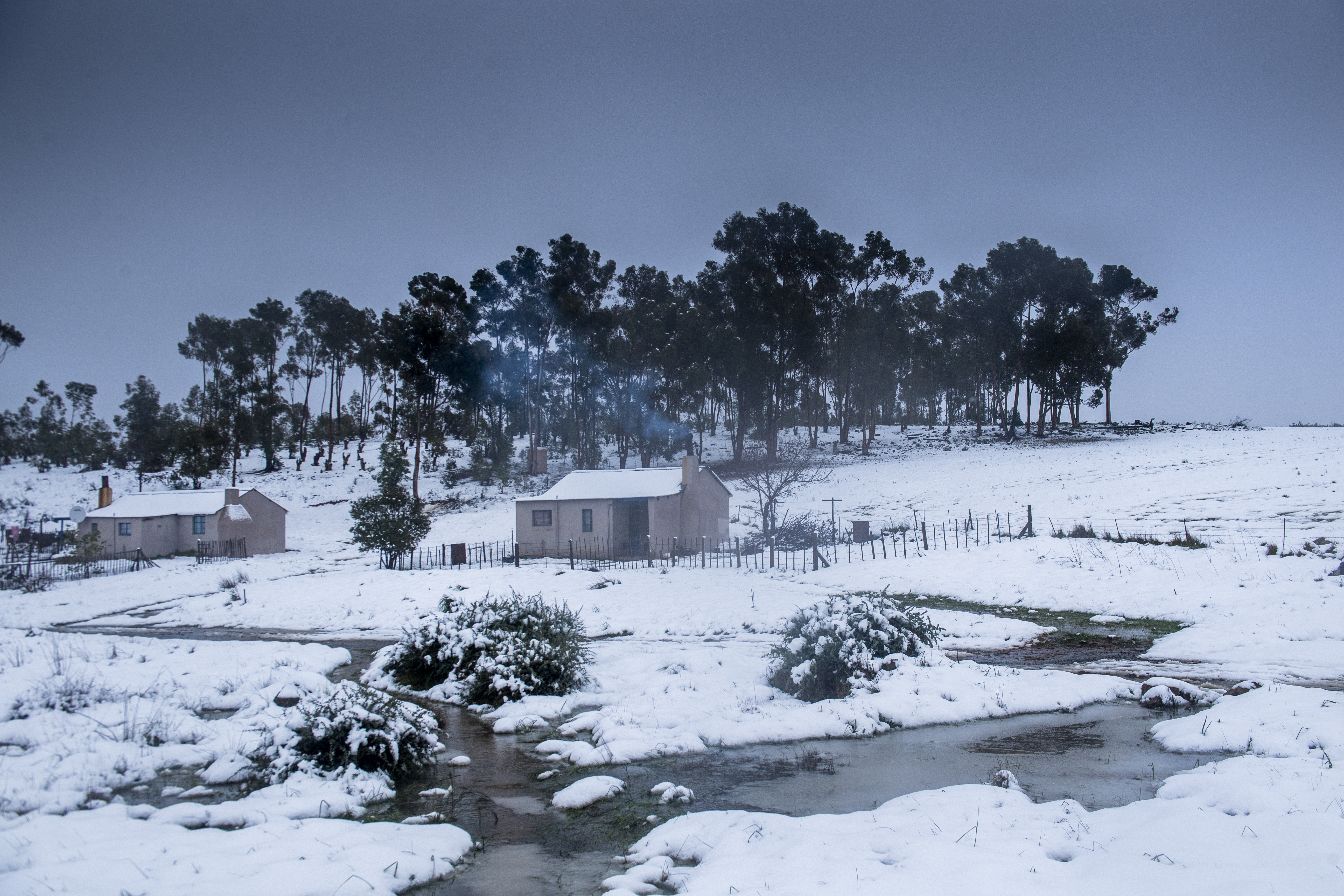 A farm house at Bokkeveld during snow on July 02, 2018 in Western Cape, South Africa. Image: Gallo Images / Netwerk24 / Jaco Marais
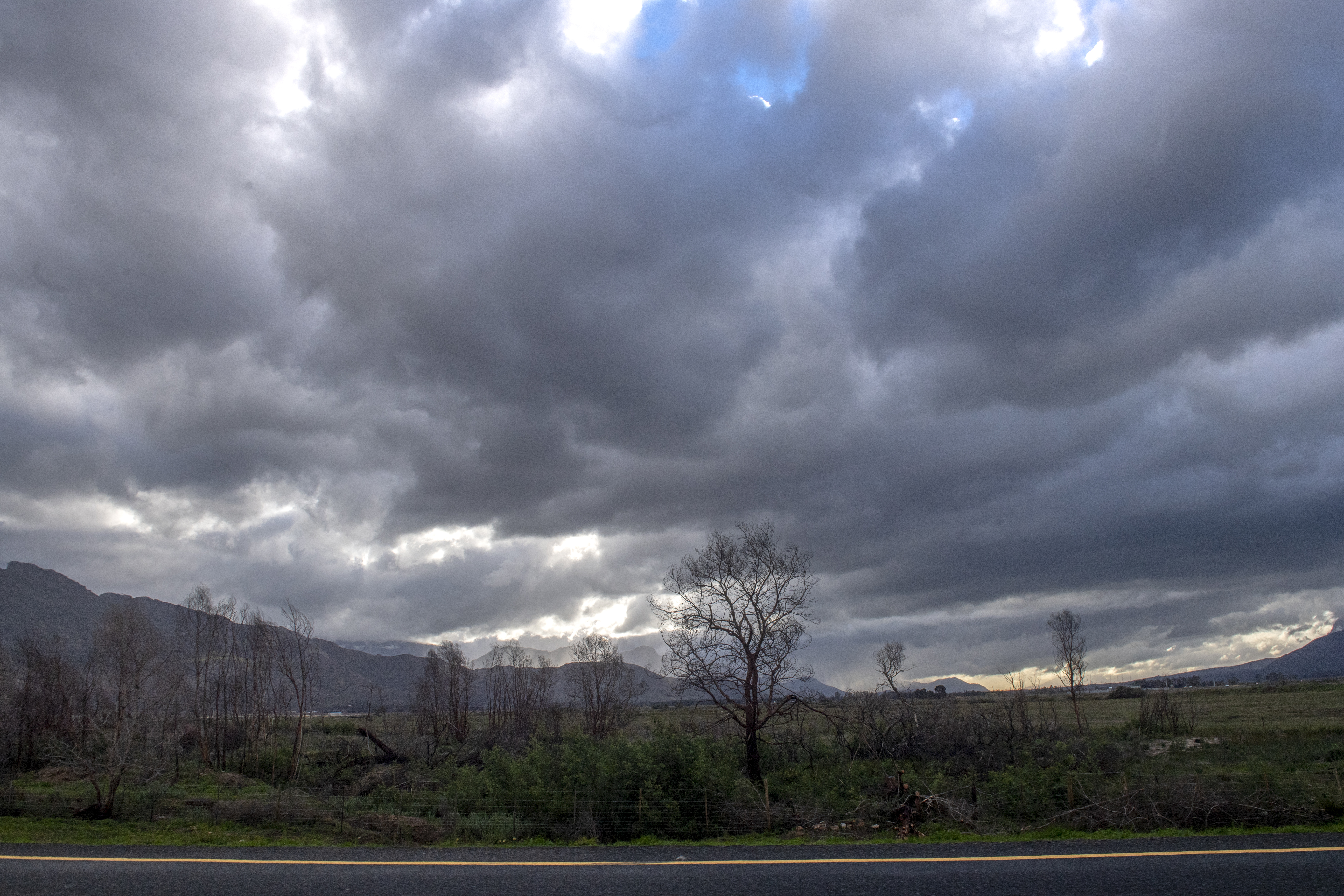 Clouds are seen near Worcester on July 02, 2018 in Western Cape, South Africa. Image: Gallo Images / Netwerk24 / Jaco Marais
Read in Daily Maverick: “Saddling up and riding out with the cowgirls in the Karoo mountains”
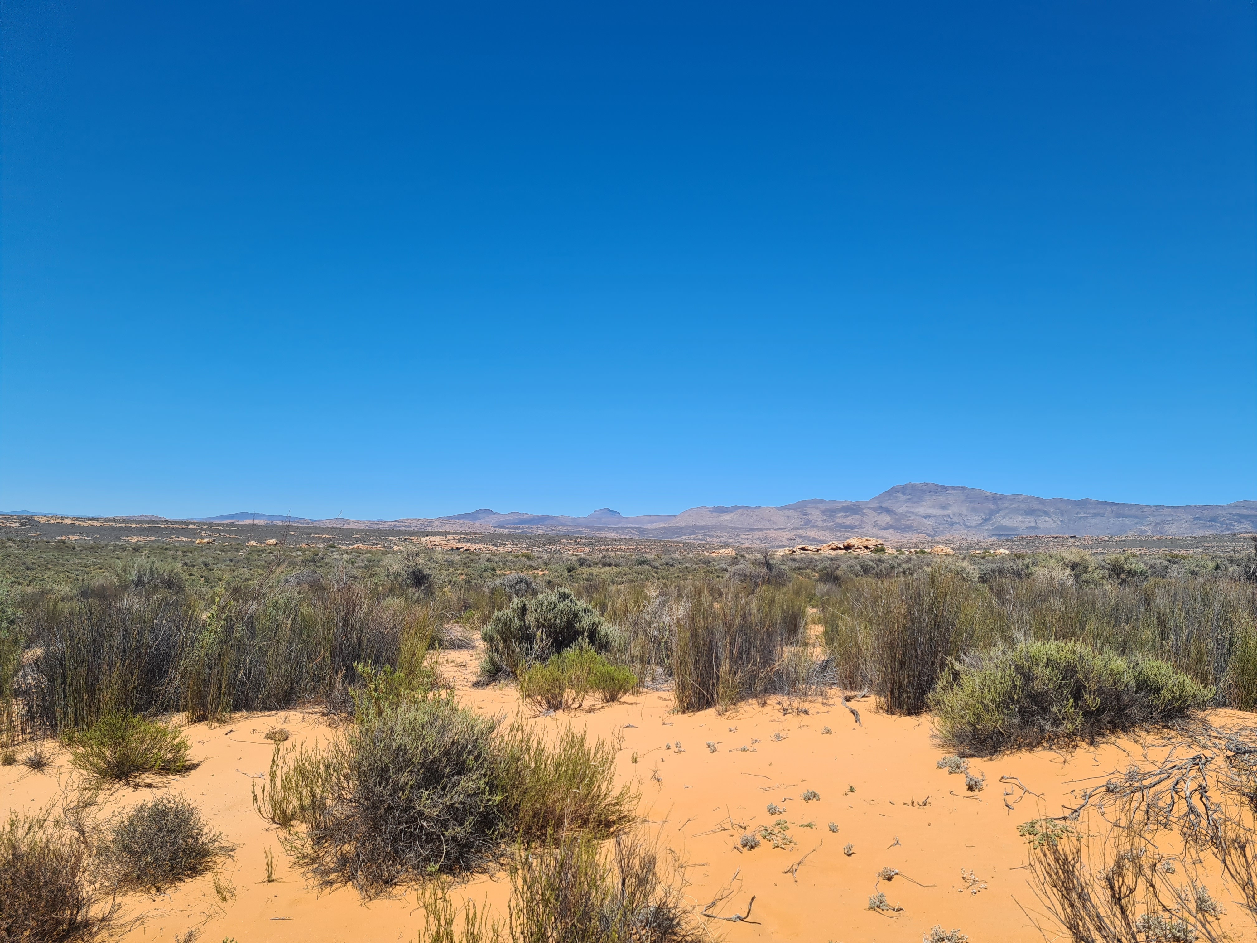
In fact, the Koue Bokkeveld is a connecting biome between the Cederberg and the Ceres-Karoo. Towards the southeastern section of the Cederberg, in the Swartruggens region and within the Kagga Kamma terrain, the area transitions into a maze of fynbos, buttery-soft, caramel-coloured sand and rocky outcrops, which the region is best known for.
Behold the history
Most eye-catching are the formidable sandstone and quartz rock formations standing sentinel as far as the eye can see. These ancient, omnipresent sandstone structures stand stoically in fascinating forms that defy gravity yet transcend grandiosity. The sandstone rocks were used as a canvas for the San between 6,000 and 12,000 years ago and, etched throughout the Cederberg and Koue Bokkeveld, are descriptive of the San and Khoi paintings, creatively told; left behind on rock faces to those who called this ancient land home.
Using a combination of porcupine coils and bird feathers to make “paint brushes” which reflect the fine craftsmanship we see today, the San people also created a foolproof “paint mixture” that included animal fat, blood, berries and dung as colour palettes – most of which has withstood millenia, reaching through the hourglass to the present day.
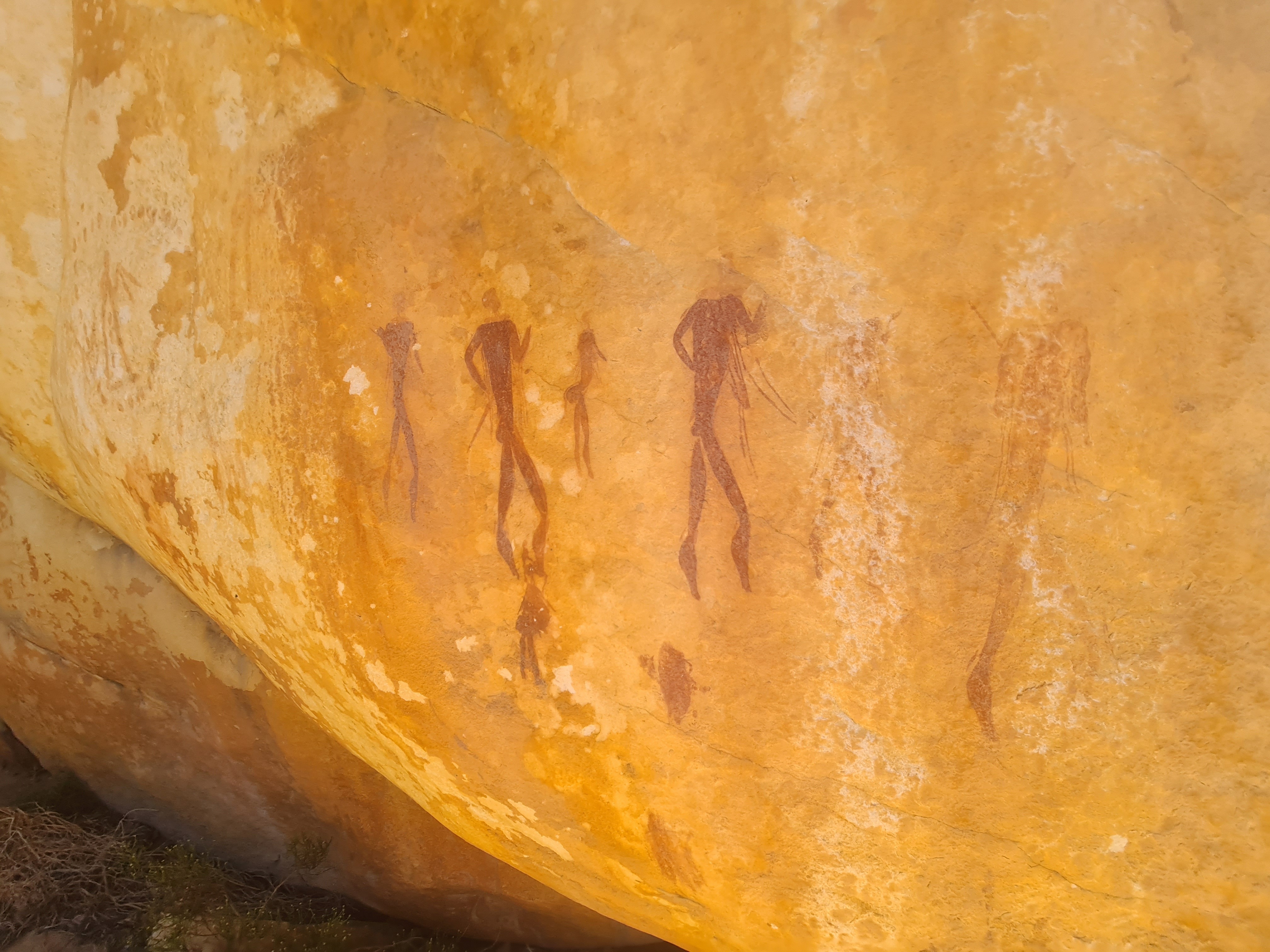 San painting of an average size San Tribe, including small children. Image: Carmen Clegg
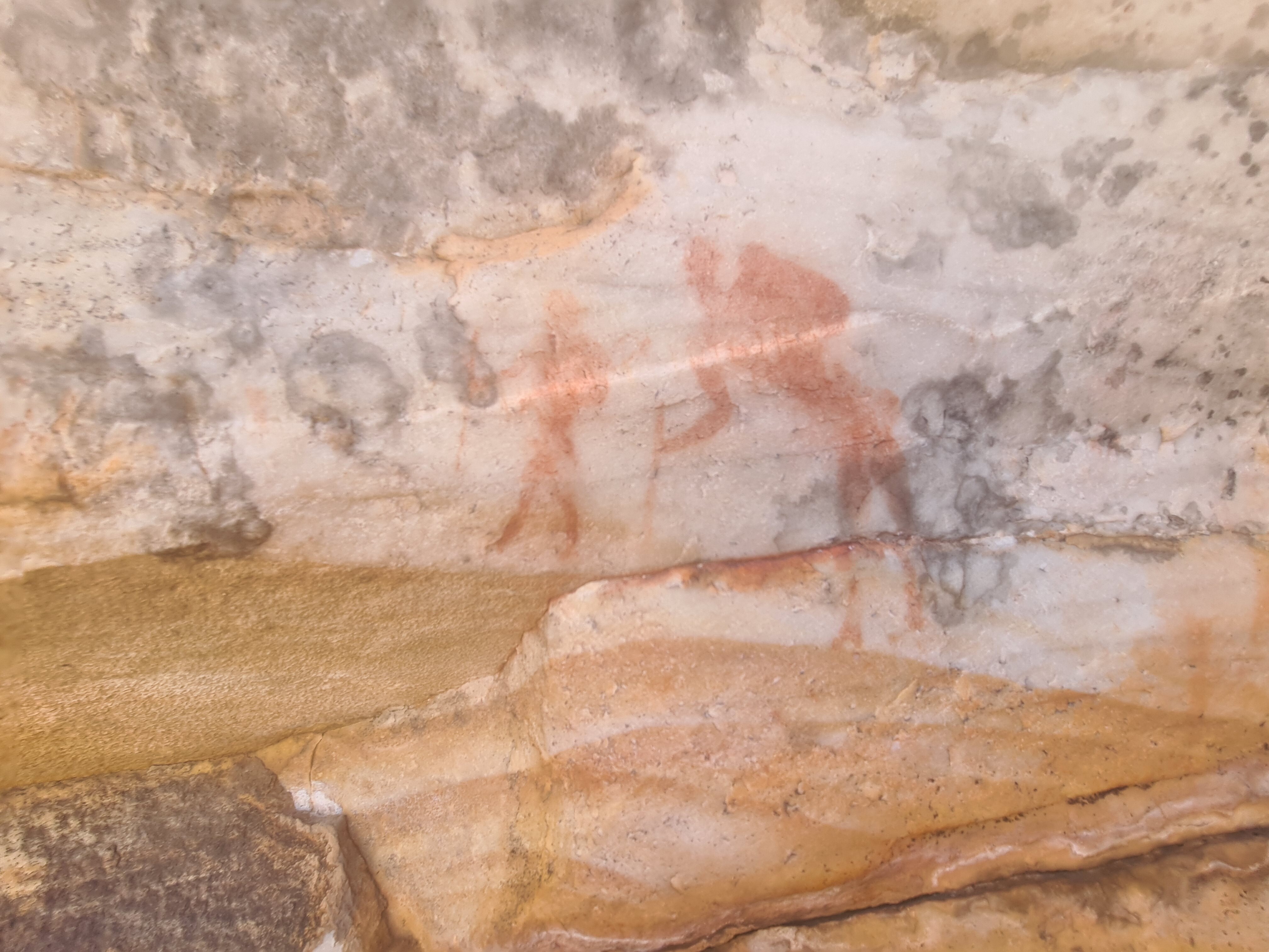 San illustration of man aiming a bow and arrow and behind him and illustration of a San carrying supplies on his back. Image: Carmen Clegg
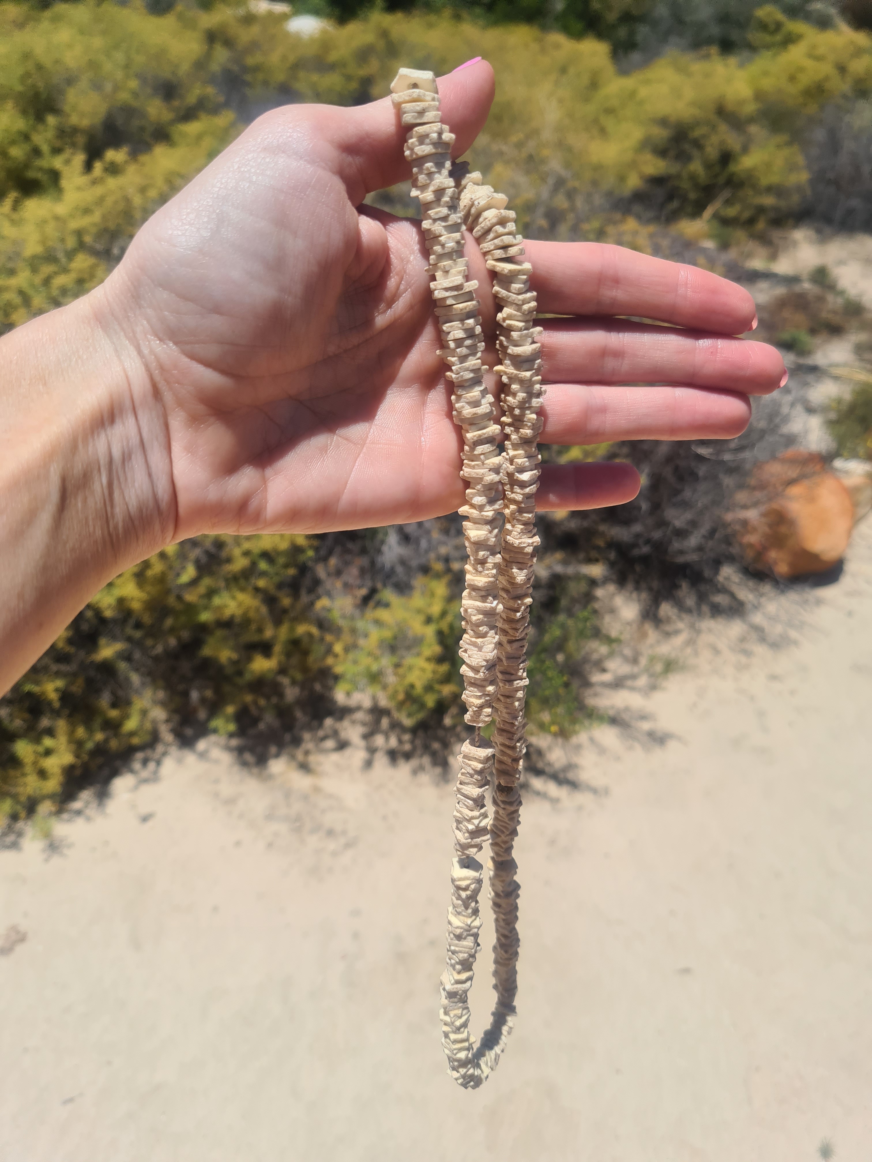 Original San necklace made from animal animal bone. Image: Carmen Clegg
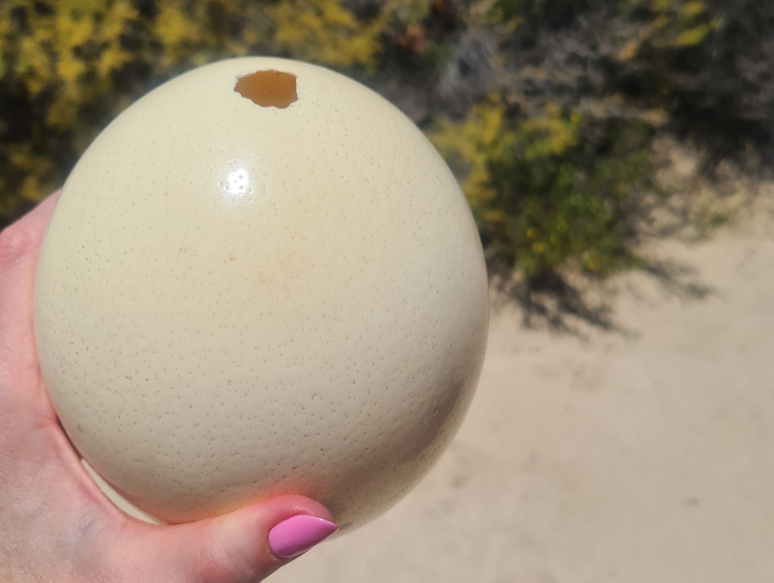 Ostrich egg used by the San people as a water carrier. Image: Carmen Clegg
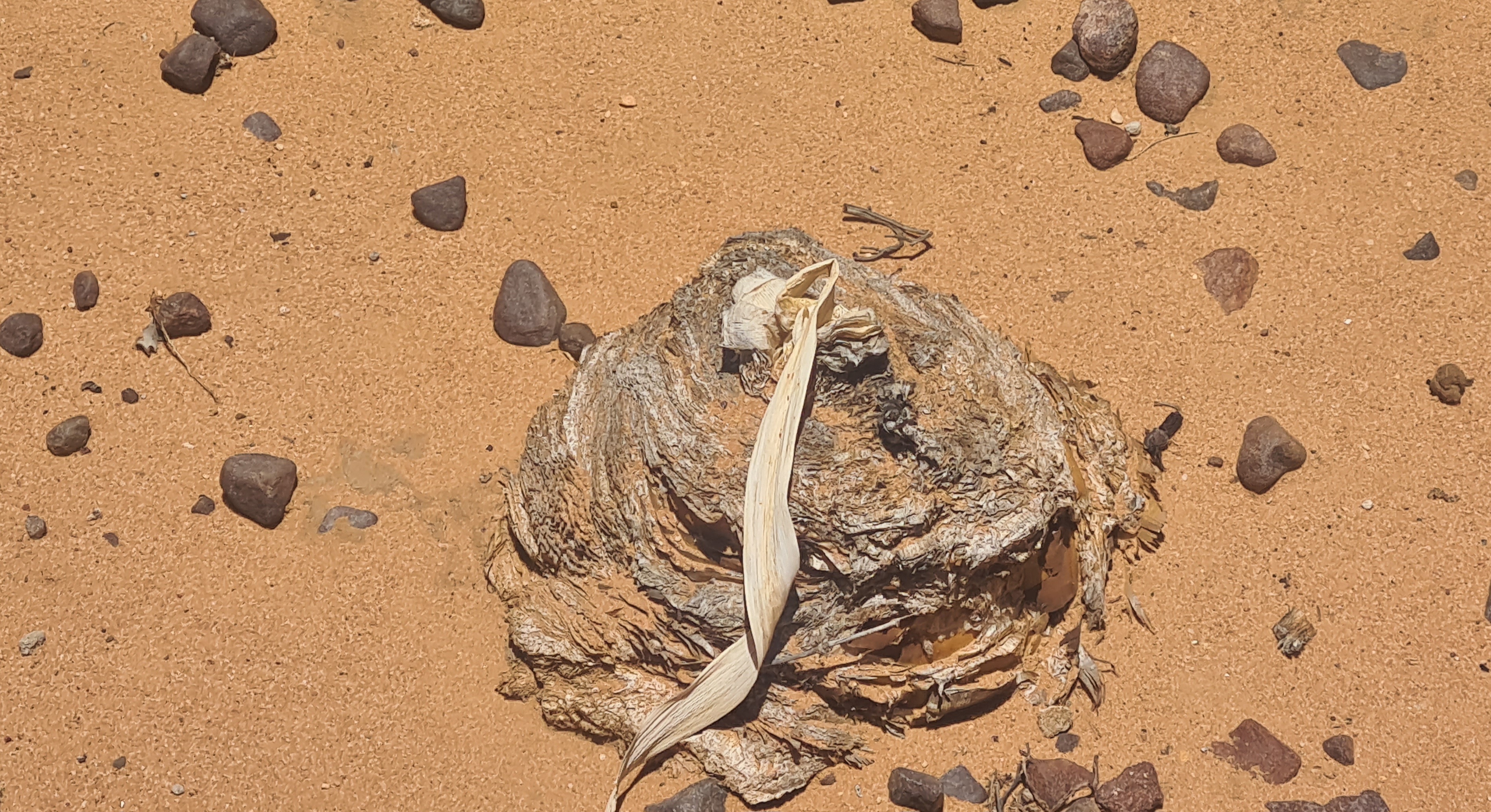 Dormant Bushmans Poison Bulb. Image: Carmen Clegg
These paintings inextricably link the past to the present, the voices of their stories softly sifting through the passage of time. It is well documented that the San relied on their indigenous knowledge for survival (medicinally or otherwise), particularly since resources were often scarce or difficult to access. Perhaps by instinct or perhaps through trial and error, since this largely remains a mystery (this method could very well prove fatal, which begs the question as to how they got the ratio on par), the San investigated and saw fit to use the Bushman’s Poison Bulb (Boophone disticha) as one of their means to recreation as well as survival.
Taken in minuscule amounts, the bulb induced a trance-like state, inspiring the leader of the tribe to imprint his creative mark on the sandstone. Quite masterfully, the San invented their own type of bow and arrow which was effective in hunting antelope and other animals. To stave off deprivation, an ingenious lethal paste made from snake poison or from the Poison Bulb was skilfully used as the weapon that proved to be the coup de grace for the animal and ensured the tribe’s food supply.
Read in Daily Maverick: “Maverick Mapper: A desert trip to the Tankwa Karoo National Park”
The Koue Bokkeveld is also home to the second-deepest canyon in South Africa, the Riet River Canyon (elevation 971m). This deeply incised canyon is evidence of a much wetter era when rainfall was high and fynbos covered extensive parts of what today is known as the Karoo. Submerged between the mudrock and sandstone formations of the lower Bokkeveld group is a wide variety of marine fossils such as sea lilies and molluscs.
 Swartriggens Mountain Range framed by Mountain Fynbos. Image: Carmen Clegg
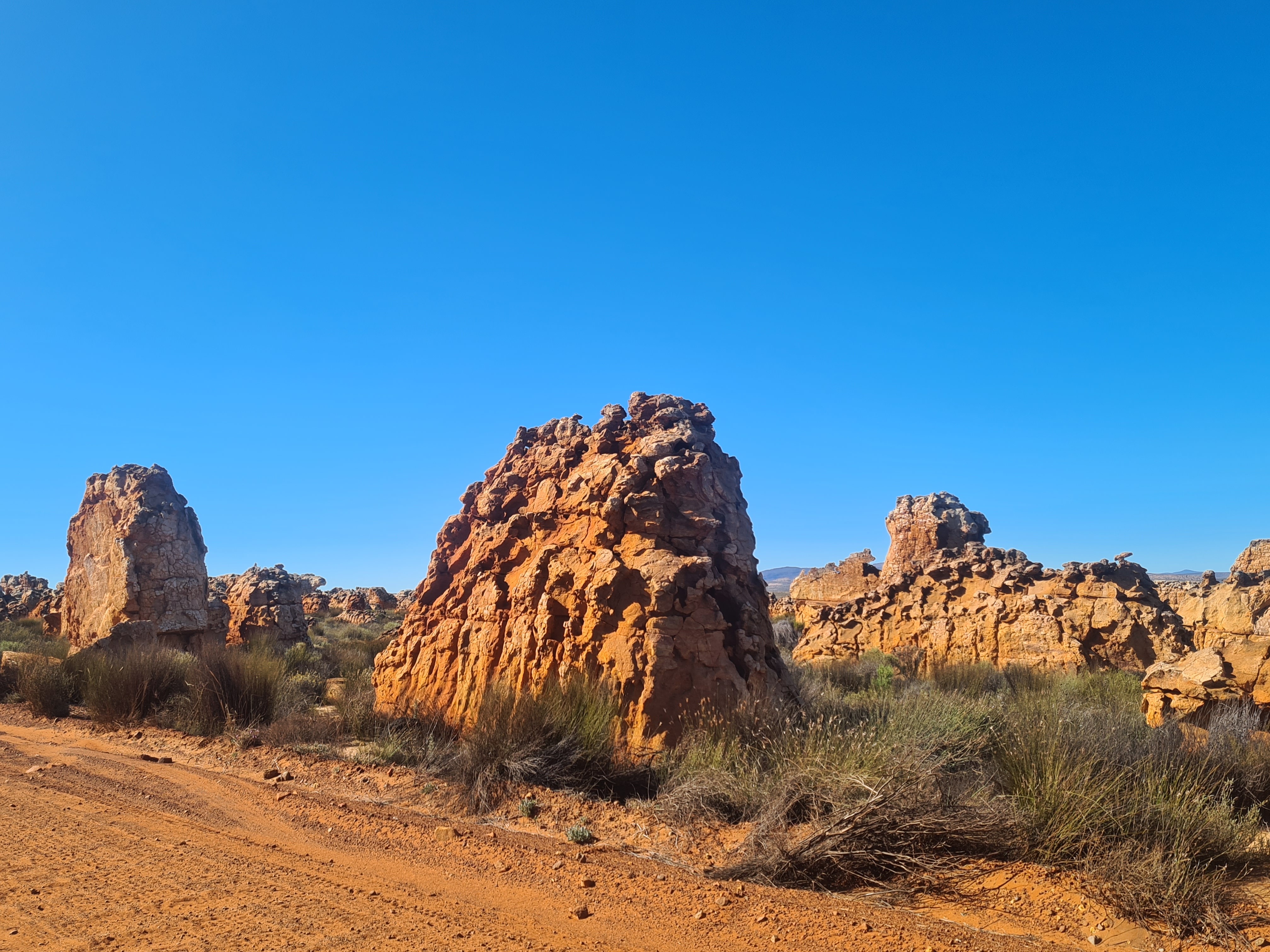
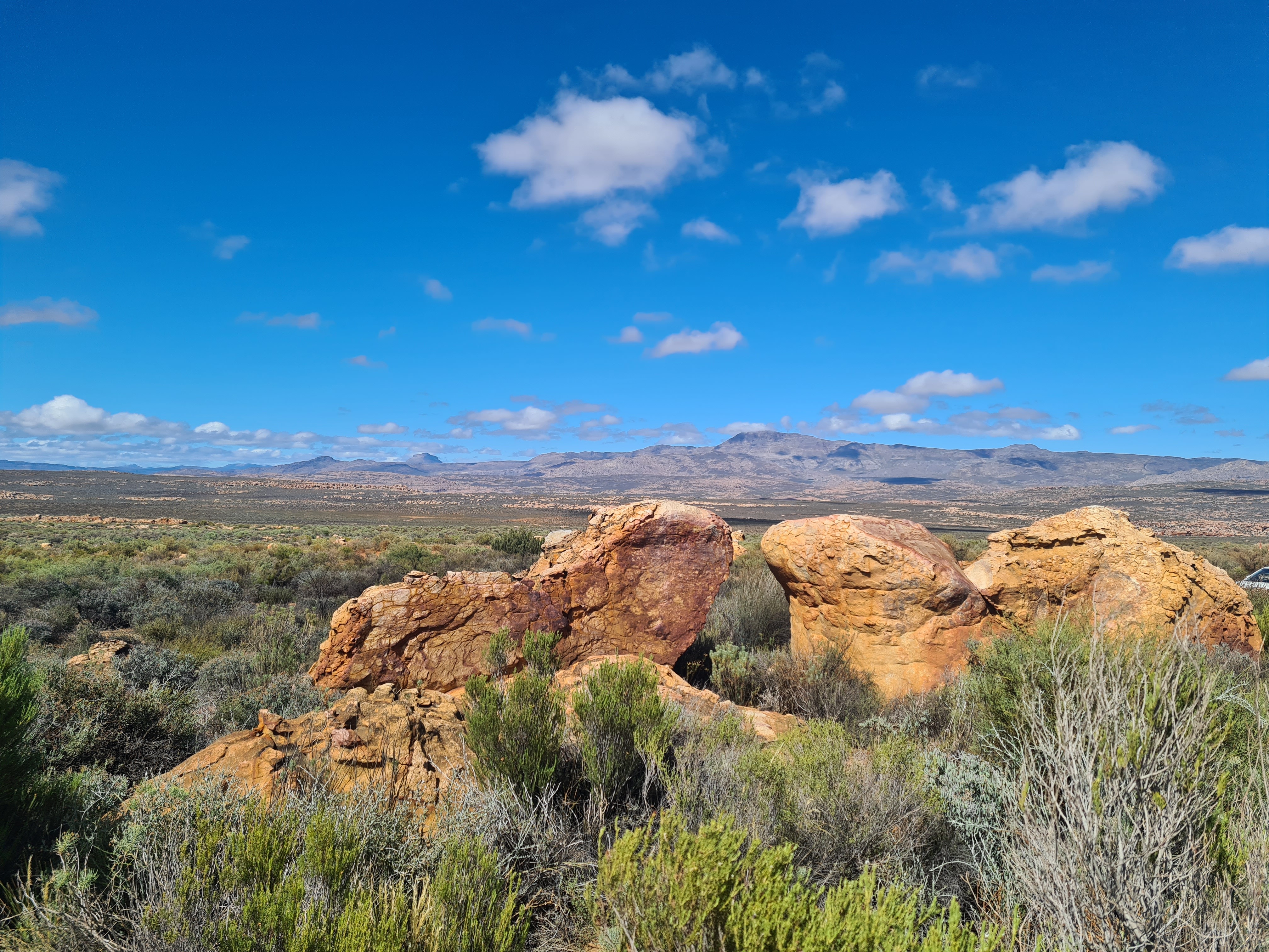
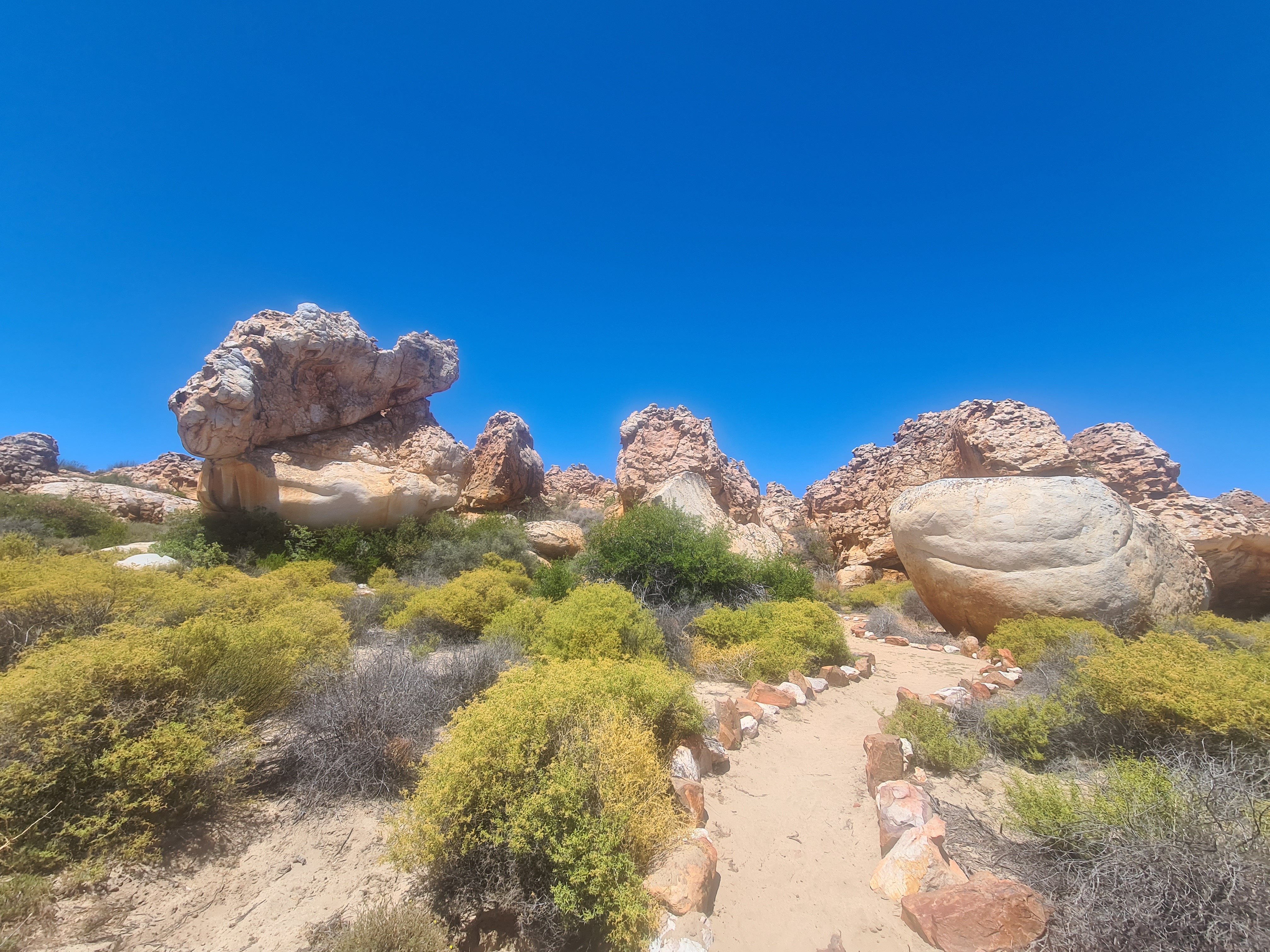
 Sandstone rock formations saluting the visitors on the gravel road toward the Kagga Kamma reception. Image: Carmen Clegg
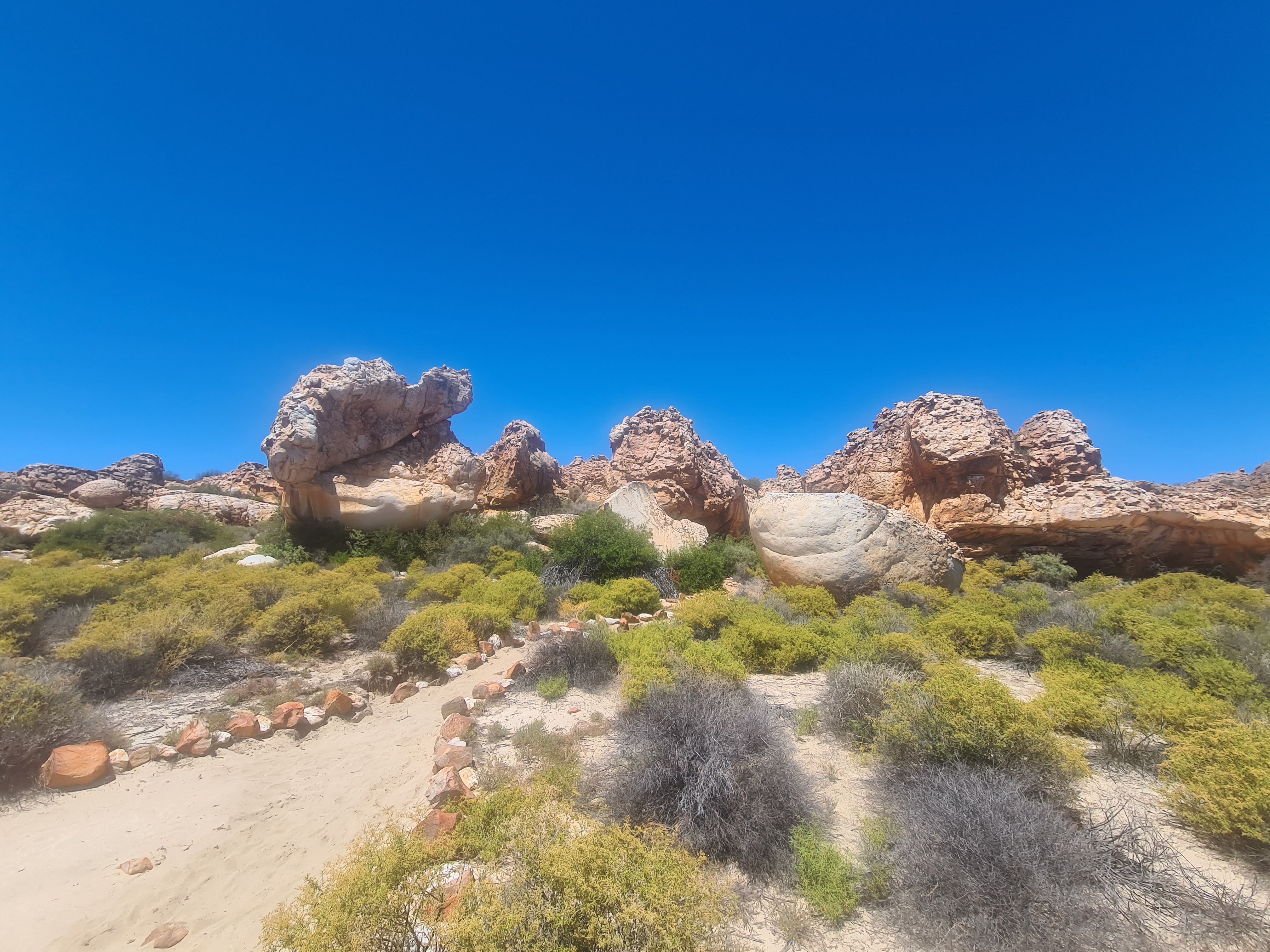
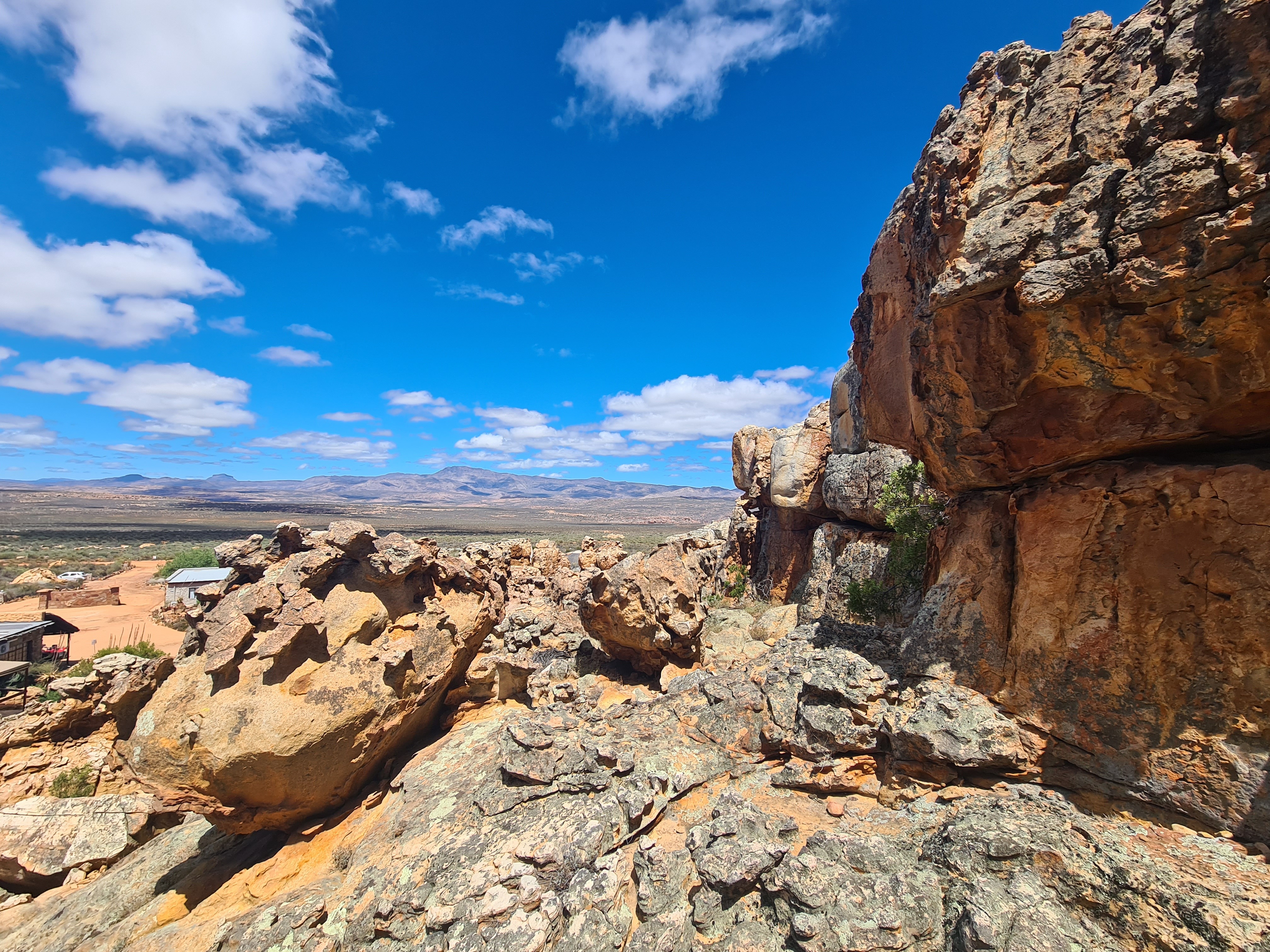
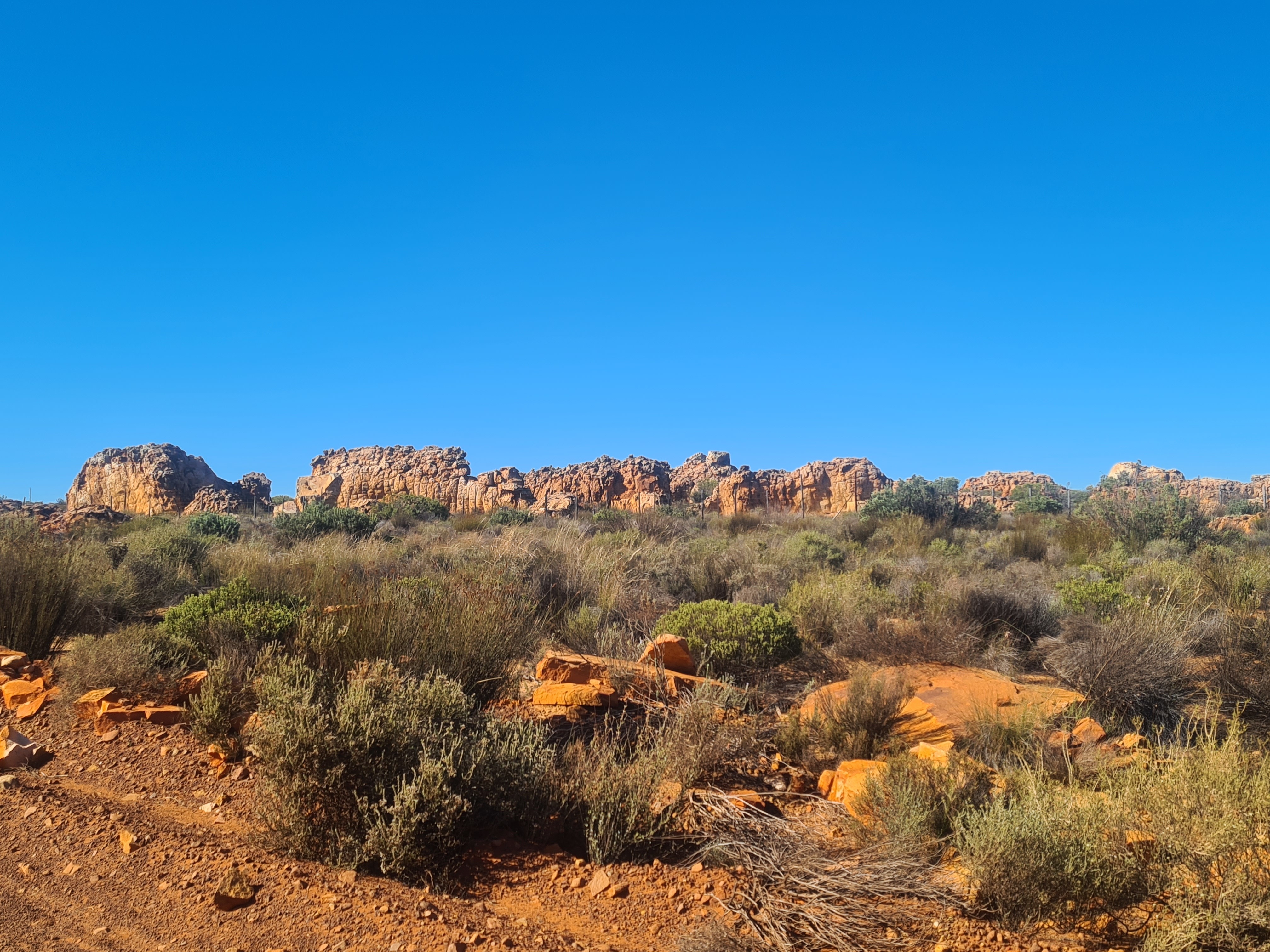 Emergence of sandstone rock arrangements. Image: Carmen Clegg
 Soft sand paving the vast territory. Image: Carmen Clegg
 Sea of Mountain Fynbos. Image: Carmen Clegg
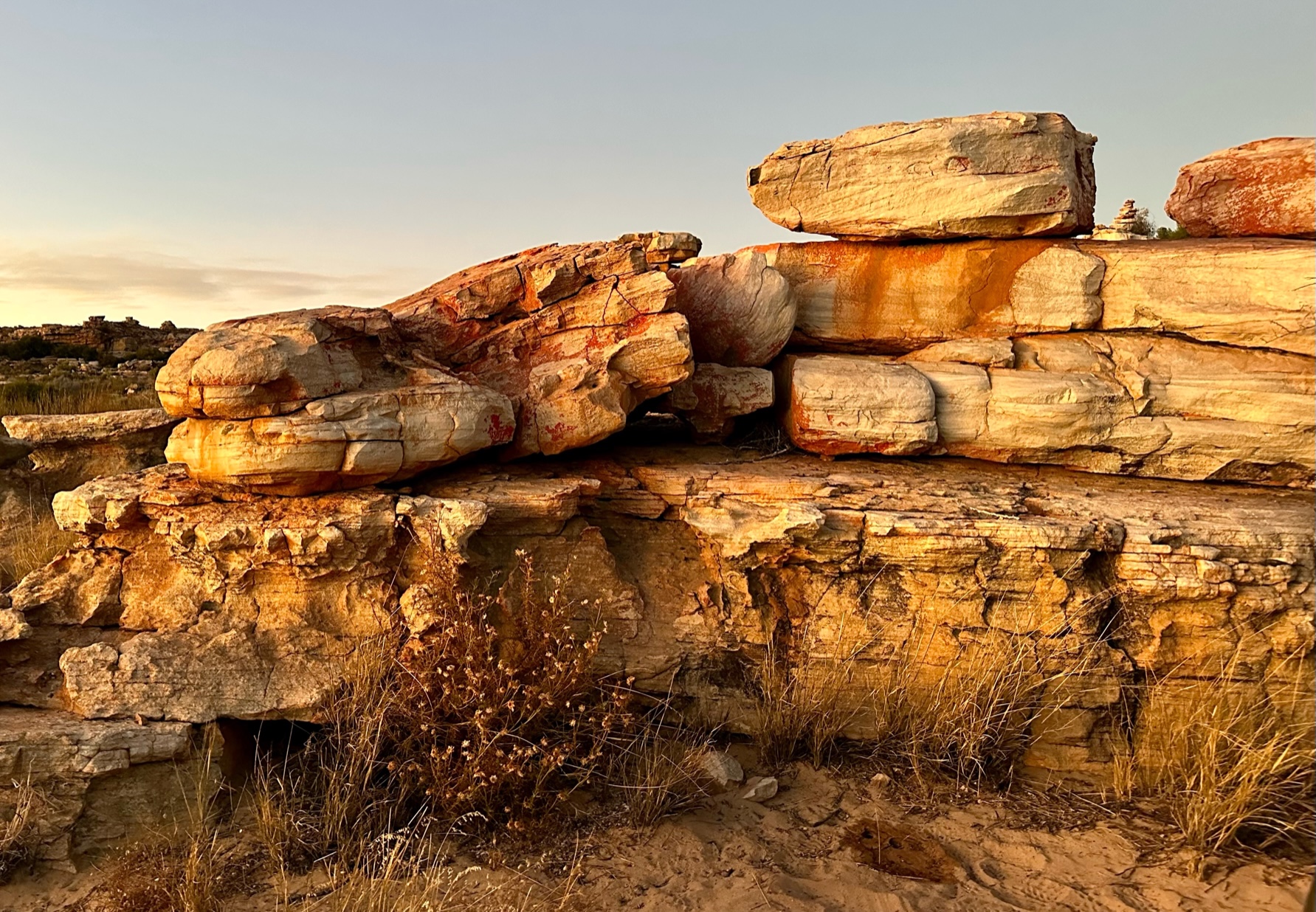
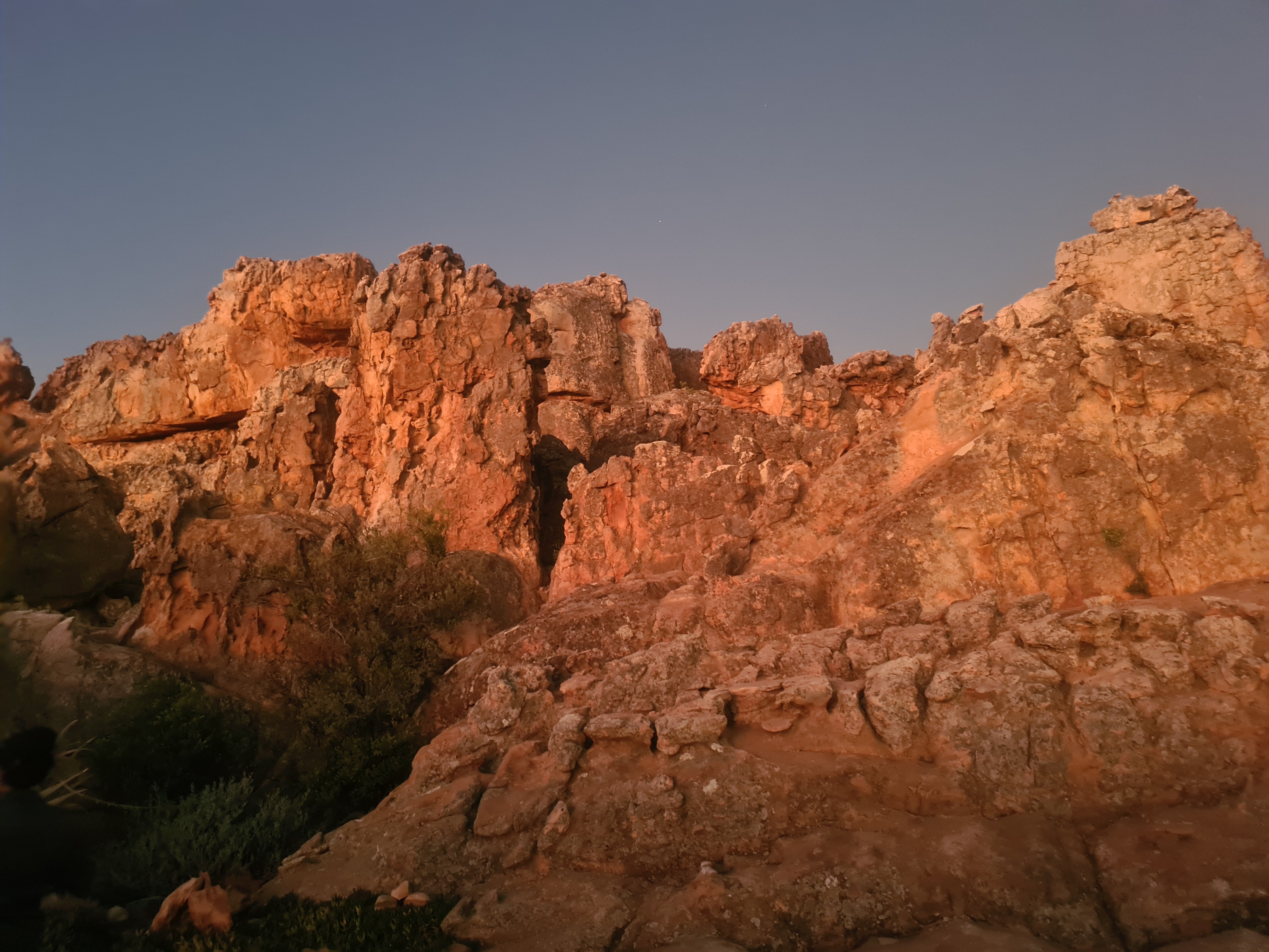 Sandstone rock formations aglow at dusk. Image: Carmen Clegg
 Rock formations. Image: Carmen Clegg
 Rock formations. Image: Carmen Clegg
 View from the outdoor spa at Kagga Kamma. Image: Carmen Clegg
It is almost inconceivable to allow one’s mind to stretch back to a time when this entire area is believed to have been covered by sea water, about 170 million years ago. As the mountains hold onto the glow of the cascading sunlight and the last rays spill across the landscape, a new fascination comes to light. The escarpment is now wholly submerged by the illuminating Milky Way standing guard over history. Finally, the last activity needed is to put one’s feet up and gaze at the night sky; with deep appreciation and childlike wonder.
Where to stay
If staying for a weekend getaway, the Kagga Kamma Nature Reserve is it. Relax on the stoep of the cave suite or soak up the sun at one of the two picturesque pools. With many activities at your fingertips, your trip can be tailored – whether adventurous quad-biking or a lazy star-gazing evening by the fire pit, this destination offers unique encounters with the natural world.
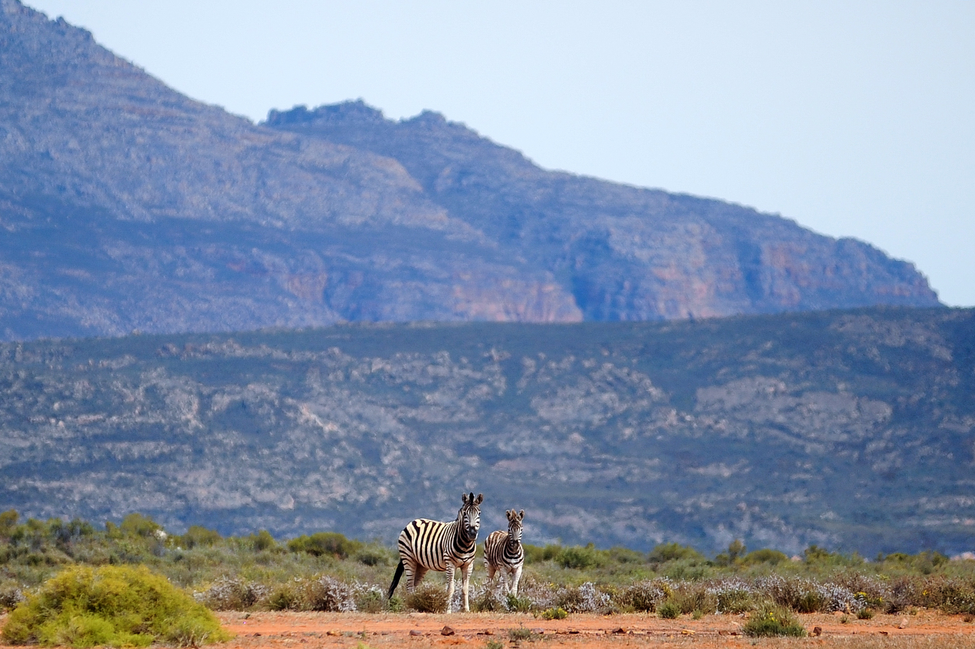 Kagga Kamma zebra. Image: Purepix Photography / Kagga Kamma
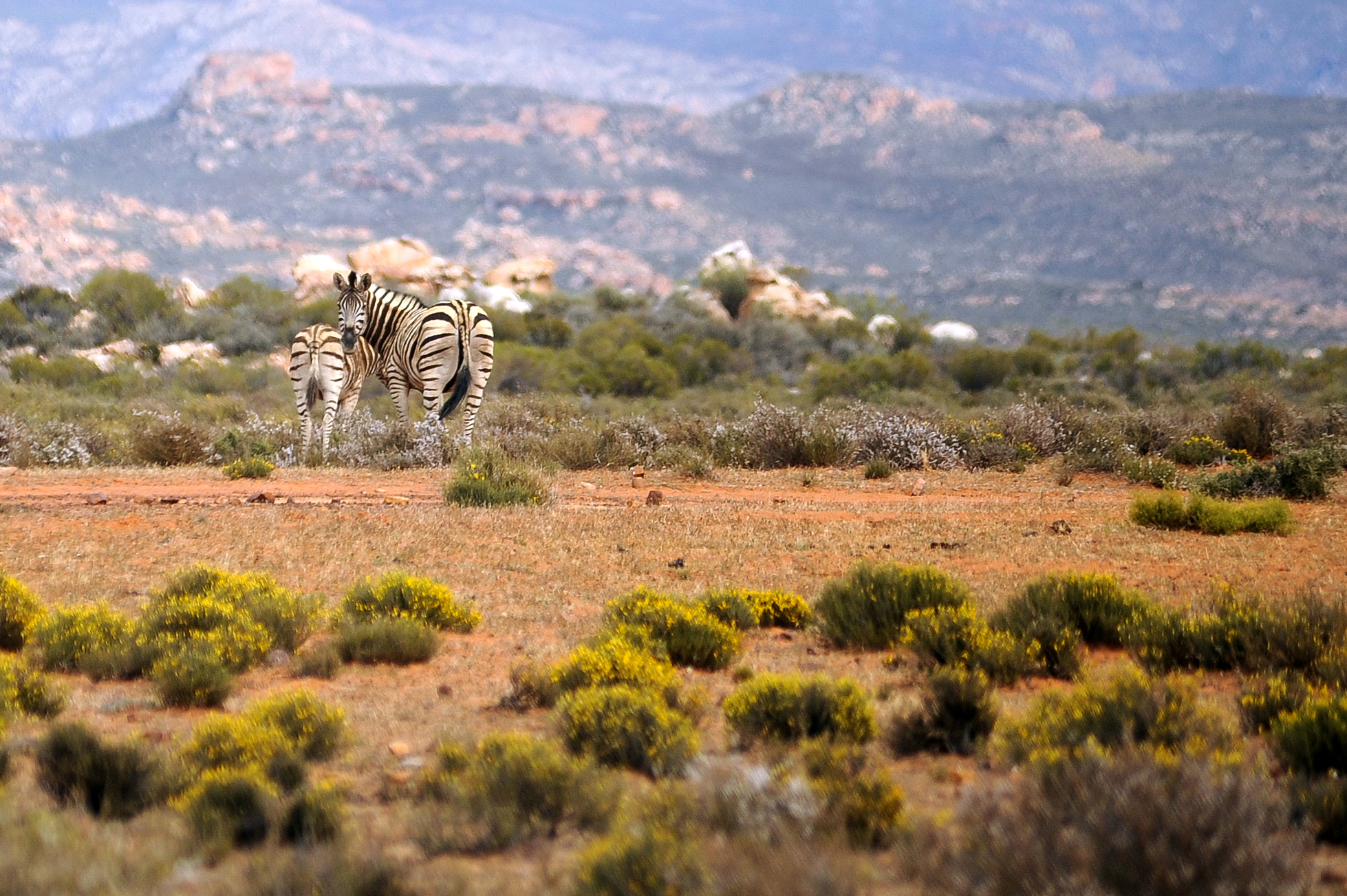 Kagga Kamma zebra. Image: Purepix Photography / Kagga Kamma
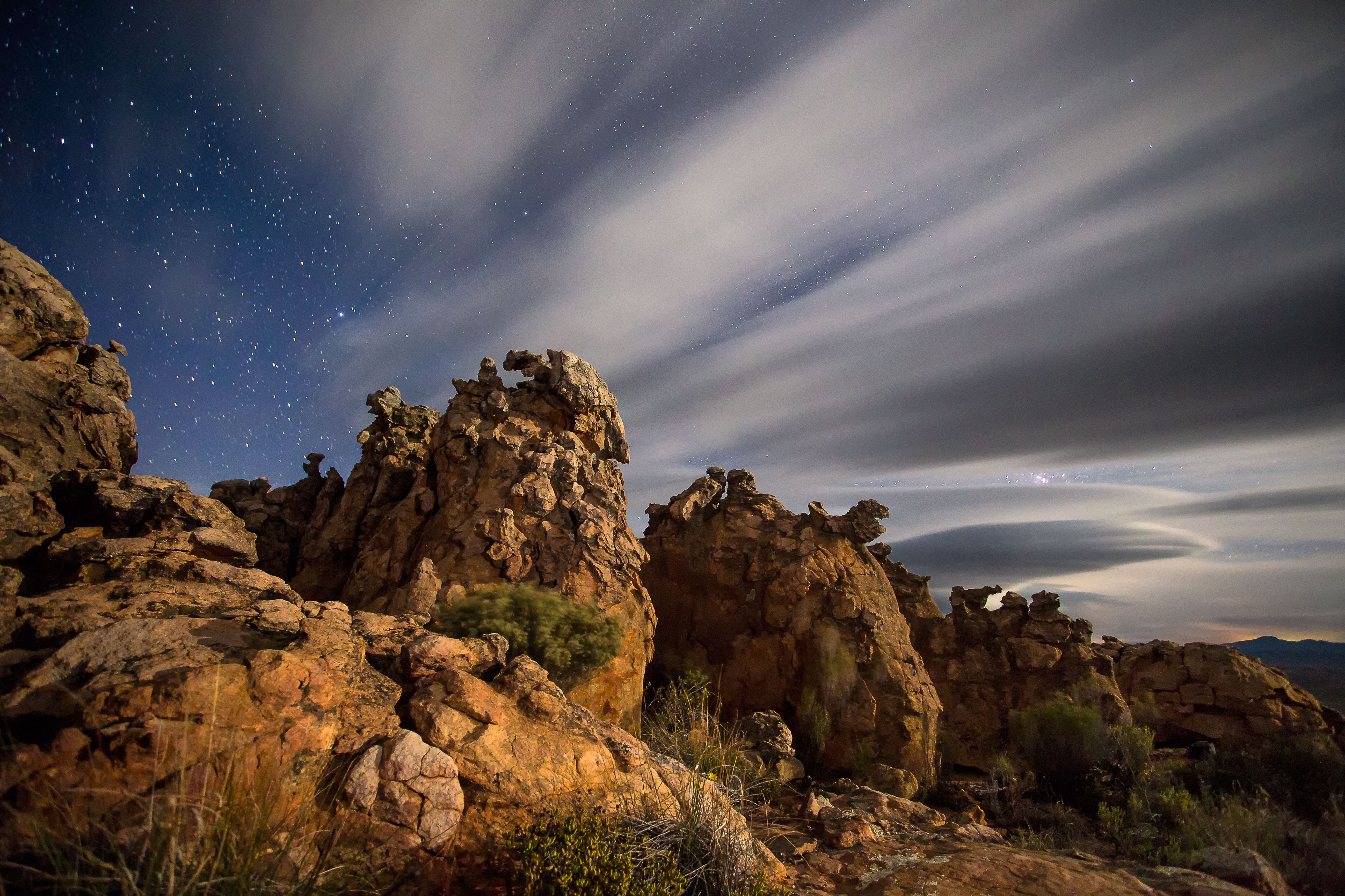 Clouds streaking over the sandstone rock formations in the Southern Cederberg in South Africa. Image: Kagga Kamma
DM/ML