


 Huge waves smashing against the breakwater in Thre Anchor Bay caused foam on July 08, 2024 in Cape Town, South Africa. It is reported that the South African Weather Service (SAWS) has further upgraded its initial warning from Yellow Level 4 to Yellow Level 6 for disruptive rain. (Photo by Gallo Images/Brenton Geach)
The City of Cape Town is warning residents to expect falling trees, flying debris, and possible roof damage as a cold front is set to hit the Western Cape this weekend, bringing strong gale-force winds and big waves to Cape Town starting Friday evening.
The cold front is expected to move more fully into the Western Cape early on Saturday. These frontal systems are typical for this time of year as the region usually sees more intense fronts during the winter months, particularly from June to early September.
According to the South African Weather Service (SAWS), these cold fronts tend to occur in autumn, winter and spring, but they do occur all year round. They usually occur further north during winter months, with a greater effect on the Western Cape.
They vary in severity, from steepness to latitude, stage of development and more, often arriving as a “family” or series of cold fronts.
Wayne Venter, Senior Forecaster, Cape Town Weather Office, told Daily Maverick that the incoming cold front was not a particularly intense one, but that it would bring cold and rainy conditions, strong to gale force winds and high/choppy seas.
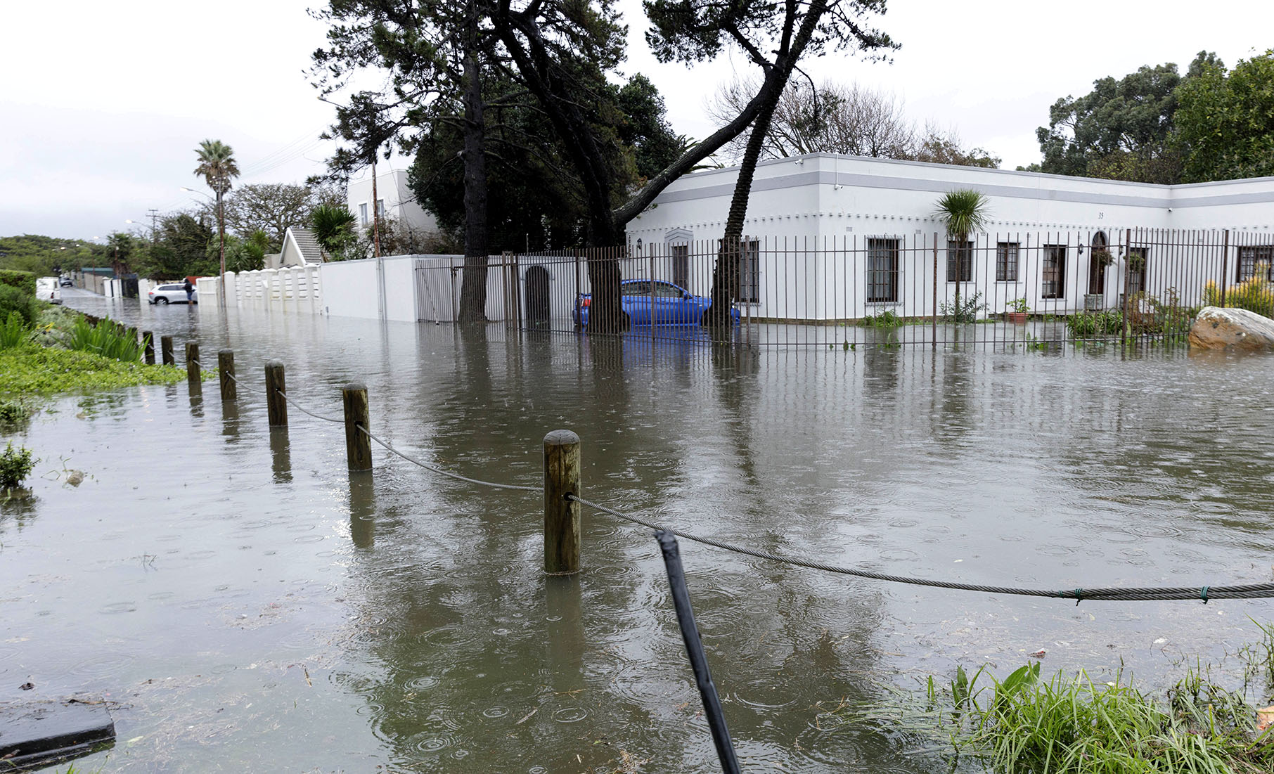
Residents should expect cloudy and cold conditions on Saturday with rain and showery conditions across Cape Town, the West Coast District, western Overberg, and the Cape Winelands for most of Saturday, with about 10-20mm widely possible while 25-40mm is possible over the high-lying/mountainous regions.
Venter said this front would weaken as it moved east, so the eastern parts of the Western Cape would see little to no rainfall with this system, but would still see strong winds.
Winds and Alerts
The Cape Town Weather Office has issued Yellow Warnings for damaging winds and high waves from Friday night, which could cause delays or disruptions, especially on wind-prone routes and for the maritime community.
Venter said the winds would be strong, ranging from 30 to 50km/h across most of the Western Cape and southern Northern Cape.
Gale-force wind gusts were also possible along the coast, the Cape Winelands, Central Karoo, and southern Namakwa region.
There are no storm surge warnings for coastal areas at the moment, but warnings for high waves were issued with heights of 4.0 to 6.0 metres expected through Saturday and Sunday, along with rough seas.
“The start of Spring Tide on Monday could also bring higher-than-usual tides along the coast,” said Venter.
A weather advisory is also in place for the southern high ground of the Northern Cape and northwestern Western Cape, where very cold, wet, and windy conditions were expected.
https://www.youtube.com/watch?v=REeWvTRUpMk
SAWS indicated that small stock farmers should take all necessary precautions to ensure their animals were sheltered, mariners should be cautious due to rough seas, and small-scale fishers should avoid going out on Saturday and Sunday.
It was also recommended that beachgoers suspend activities during the weekend due to the strong winds, choppy seas and the rainy/cold weather.
Venter said that the front would clear out quickly on Sunday, and that we could expect calmer and sunnier weather from Monday onwards.
“We’re also keeping an eye on another cold front that may be possible next weekend, but it’s still far out, and the forecast will most likely change,” said Venter.
During a media briefing about the weather systems experienced in this region for the Autumn and Summer months, SAWS’ executive on infrastructure and information systems, Mnikeli Ndabambi, said that the Western Cape would mainly experience cold fronts and cut-off low pressure systems.
Daily Maverick previously reported that, according to the South African Weather Service, Cape Town would start to experience more cold fronts as the winter season approached in June, and that April was the month that brought the highest frequency of cut-off lows.
Read more: Weather service predicts below-normal rainfall for parts of Western Cape this winter
Residents urged to secure their properties
The South African Weather Service has issued a Yellow Level 4 warning about damaging winds and waves associated with an incoming cold front.
City of Cape Town Disaster Risk Management Spokesperson Sonica Lategan on Tuesday alerted that the forecast was for strong to gale force north-westerly to westerly winds along the Western Cape coastline between Friday night and Saturday night, with the wind starting to moderate from Saturday afternoon.
As tends to be the pattern during these cold fronts, Lategan warned that potential impacts could include uprooted trees, damage to roofs, an increased risk of runaway fires and disruption of coastal activities.
 Houses were damaged and roofs blown off in Wynberg on 11 July 2024 in Cape Town, South Africa. Formal and informal housing structures, electrical and communication infrastructure, as well as roads and trees, were severely damaged by strong winds that swept through the region. (Photo: Gallo Images / Brenton Geach)
 Huge waves smash against the breakwater in Thre Anchor Bay on 8 July 2024 in Cape Town, South Africa. (Photo: Gallo Images / Brenton Geach)
“The public is urged to secure objects on their properties that could be carried by the wind, like outside furniture, and to be mindful of potential damage to garage doors, sliding doors and windows.
“When travelling, please be on the lookout for obstructions on the roadway, like fallen trees or other debris,” said Lategan.
The City’s Public Emergency Communication Centre should be contacted at 021 480 7700 for any weather-related emergencies.
Read more: Weather watch: SA’s southwest forecast to have a dry autumn/early winter
Previous cold fronts in the Western Cape
Ndabambi said that in the 2024 winter, just like the other winters before it, communities in parts of the Western Cape had found themselves at the receiving end of cold front-induced hazardous weather, which caused serious disruptions to everyday life.
There were episodes of heavy rains, flooding and gale force winds, notably affecting informal settlement dwellers from Siqalo near Mitchells Plain and Masiphumelele on the Cape Peninsula to Spoemiesdorp and Bos Nakata in Rawsonville in the Cape Winelands, among other places.
Ndabambi said that tens of thousands of people and property as well as infrastructure were affected, with roofs blown away by the forceful winds and residents wading through floodwater inside their shelters.
He added that there were severe cases of flooding in townships surrounding Cape Town, while damage was also reported in places such as Oudtshoorn, Elim, Cederberg, Knysna and Mossel Bay.
In addition, power outages affected residents in areas such as the Overberg District, the Garden Route, the Central Karoo, the West Coast and the Cape Winelands. DM
For real-time updates, follow SAWS on X (@SAWeatherServic) and Facebook (South African Weather Service) or visit www.weathersa.co.za.
For USSD alerts, dial 1207297# for weather warnings.
Or download the WeatherSMART app for Apple and Android phones.