


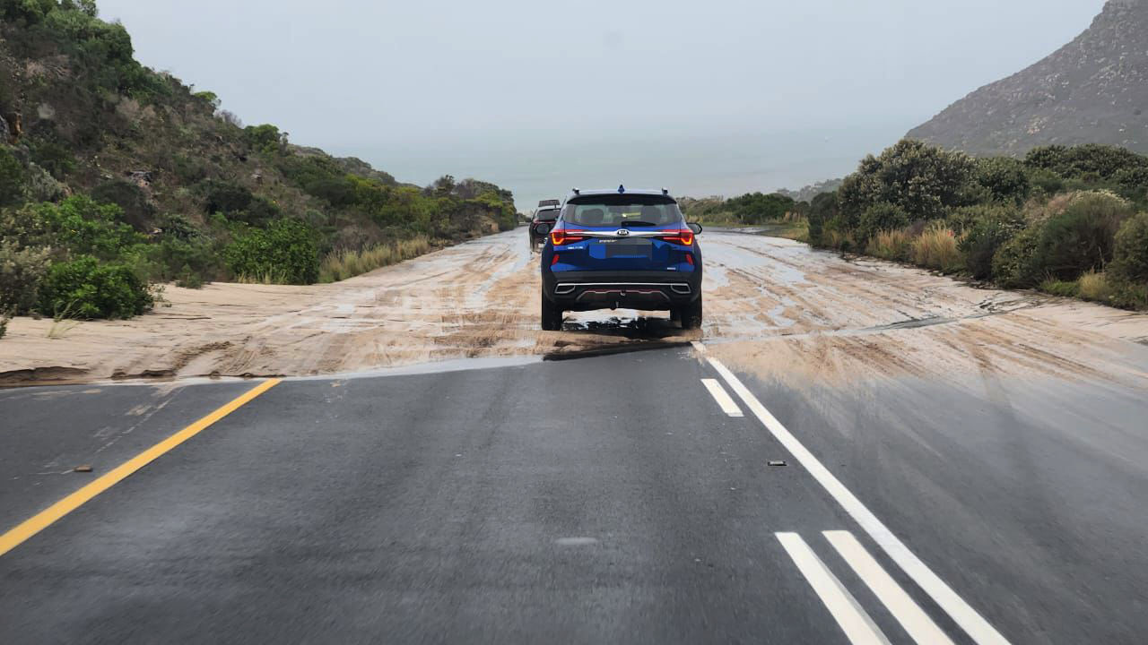
 Travellers have been advised to drive with their lights on and to ensure their vehicles are in good working condition. Heavy rain is expected in the central and eastern parts of the country. (Photo: Theo Jeptha / Die Burger / Gallo Images)
Motorists returning from the festive season and residents across the central and eastern regions of South Africa are being warned that heavy rainfall is expected from Sunday, 5 January, to Wednesday, 8 January 2025.
Persistent rainfall could result in flash floods, flooded roads and hazardous driving conditions. The South African Weather Service (Saws), the country’s sole mandated weather regulatory body, issued the alert on Friday, 3 January 2025, encouraging vigilance as many return to work or travel after the festive season.
Scattered to widespread showers
Scattered (60%) and widespread (80%) showers and thundershowers are expected on Sunday across North West, Free State, KwaZulu-Natal and parts of Mpumalanga and Gauteng.
It’s expected that rainfall will increase significantly, with 50mm–70mm of rain ecpected, which means road flooding, slippery surfaces and widespread flash flooding are possible, Saws said.
It warned that it was inevitable that some low-water bridges would overflow, with powerful water currents that could sweep away vehicles, leading to a loss of lives and property. It strongly advised motorists not to enter flooded low-water bridges or roads.
The alert follows a December of unusually heavy rainfall in the summer rainfall areas, which has already caused flooding and infrastructure damage, according to the weather service.
Impact-based warnings from Saws indicated a high likelihood that Gauteng, Mpumalanga and Limpopo and parts of North West would receive disruptive rain and severe thunderstorms on Friday, with minor impact.
Persistent rainfall through midweek
The heavy rain is expected to continue until Monday across the central and eastern regions, with disruptive rain and localised flooding expected across North West, Free State, Gauteng as well as the western Bushveld region of Limpopo, Mpumalanga and KwaZulu-Natal.
While the central regions may see some relief midweek, rainfall and flooding risks will persist in the north-eastern and eastern provinces until at least Wednesday.
Hazardous conditions for motorists
 Travellers have been advised to drive with their lights on and to ensure their vehicles are in good working condition. The South African Weather Service is predicting disruptive rain in the central and eastern parts of the country, which might cause flooding. (Photo: Theo Jeptha / Die Burger / Gallo Images)
Saws explained that typically, summer thundershowers would be confined to the afternoon and early evening, but a persistent flow of warm, tropical air from northern regions is expected to bring showers at any time of day.
This means that ordinary, or even heavy showers, could be expected even between 6pm and 1am, which are the critical hours that road users should avoid driving, according to the Road Traffic Management Centre (RTMC).
Saws highlighted that this festive season has already seen a higher number of road fatalities reported, compared to previous years.
“Saws, in collaboration with the RTMC, would like to urge motorists, pedestrians and the public to be extra vigilant and careful on the roads during these conditions to prevent the further loss of lives.”
Key safety recommendations
- Avoid crossing flooded roads or bridges, as strong currents can sweep away vehicles;
- Use headlights in rainy conditions to improve visibility and alert other driver;
- Reduce speed, increase following distances and ensure windscreen wipers are functional; and
- Check that tyres have sufficient tread and that lights, indicators and mirrors are in good working condition.
Elton Smith from RelayEMS, an emergency operations service in Gqeberha, told Daily Maverick that emergency medical services see an increase in the number of motor vehicle accidents owing to disruptive rain, primarily caused by reduced visibility, longer stopping distances and driver fatigue.
ER24 told Daily Maverick that adverse weather might bring with it reduced visibility, steering ability and traction and could lead to more emergency calls during this time.
ER24’s essential driving tips in bad weather
- Wear your seatbelt and ensure all your passengers are buckled in too;
- Turn on your headlights to see and be seen;
- Slow down. Make turns as gently as possible, and don’t apply the brakes any harder than necessary. Don’t pass slower vehicles unless you really have to;
- Make space. Keep a longer following distance and watch far enough ahead to maintain a steady speed without having to slam on brakes;
- Beware of puddles and oil patches that make the road more slippery. Try to avoid them if possible – or drive through them slowly;
- Make sure your windscreen wiper blades are in a good condition and able to clean the window without smudging.
- Your tyres should have adequate tread for better traction on the road; and
- Brake lights, indicators, mirrors and headlights should all be in good working order.
For real-time updates, Saws stressed the importance of keeping up to date on daily weather warnings by checking its website and social media pages, or downloading Saws’ free WeatherSMART app (for Apple smartphones and Android smartphones).
La Niña and rainfall
As of January 2025, the El Niño–Southern Oscillation (ENSO) is in a neutral state, transitioning from the recent El Niño event that ended in 2024. There are indications that a weak La Niña may develop during the mid-summer season, although there is still uncertainty in the predictions.
In its seasonal climate watch, for January to May 2025, Saws reported the ENSO is still neutral, with a weak La Niña potentially developing only in mid-summer. This means the predicted effect on South Africa’s rainfall will likely be felt in late summer, with above-normal rainfall expected for parts of the northeastern, central and coastal areas. This could increase flash flood risks, particularly in flood-prone areas.
While it’s hard to predict exactly when or how a La Niña might develop – especially when ENSO is in a neutral state – Saws expects wetter conditions in late summer, warning that these could worsen flooding in vulnerable areas.
Above-normal temperatures
Saws reported that minimum and maximum temperatures are expected to be mostly above-normal across the country from now until May – however, southern coastal areas are likely to experience below-normal maximum temperatures throughout the summer.
Saws noted that higher temperatures could increase heat stress and heat-related health problems, while elevated temperatures may accelerate the growth of foodborne pathogens, raising the risk of foodborne illnesses.
ER24 told Daily Maverick that while temperatures have risen, they have not had unusual heat-related incidents, but the service recommends the public be cautious of heat illnesses like heatstroke and heat exhaustion.
“Heatstroke is a serious, life-threatening illness where the body loses its ability to control temperature and cool down,” said ER24, a national private emergency medical service. “Although it is rare, it can be fatal if you don’t get the correct emergency medical attention.”
ER24 explained that heat exhaustion is a less serious condition where the body loses water and electrolytes through excessive sweating, and it generally improves quite quickly with the right treatment.
Water-related risks
RelayEMS told Daily Maverick that two fatal drownings, and one-near drowning occurred on Thursday, 2 December, with three people still unaccounted for in Gqeberha, despite swift efforts from Relay EMS, Coastal Water Rescue, Metro EMS, NSRI and the SAPS Dive Unit. The emergency service urged bathers to always swim in designated areas where lifeguards are on duty.
While these incidents were related to the spring tide and strong rip currents, and not increased rainfall, Saws noted in its climate watch report that increased rainfall in the months to come may increase the incidence of waterborne infections, water-related injuries and drowning accidents, heightened by recreational water activities over the festive season.
Saws also highlighted the risk of prolonged UV exposure – if the UV level exceeds level 3 on the World Meteorological Organisation’s UV Index, sun protection is recommended, as heightened UV exposure could result in a higher incidence of sunburn and other UV-related health issues. DM
https://www.youtube.com/watch?v=REeWvTRUpMk