


 Snow in Nieu-Bethesda, Eastern Cape. 08 July 2024. (Photo: Marlene Van der Linde/X @ReenvalSA)
 A series of cold fronts is still on track to bring a week of cold and wet conditions, said Anton Bredell, the Western Cape MEC for local government, environmental affairs and development.
Mop-up operations and damage assessments have begun in parts of the Western Cape after a series of cold fronts caused damage to infrastructure, frigid temperatures and road closures.
“Today will see the coldest daytime temperatures, and the next cold front with rain is expected to arrive on Tuesday. Between 10mm and 20mm of rain is expected over the western parts, and between 40mm and 60mm can be expected over the southern western mountains,” said Bredell.
Last week, Daily Maverick reported on a storm that caused localised flooding of homes. Over the weekend, damaging winds caused havoc in parts of the province.
Read more in Daily Maverick: Weekend weather alert – Mom, kids forced to flee in dead of night after storms cause havoc in Cape Town
Read more in Daily Maverick: Thousands left homeless in Western Cape as gale-force winds and torrential rain wreak havoc
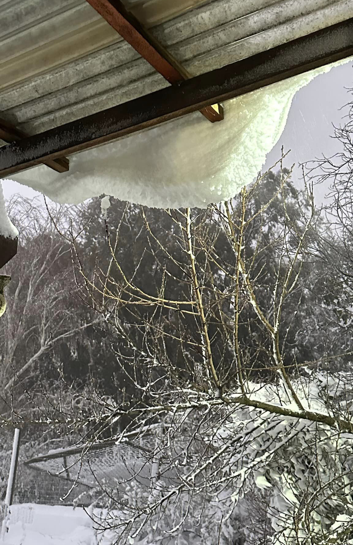
Snow warnings were also issued for Western Cape towns including Stellenbosch, Worcester, Paarl, Ceres and Clanwilliam between Sunday and Monday. Northern Cape towns such as Sutherland and Calvinia were affected by snow too.
There have also been warnings for storm surges in areas such as Table Bay, Cape Town, Hermanus, Mossel Bay, Stilbaai, Saldanha Bay and Lambert’s Bay, stretching to Port Nolloth in the Northern Cape.
“Widespread disruptions and damages, including loss of shelter in informal settlements, localised flooding, fallen trees, electricity outages, and road closures due to snow or flooding, were reported during our meeting today,” said Bredell.
The City of Cape Town, Overberg, Cape Winelands and West Coast districts were hit hardest by the severe weather, he added.
Warnings from the weather service also include an outlook for strong to gale-force west to northwesterly winds for the southwest coast, emphasising a high danger for runaway wildfires in the Garden Route District. DM
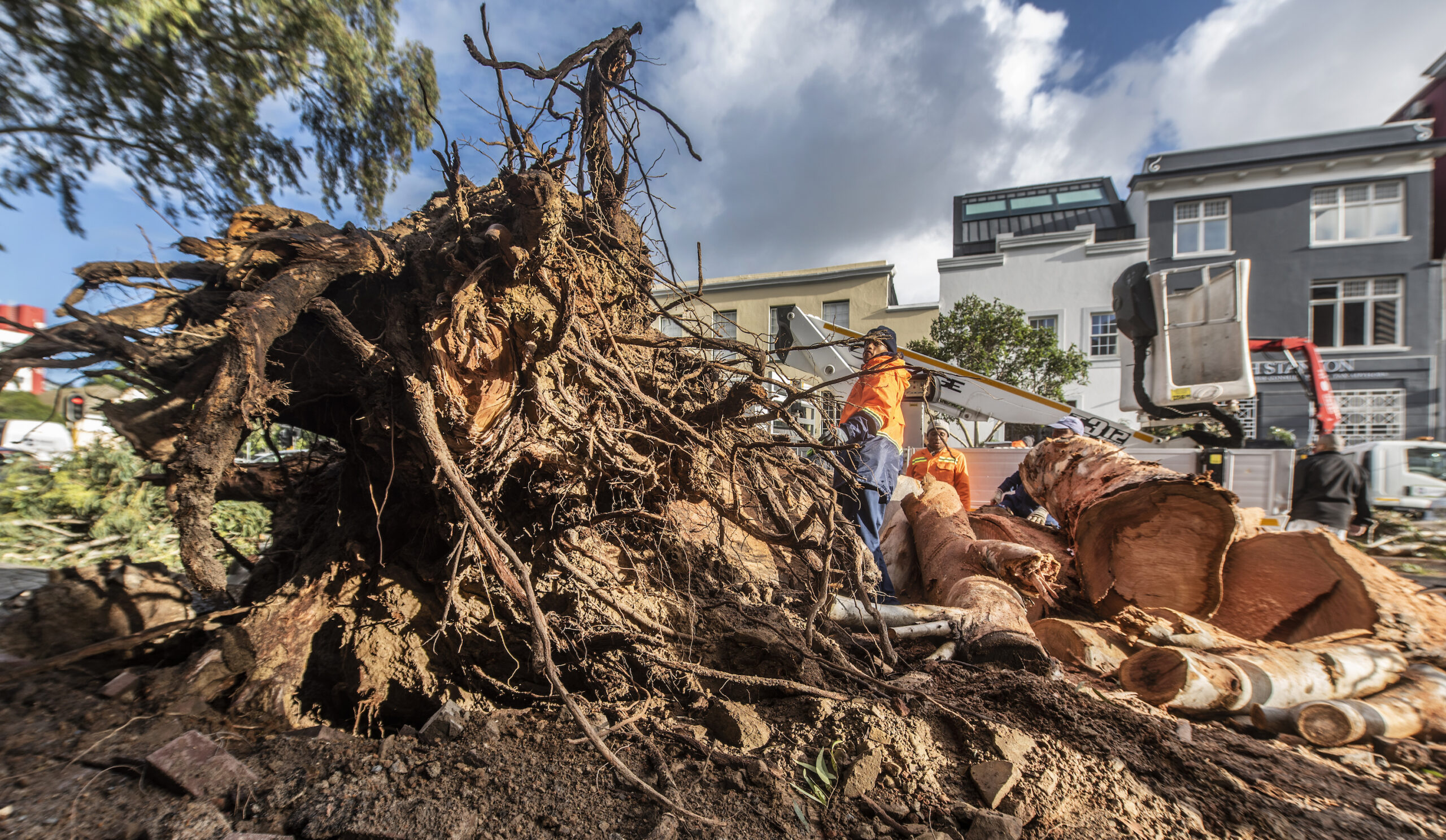 Strong winds caused a large tree to be uprooted on Bree Street in the Cape Town city centre on 8 July 2024. (Photo: Gallo Images / Brenton Geach)
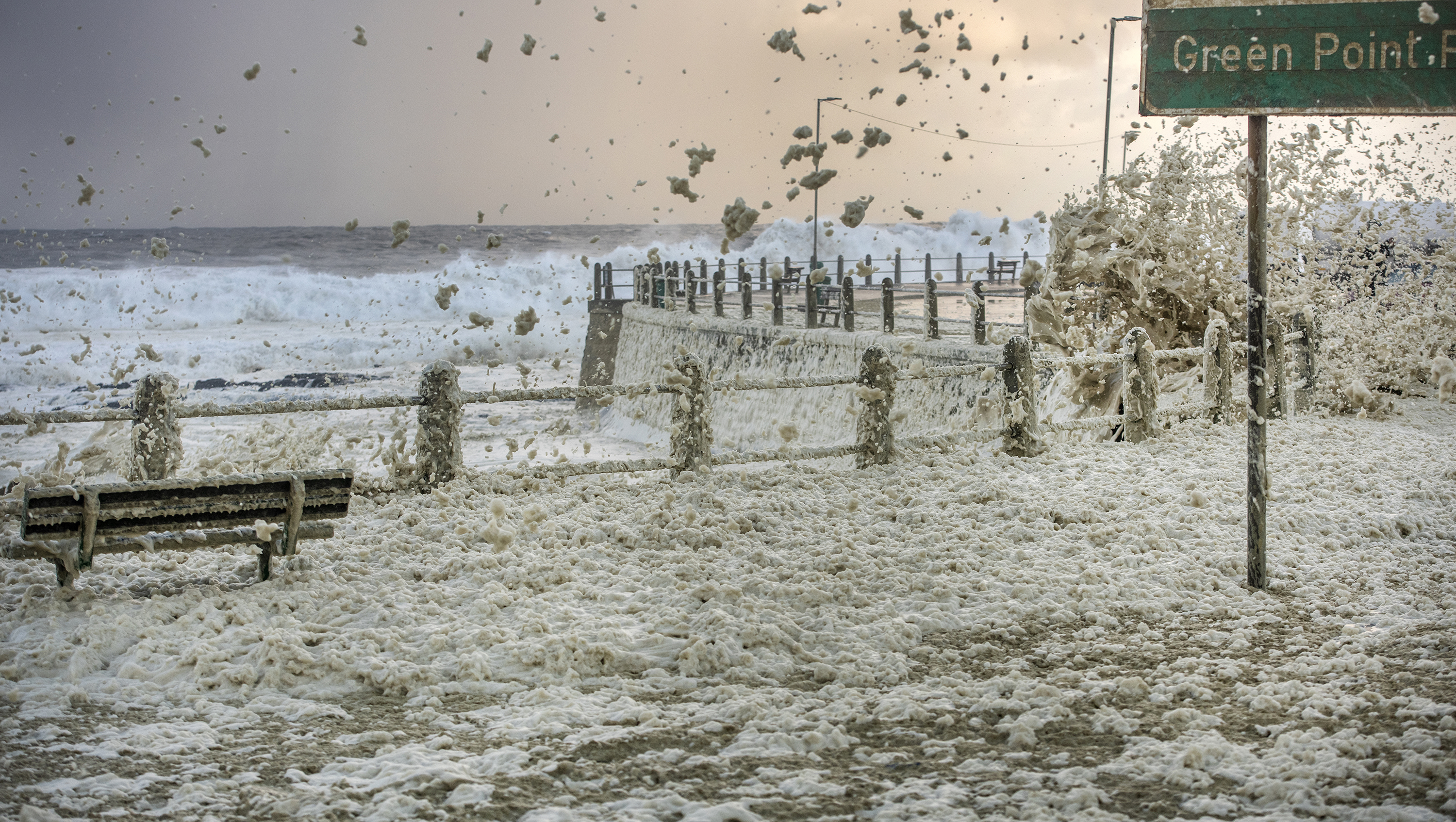
 A bench covered in sea foam at Three Anchor Bay in Cape Town on 8 July 2024. (Photo: Gallo Images/Brenton Geach)
 Huge waves break off Sea Point on 8 July 2024. (Photo: Gallo Images/Brenton Geach)
 View from Rawsonville of snow on the Slanghoek mountain range, 8 July 2024. (Photo: Nico Harmse)
 Snow at Matroosberg Reserve near Ceres on 8 July 2024. (Photo: facebook.com/MatroosbergReserve)
 Snow at Matroosberg Reserve near Ceres on 8 July 2024. (Photo: facebook.com/MatroosbergReserve)
 Snow at Matroosberg Reserve near Ceres. (Photo: facebook.com/MatroosbergReserve)
 Garden view in the Free State on 8 July 2024. (Photo: Renè Roos/X @ReenvalSA))
 Sutherland at 7.45am on 8 July 2024. (Photo: Stiaan Steyn/X @ReenvalSA)
 Sutherland at 7.45am on 8 July 2024. (Photo: Stiaan Steyn/X @ReenvalSA)
 Hanover in the Northern Cape. (Photo: Barry Guy Naude)
 Snow in Hanover in the Northern Cape. (Photo: Barry Guy Naude/X @ReenvalSA)
 Snow at Matroosberg Reserve near Ceres. (Photo: facebook.com/MatroosbergReserve)
 Snow in Nieu-Bethesda, Eastern Cape, on 8 July 2024. (Photo: Marlene Van der Linde/X @ReenvalSA)